In 2019, the mountainous landscape of north-western Gran Canaria was declared a World Heritage Site, mostly due to its importance to the island’s pre-hispanic inhabitants. As an archaeologist, I never can resist tracking down prehistoric sites on my travels, so obviously we had to visit the area on our trip to the island.
Something we quickly realized is that the area is absolutely beautiful and worth visiting, even if you’re not interested in the life of the island’s aboriginal people at all. Conversely, if you’re indeed looking for traces of the ancient Canarii, finding the most important spots in the vast area isn’t too easy.
There are a total of 8 significant prehistoric sites that are specifically mentioned in the description of the UNESCO property and during our time on the island, we managed to visit all of them. Here’s my personal breakdown of which of the sites you definitely shouldn’t miss.

This post may contain affiliate links, and I might earn a small commission at no additional cost to you. For more info, click here.
How to Explore the World Heritage Area
As you would expect from prehistoric dwellings and cult places, most of the sites connected to the WHS property are rather remote and can most easily be reached by a combination of driving and hiking. Almost none of the sites are accesible by public transport, so you’re going to need your own set of wheels.
All sites except Barranco Hondo require at least a short walk to reach, some (like the Cueva de los Candiles and the Cueva de Caballeros) even a lengthier hike, so it’s nearly impossible to fit all the sites into a single day. If you want to visit all of them, you’ll need at least two days.
If you’re pressed for time, I suggest concentrating on sites that are located next to each other in a single cluster. For instance, you could visit Risco Caído, Barranco Hondo and El Hornillo or Roque Bentayga and the Cuevas del Rey.
If you’re down for a longer hike, you could also combine the Cueva de los Candiles and the Cueva de Caballeros. Check out my descriptions to the separate sites to see which of them strike your fancy.
The UNESCO Interpretation Centre in Artenara
The visitor center in Artenara is a good starting point for exploring the World Heritage site, as it helps to understand why the area is so important. Its exhibits include replicas of prehistoric artefacts, multimedia presentations, and descriptions on the cultural and astronomical importance of the region.
The most interesting exhibit for us was a life-sized reconstruction of Cave 6 at Risco Caído, especially as the original was firmly closed when we were there. A light show recreates the movement of the sunlight through the cave opening at different times throughout the year, to demonstrate why some people believe that the cave had a calendar function.
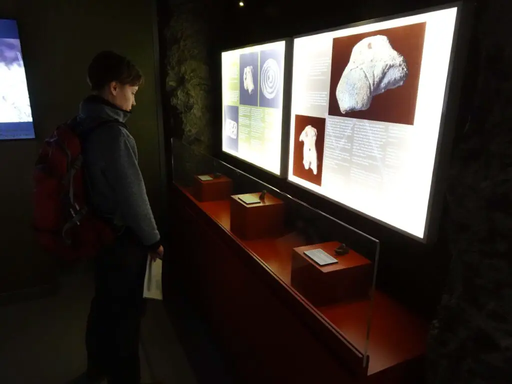
To be honest, the show only increased my scepticism about the interpretation. There are lots of prehistoric sites to which people try to attribute a calendar function without convincing observations, and while it’s true that the light at Risco Caído moves through some of the artificial openings in the cave wall, I couldn’t help but notice that there are also countless man-made features it doesn’t touch.
But that’s just the natural sceptical archaeologist in me and altogether, the reconstruction is a great idea to helpfully illustrate something that most people would never have a chance to experience in its original location.
The centre is near the street at the western end of Artenara and can be visited for free. The staff is friendly and helpfully answered our questions about visiting the actual sites throughout the UNESCO zone. You can check the current opening times here.
The Prehistoric Sites Included in the Property
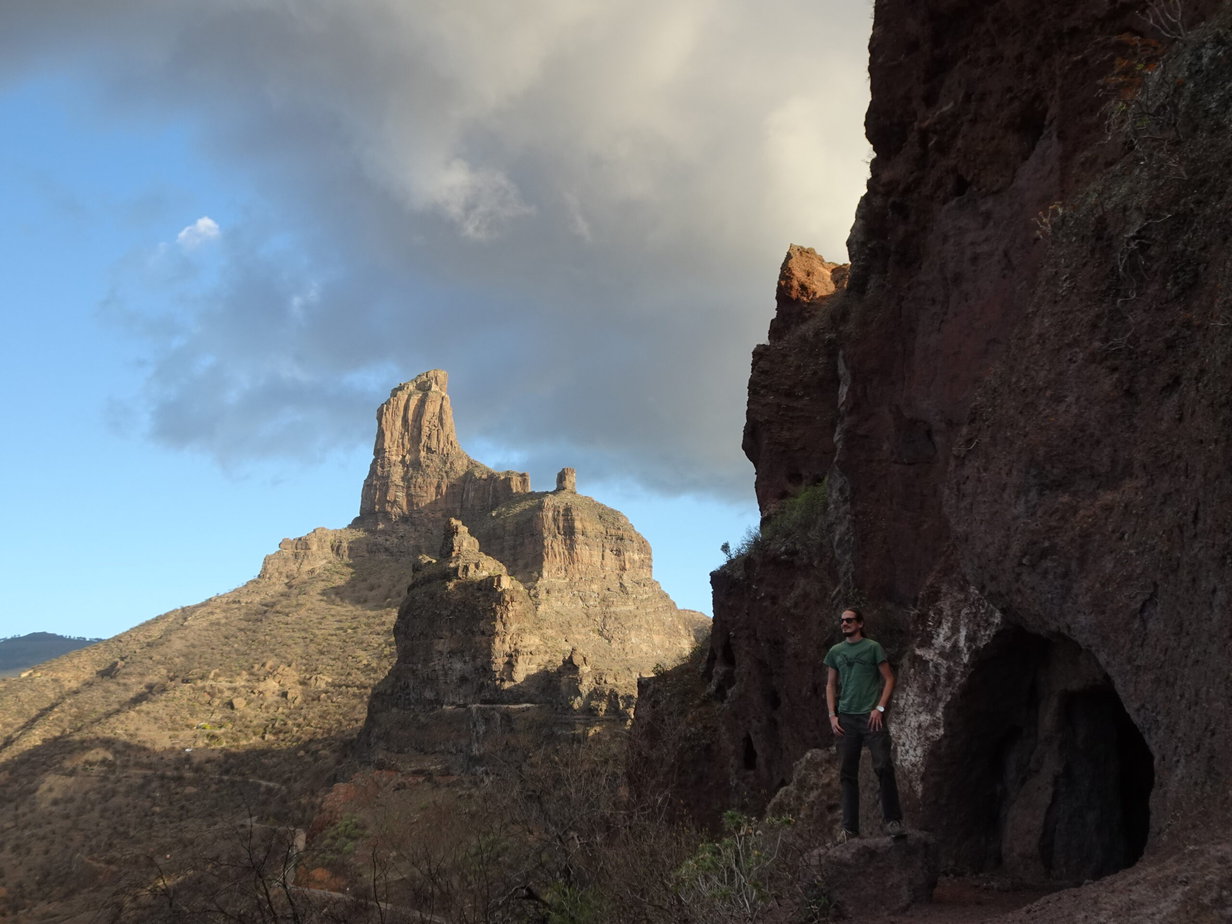
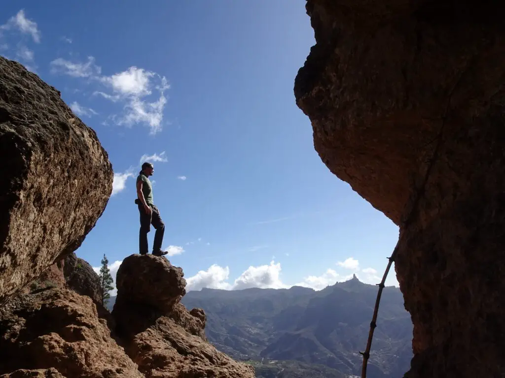
Risco Caído
Risco Caído lends its name to the entire World Heritage Site, so we expected it to be the most spectacular among the different sites. However, the main reason it’s seen as so important are Caves 6 and 7 – the ‘calendar cave’ and a cave decorated with a large number of geometrical petroglyphs.
Both of these caves were firmly locked when we were there, however, and no caretaker was anywhere around the area (or any other person, for that matter). Other caves were open and allowed us a glimpse of the construction and interior organization of the dwelling caves.
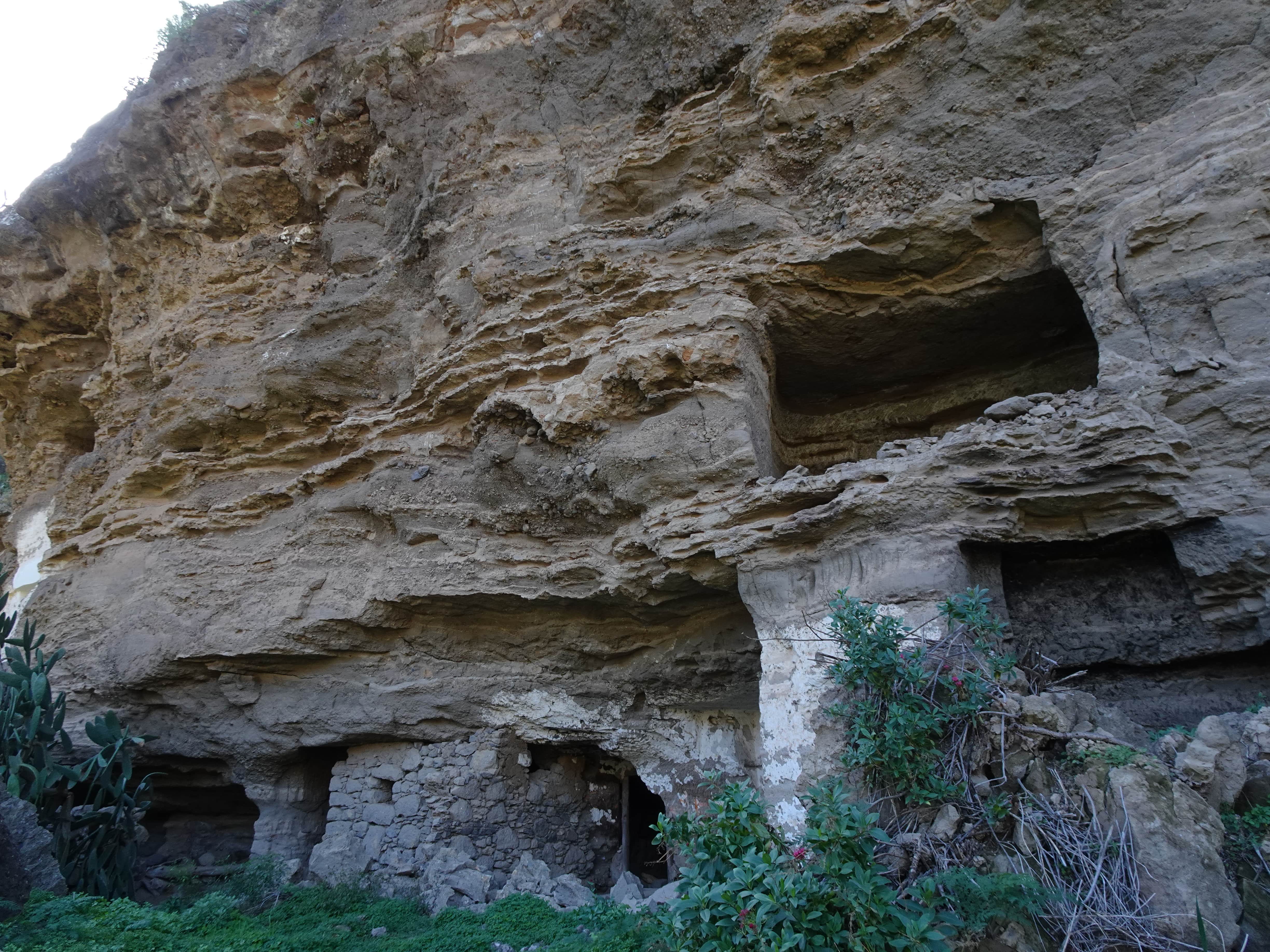
We liked Risco Caído well enough and enjoyed the location and great views down the Barranco, but in the end we found some of the other listed sites much more intriguing. This might have been different if we had been able to actually look inside the locked caves.
How to Get There
Riso Caído can be found near the village of Lugarejos. You can park your car at the eastern end of Presa de los Perez reservoir, from where you’ll have to walk east and then up the southern slope of the Barranco for about 15 minutes. There are signs pointing you in the right direction.
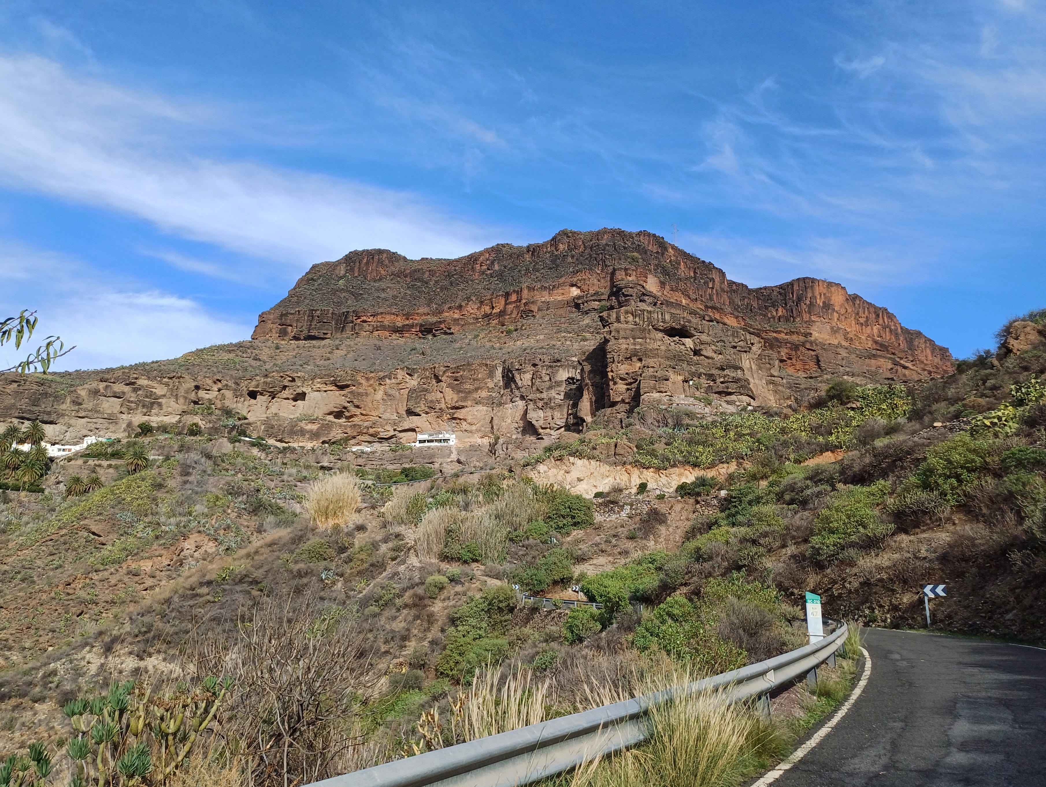
Barranco Hondo
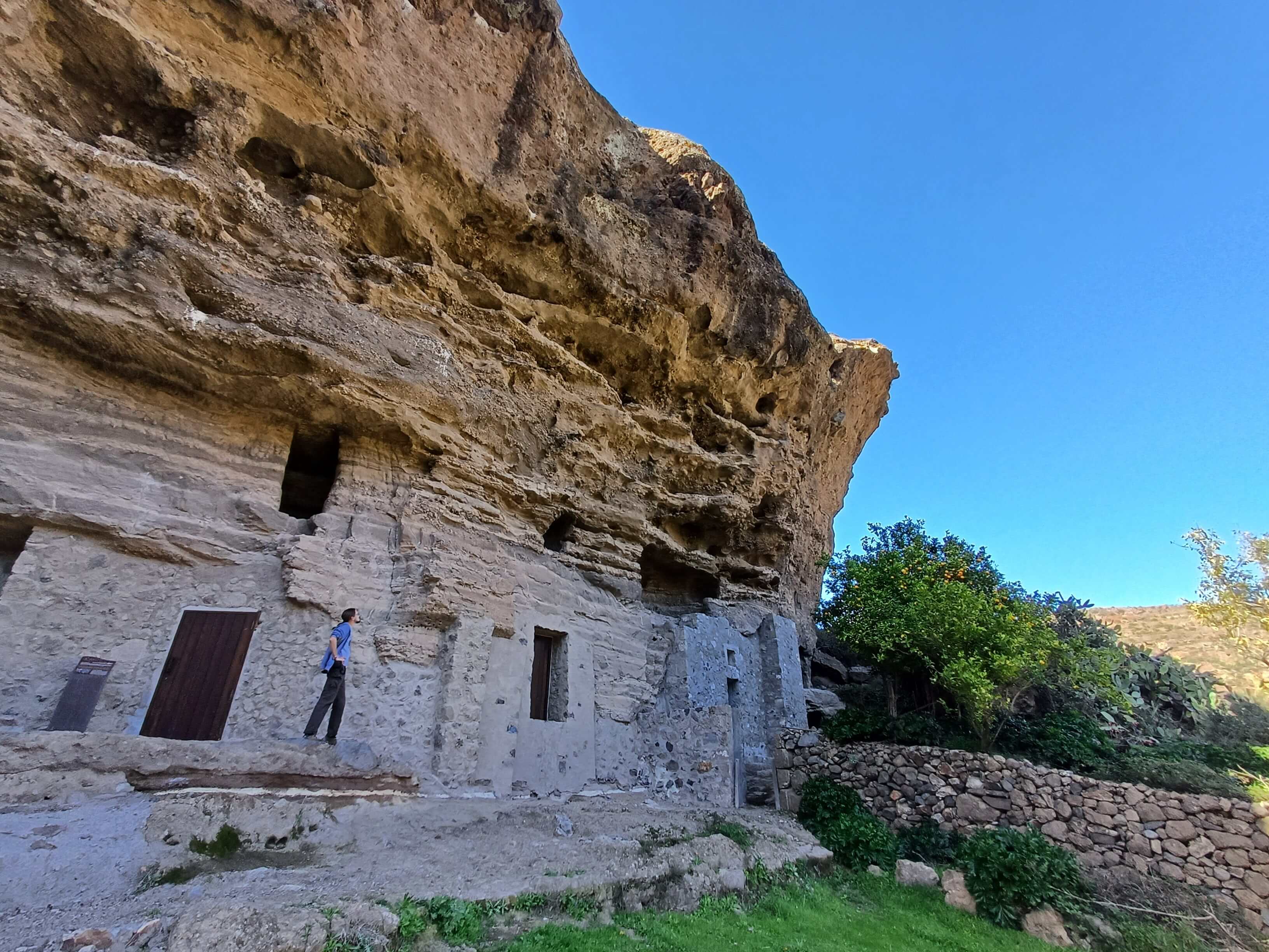
The Barranco Hondo area is the right around the corner from Risco Caído, so a visit to both can easily be combined. It’s also the most accessible of all the locations, so if you’re short on time or not really able to do strenuous hikes, it’s a good place to get a general idea of the World Heritage Site. Otherwise, there are more interesting places in the property.
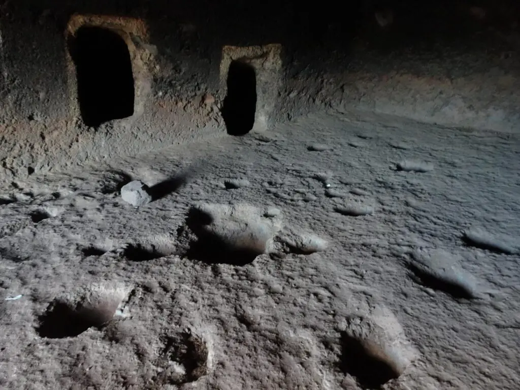
At Barranco Hondo, there is a series of dwelling caves in a cliff (all of which are closed off), as well as a small chapel inside a cave, which you can actually peek into through the bars of the gate. There are signs to an Ethnographic museum, which we followed, but we ended up in what we assumed was someone’s (picturesque) backyard. If there ever was a museum here, it seems to be closed now.
How to Get There
The site is located on the road from the Presa de los Perez reservoir to the village of Juncalillo. Turn right at the first opportunity north of the lake and follow the steep road up the mountain Barranco Hondo is the first village you’ll drive through, and you’ll see the caves right next to the road, where you can park your car.
Note, that there are two settlements called Barranco Hondo in the area. These caves are in Barranco Hondo de Abajo – The ‘lower’ Barranco Hondo village.
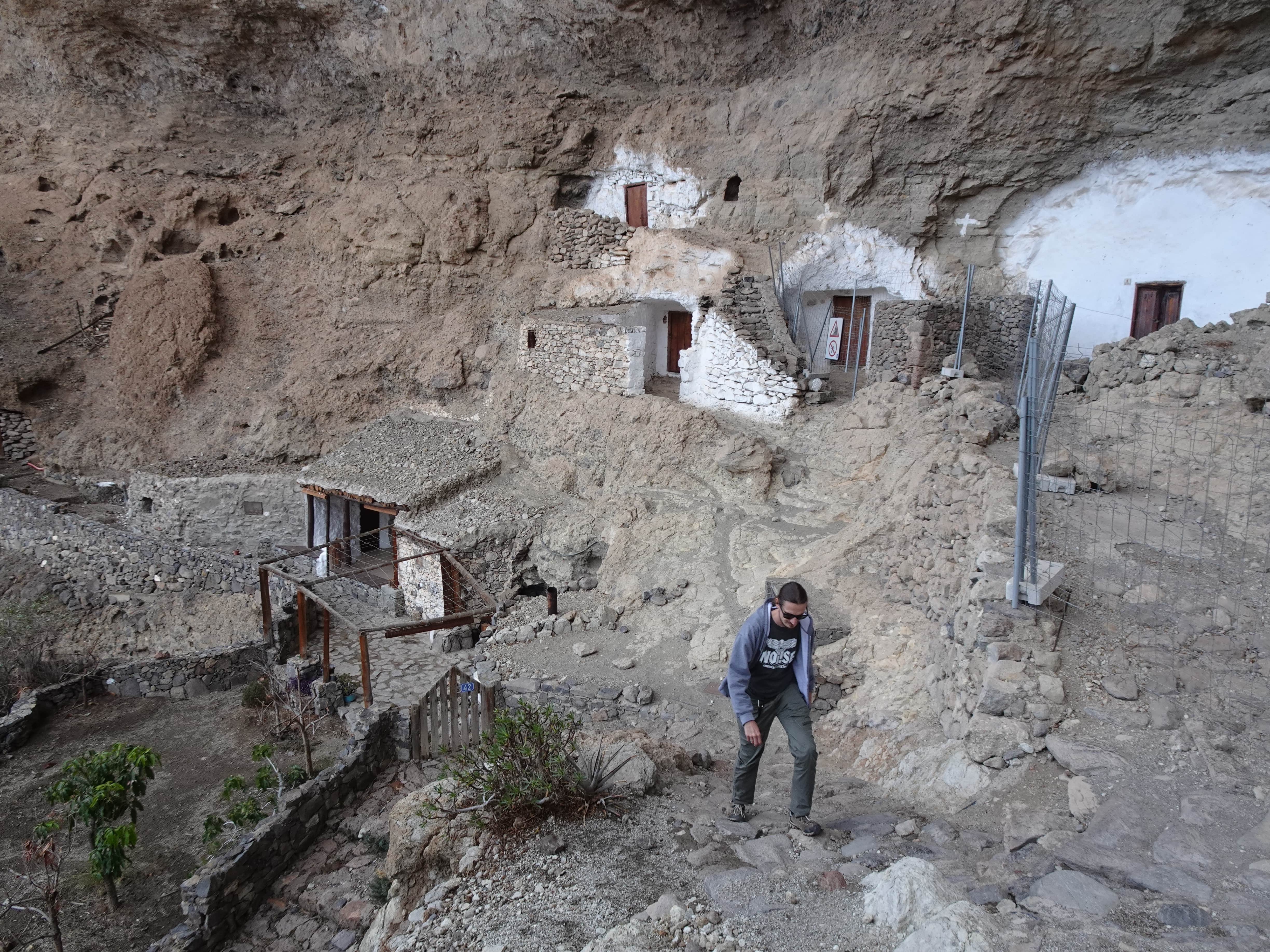
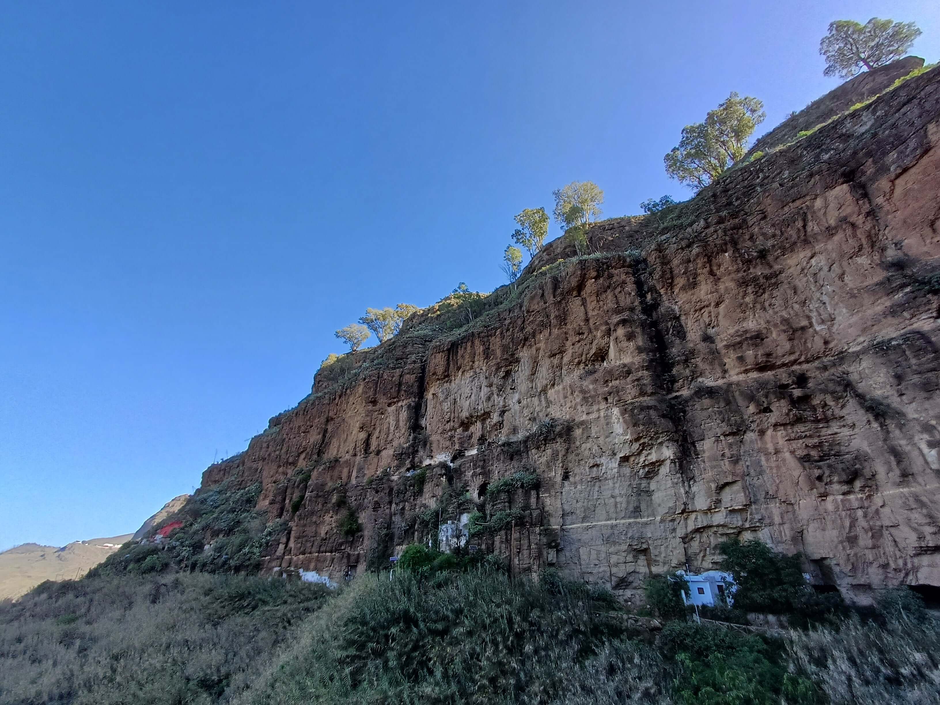
Mesa de Acusa
The Mesa de Acusa is a huge, flat table mountain that was definitely used as a settlement and a storage space for grain, and perhaps also as a ceremonial site (although this is usually hard to determine for sure).
The mesa is gigantic, and when you drive towards it from any direction, you can see that nearly the entire cliff-wall is covered in caves. The famous Cueva de las Estrellas in Candelaria, which is covered in petroglyphs of stars, is unfortunately not open to the public, but there are a few other places worth visiting.
In my opinion, the most interesting among these is Acusa Seca at the south-eastern end of the Mesa. Many of the ancient cave homes in the area have been converted into holiday homes, and if we didn’t already have booked our accommodations for the trip, we probably would have opted to stay here.
If you walk past the holiday homes, you’ll come to a series of cave dwellings that have mostly been left in their original state. I write mostly, as many of them have been re-used continually or on-and-off in historical and modern times, so they’re the result of a continual process of use instead of a snapshot of the life of the pre-hispanic inhabitants.
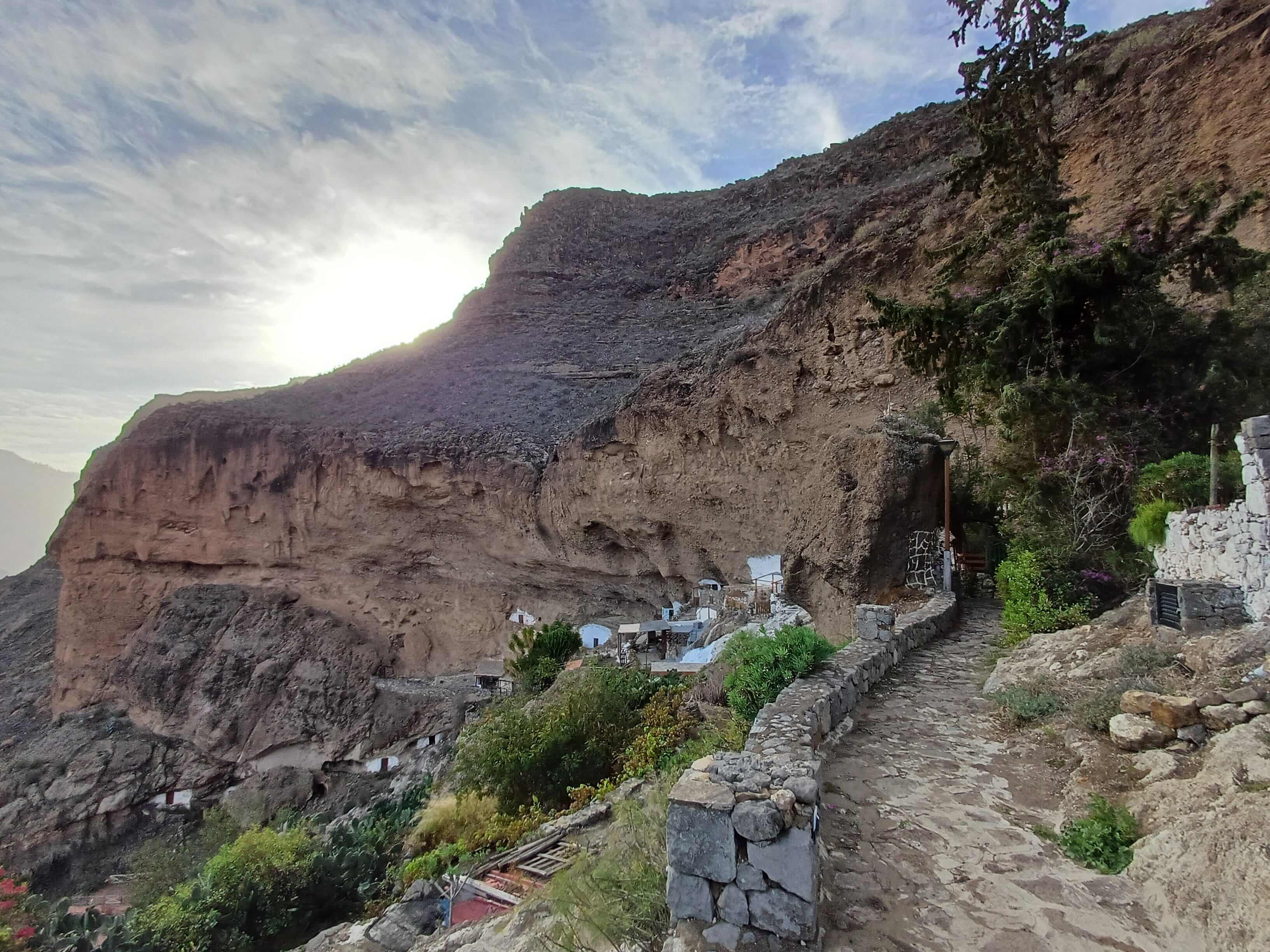
The views of the Tejeda Crater from Acusa Seca are amazing, and you can see the Roque Nublo and Roque Bentayga from here, both of which are said to have held a spiritual significance to the prehistoric inhabitants. It’s also worth to visit the top of the Mesa, from where we found the views even more impressive.
How to Get There
The mesa is located off the GC-210 or ‘Grand Canyon’ Road between La Aldea de San Nicolás and Artenara and is impossible to miss. To get to Acusa Seca, you’ll have to turn south in the tiny village of Vientanieves and drive down a steep, narrow road full of switchbacks.
There’s a parking lot from where it’s a 5-minute walk to the caves. To get to the top of the mesa, you can turn south in Candelaria village, west of Vientanieves.
El Hornillo
A little higher up in the mountains you’ll find El Hornillo – another set of dwelling caves and granaries cut into a tall cliff face. The location is quite dramatic, but unfortunately the path leading close to the caves was closed when we were there, due to the danger of falling rocks.
That said, the place was impressive even from afar, and the café next to the little church on the ‘main square’ of the tiny hamlet is a great place for a Cafe Cortado. There are also nice views down into the lush Agaete Valley.
How to Get There
El Hornillo is at the end of a dead end road north of the Presa de los Perez reservoir. Just stick to the left when the road branches north of the lake. To get to the cliff with the caves, follow the trail to the left of the little café.
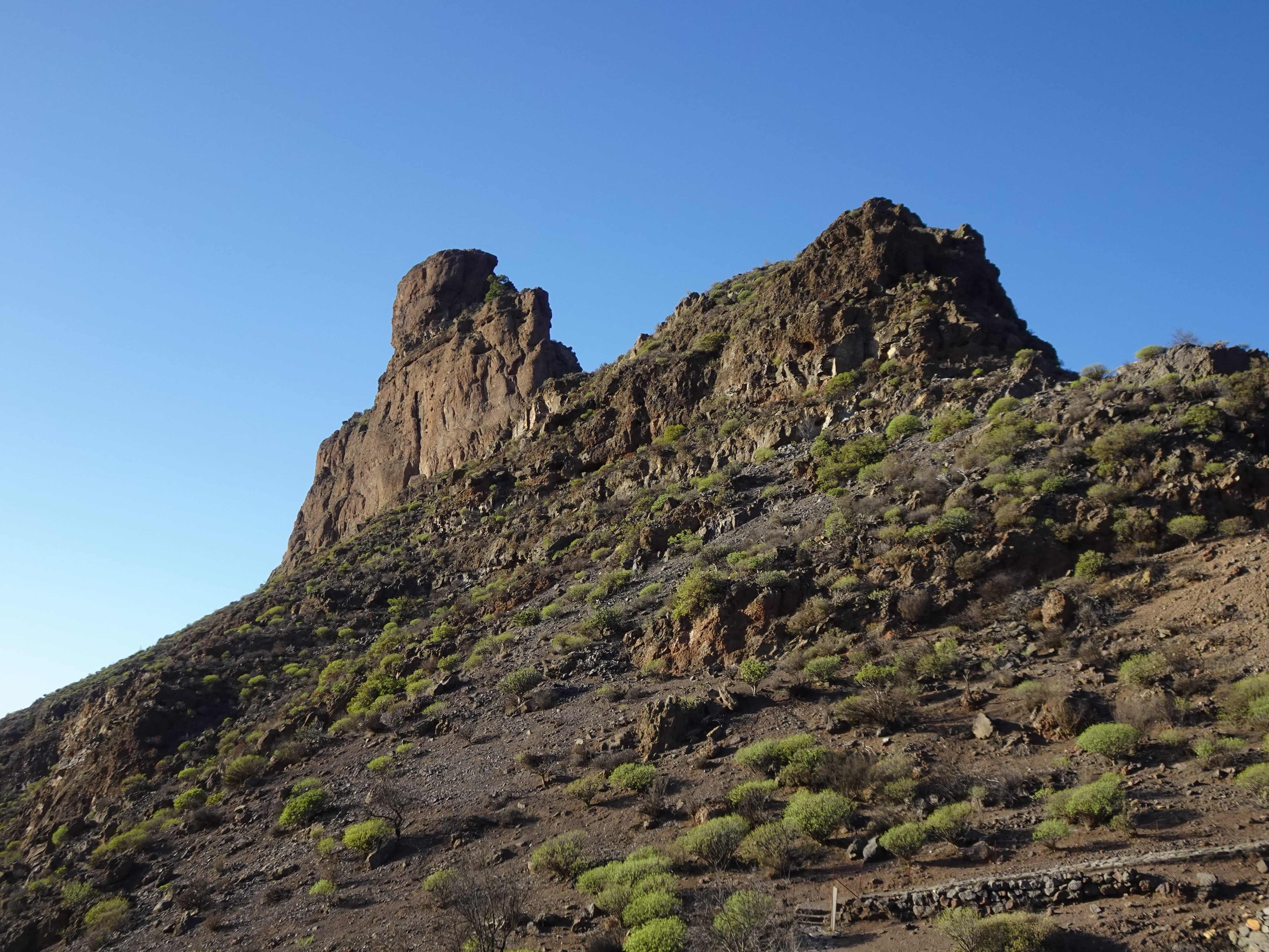
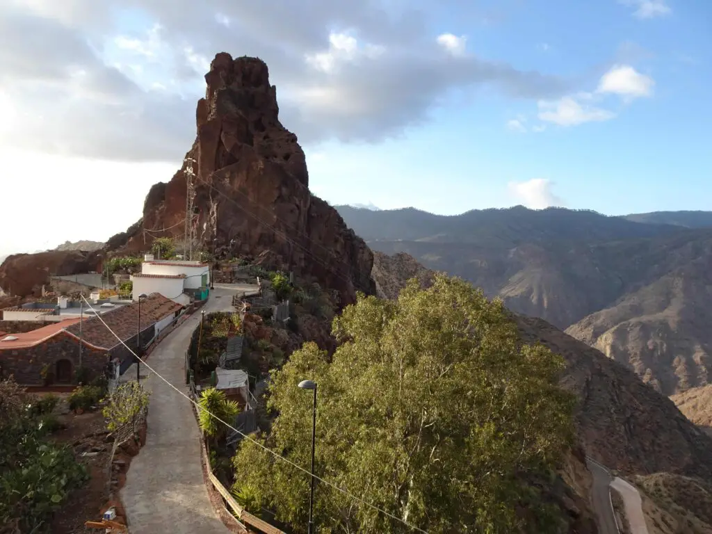
Roque Bentayga
Roque Bentayga is one of the dramatic volcanic rock outcrops that dominates the landscape of north-eastern Gran Canaria (the other one is the equally impressive Roque Nublo). According to sources written by the Spanish conquerors, the formation was used by the ancient Canarians as both a place of worship and a defensive stronghold in their fight with the invaders.
At the foot of the outcrop lies an Almogarén, a ceremonial platform with an U-shaped depression, carved into the rock. There is also a small visitor centre with displays on the geology and archaeology of the area that we found worth checking out.
The Roque Bentayga is the only site that has opening times (apart from the information centre in Artenara), so make sure to not arrive too late – Once the visitor centre closes, the trail is cosed too. You’ll need at least 45 minutes to climb to the formation and back down and to quickly pop into the visitor centre.
It’s still a good idea to come here early when it opens or shortly before closing to avoid the crowds, as this is by far the most popular one of the sites. I assume most of them come for the views, which are fantastic all around.
How to Get There
To get to the visitor centre, you’ll have to turn west of the GC-G0 at the turnoff a few kilometers south of Tejeda (It’s well signposted). You’ll have to leave your car at the visitor centre and follow a trail up the mountain for about 20 minutes to the plateau at the foot of Roque Bentayga.
The trail is well maintained, but at times narrow and close to the edge, plus the sharp volcanic rock makes for bad footing, so take it slow when climbing up (and especially down).
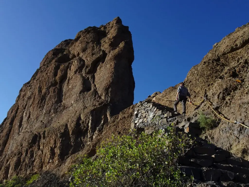
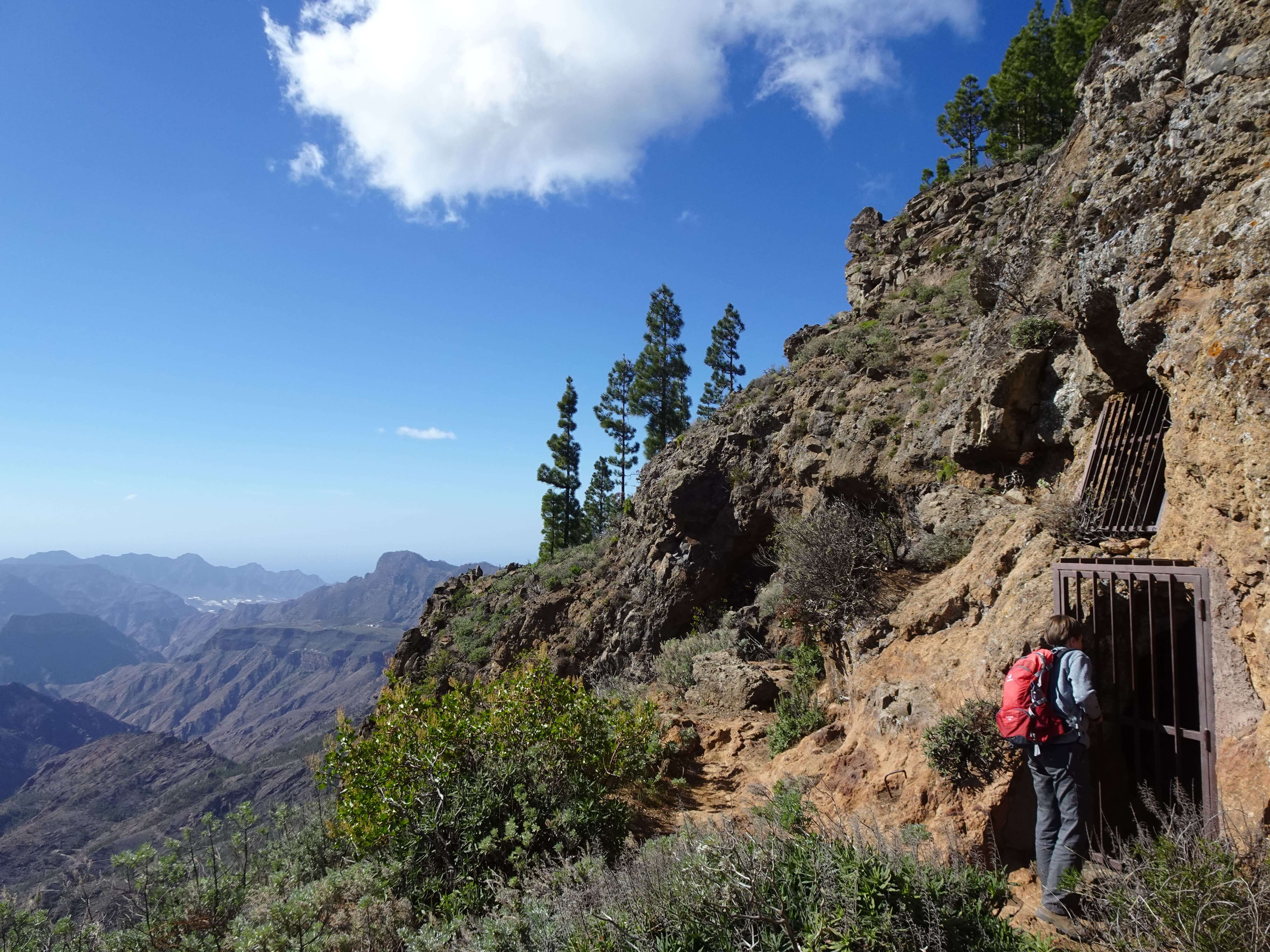
Cuevas del Rey
The Cuevas del Rey were probably my favourite site among the bunch, both in terms of location and the possibility to actually explore the place. In fact, it’s the only one of the sites were none of the caves were closed off.
The Cuevas lie behind the much more popular Roque Bentayga and not many people seem to make the little extra effort to get there, which made it all the more enjoyable in our book. Then again, the way there is not for the faint-hearted.

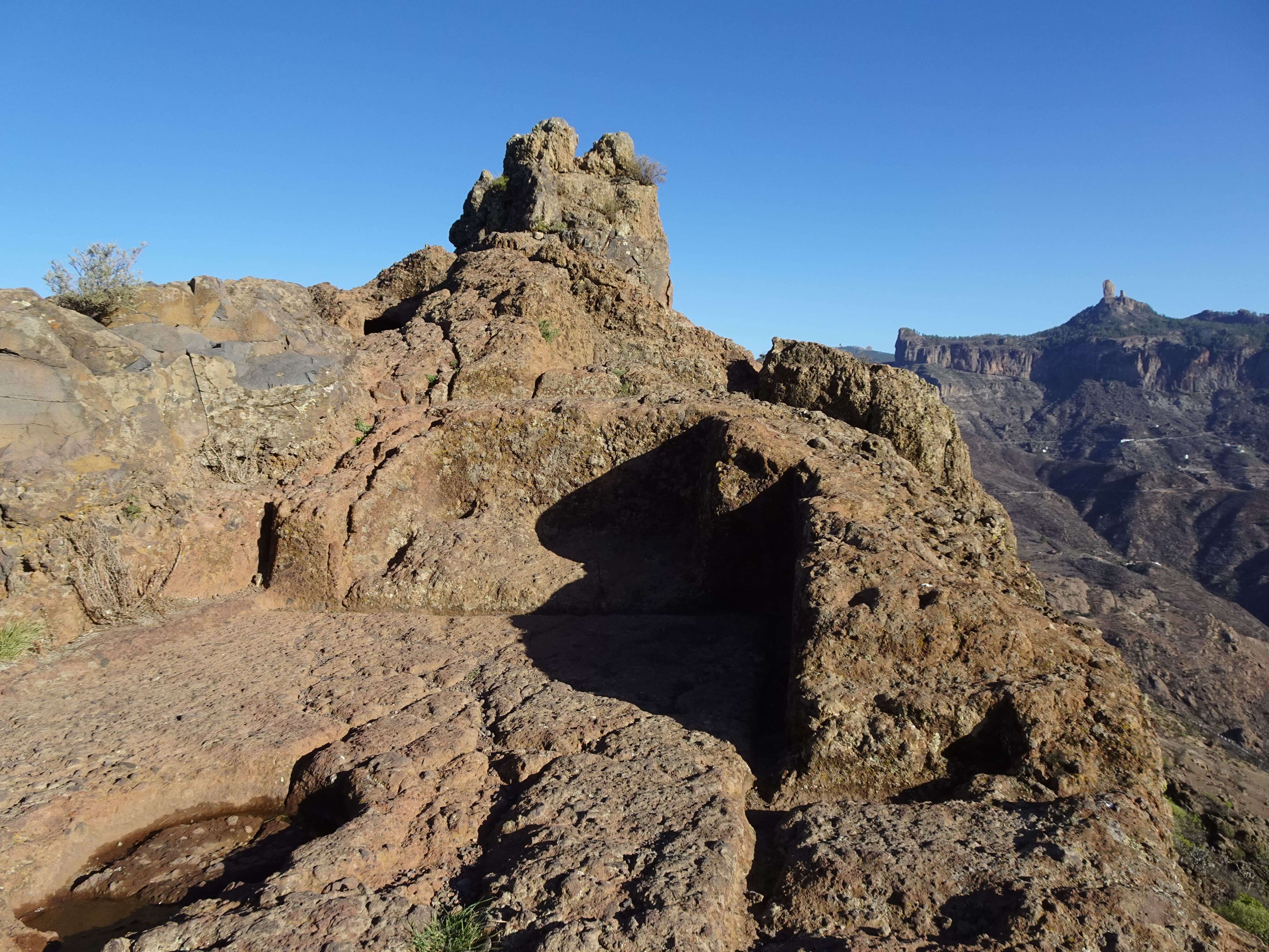
There are three accessible sets of caves in the cliff face of a rock outcrop, most of which are said to have been used as granaries by the ancient Canarians. The most important cave here is the namesake Cave of the Kings, which is impressively large, contains two small side-chambers and a series of artificial carvings and indentations in the walls and floor.
The views out of the cave opening are very impressive, too, plus we loved the constant picturesque backdrop of the towering Roque Bentayga to the West. If you visit just one of the sites, I really recommend making it this one.
How to Get There
You’ll have to follow the same road as to the Roque Bentayga, but instead of turning left and driving up to the visitor centre, you’ll have to continue straight ahead down a narrow, bumpy road next to the abyss. Take it very slow here, as there are no guardrails and the drop is steep.
There’s room to park or two cars in front of a cheese dairy at the turnoff to La Solana. From there, walk past the dairy and turn left to climb up to the caves.
Again, take it slow, as the trail is narrow, steep and it’s easy to lose your footing on the loose underground. Some sections have ropes to hold on to, but in my opinion not where it would be most useful.
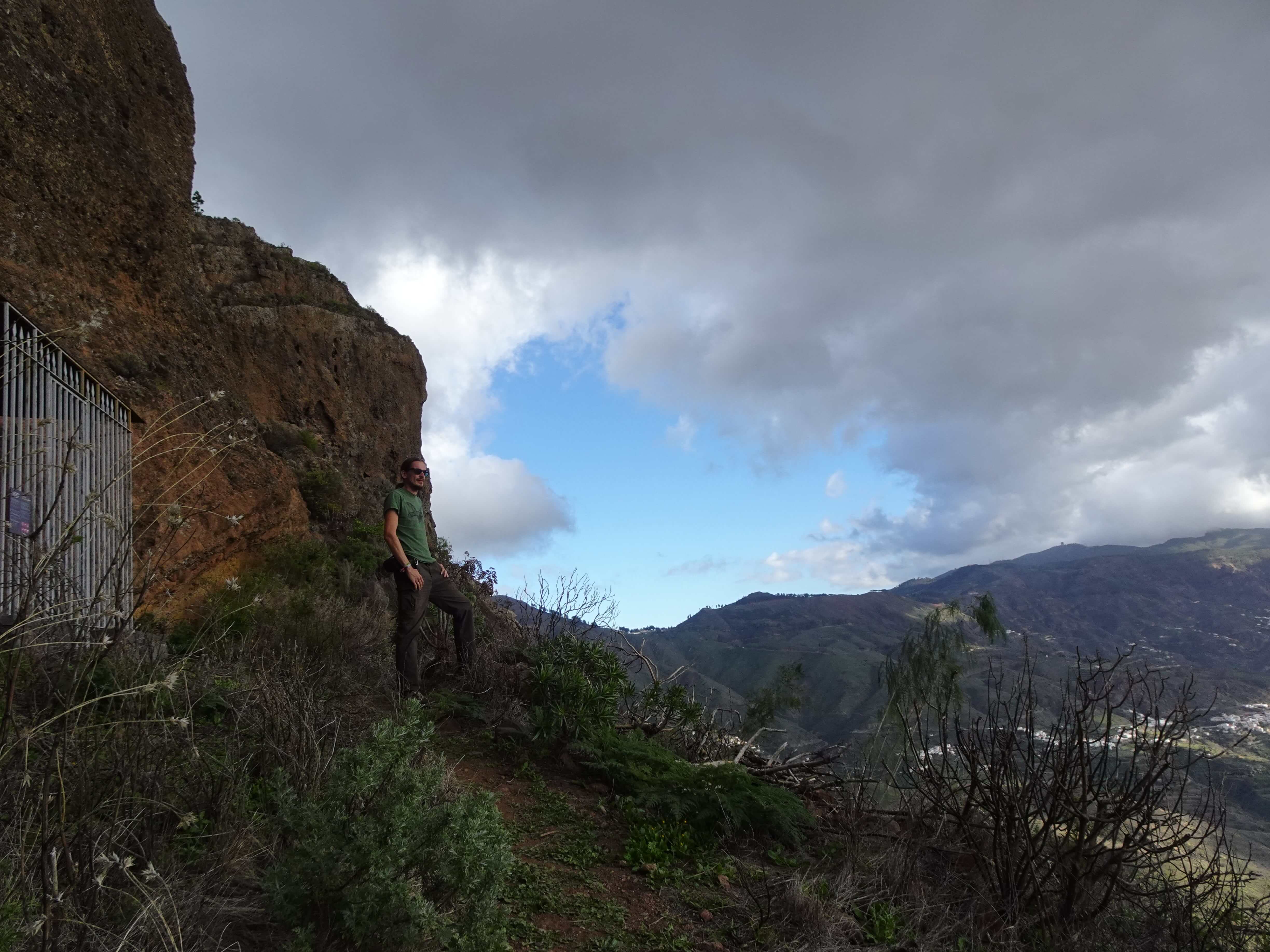
Cueva de Caballero
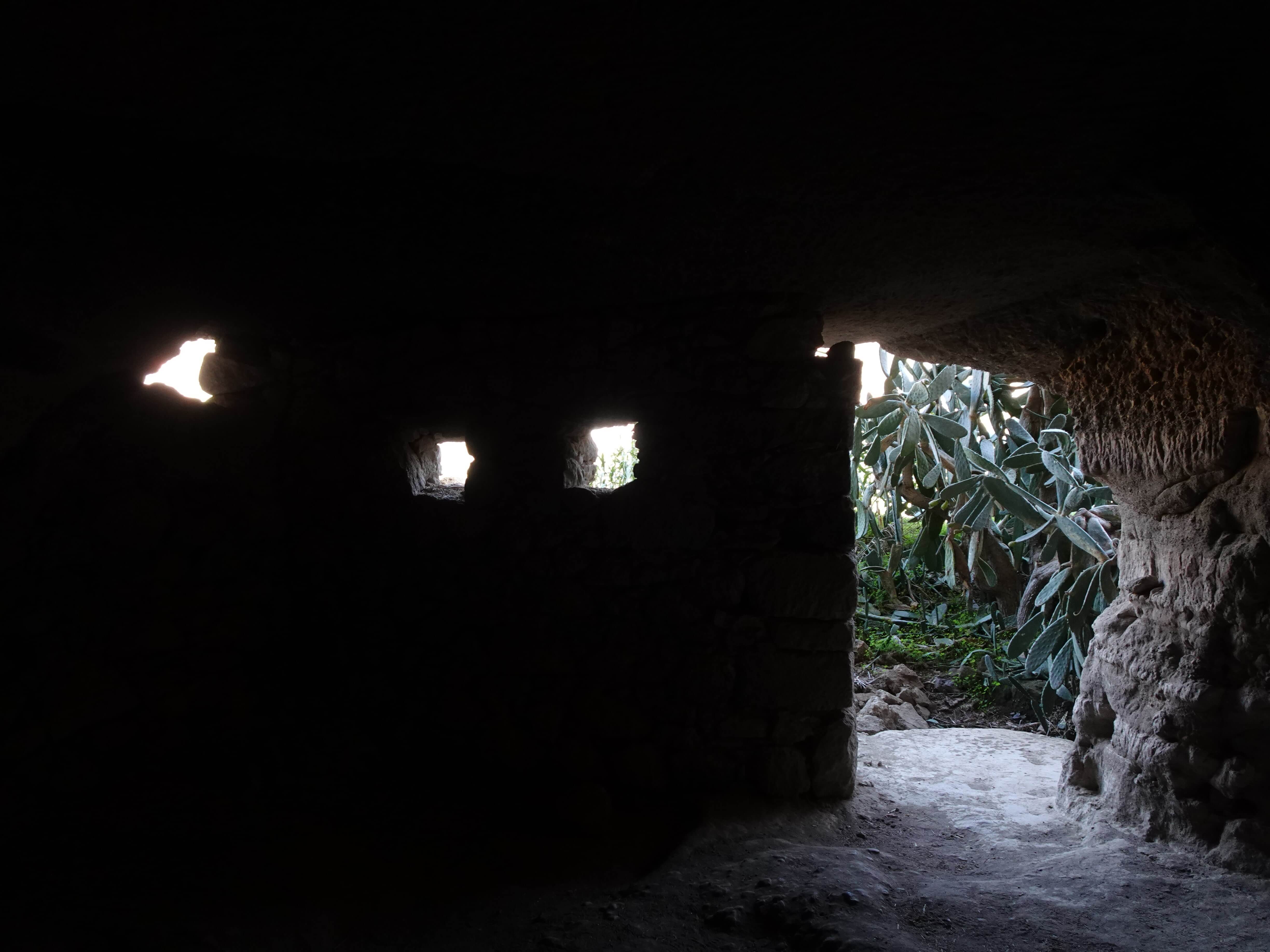
You know the drill by now: The Cueva de Caballero is another series of man-made caves carved out from a cliff in a dramatic location. The caves are closed off, but at least by barred gates, so you can peek inside all of them.
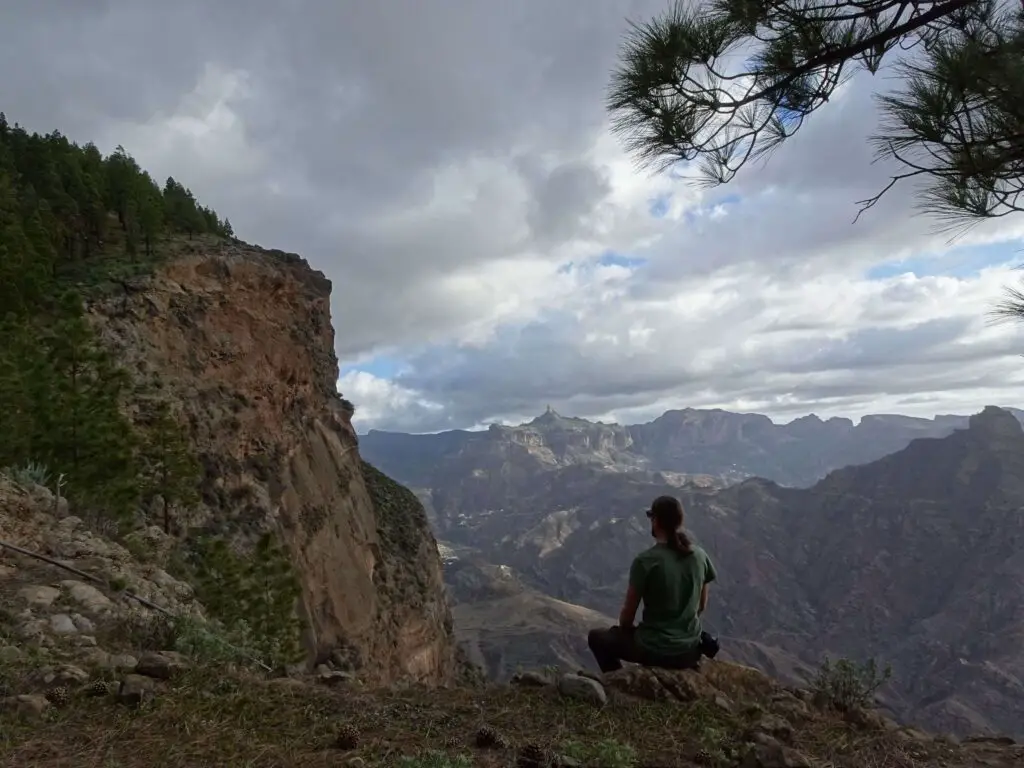
Still, as you can’t really see any of the details inside the caves, the main reason to come here are the spectacular views of the Tejeda Caldera to the south, as well as the nice stroll through the pine forest required to get there.
How to Get There
The caves are in the mountains east of Artenara. The easiest way to get there would be to follow the GC-150 south from the Mirador de Pinos de Gáldar and to park your car in the first hairpin-bend you come across.
From there it’s a 30-minute walk first south, then west to the Cruz de Los Moriscos (a small stone cross dedicated to the Virgin Mary) and then south again to the caves.
Cueva de los Candiles
This site offers an interesting contrast. It’s probably the least spectacular archaeological site among the bunch, but it sits in the most spectacular location. The Cueva de los Candiles is a single cave, once again barred by a gate, through which you can peak into the dim interior.
If you could actually explore the inside, it might be more interesting, but as it is, the way there and the views are much more of a reason to drop by. The cave mouth offers amazing views of the mountainous area to the south, stretching from the Roque Nublo to Roque Bentayga and the Cuevas del Rey and to the Mesa de Acusa.
I can really only recommend going to the Cave if you’re not in the least afraid of heights (and even then, you’ll need to be careful). If you actually do make your way there, however, you’ll likely be filled with a sense of achievement that none of the other sites provided for me;)
How to Get There
You can either continue following the trail west from the Cueva de Caballero for a long round-hike of at least two hours or park your car in Artenara, and climb up to the cave from there (which is what we did).
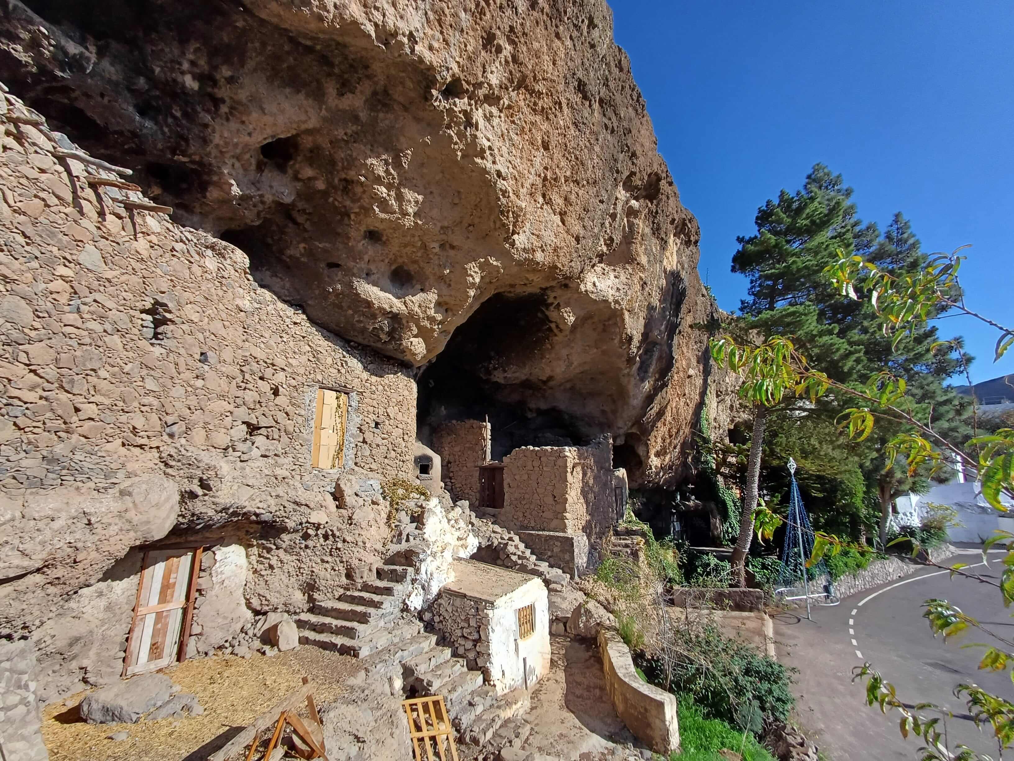
From Artenara, you’ll have to make your way to the Ermita de La Cuevita (a small chapel cut from the rock, which is very much worth visiting in its own right), then climb up the stairs next to it. Cross the road and follow the small trail east into the mountains.
From there, you’ll have to follow the edge of the cliff east, occasionaly climbing up until you come to a four-way crossroad. Here, you’ll have to turn right and follow the small, narrow trail down the cliff-face.
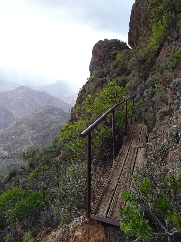
This section, which runs in switchbacks down the very steep mountainside is really only doable if you don’t suffer from vertigo and even then, you’ll have to take it very slowly. Shortly before the cave are three small ravines crossed by wooden planks, that creaked disconcertingly when I crossed them (and I don’t weigh a lot). I thought it best only to step on the parts that had a metal bar underneath them.
Again, getting here certainly isn’t easy, but once you’ve made it, I’m sure you won’t regret it.
Which Are the Must-See Sites?
I’m aware that most people don’t have the time or interest to visit all of the locations, like we did. If you wonder which of the sites are the best to check out, I’ve got you covered.
As I’ve outlined above, the most interesting and spectacular place in my opinion are the Cuevas del Rey, which offer amazing views all around. Also, you can actually enter all of the caves and explore their interiors. A visit can also easily be combined with the Roque Bentayga, which should be on every Gran Canaria Itinerary, anyway.
If you have more time, the Mesa de Acusa should be on your schedule as well and if your up for an adventure, you might want to hike to the Cueva de los Candiles. Ultimately, I found all of the sites worth visiting. but here’s my ranking from most to least spectacular:
- Cuevas del Rey
- Roque Bentayga
- Mesa de Acusa
- Cueva de los Candiles
- Risco Caído
- Cueva de Caballero
- El Hornillo
- Barranco Hondo
Map of the Sacred Mountains WHS
All of the sites described above can be found in this map of the World Heritage Area.