Something more unusual I like to do during my travels is to explore old abandoned places I come across. I just love the unreal, post-apocalyptic atmosphere of these modern ruins, and the buildings in varying stages of decay often make for great photo opportunities.
That said, we were quite surprised by the high density of very different abandoned places on beautiful Gran Canaria. They formed a nice contrast to the more touristy attractions on the island and allowed us to explore some historical traces that many people will never get to see.
Read on for my list of the best Urbex locations on the island, and remember: Take nothing but pictures, leave nothing but footsteps.

This post may contain affiliate links, and I might earn a small commission at no additional cost to you. For more info, click here.
The 6 Best Abandoned Places on Gran Canaria
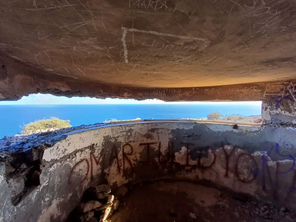
San Juan Artillery Battery
This military fortification in the capital of Las Palmas was built in 1898 in fear of a potential invasion after the Cuban War, which never took place. The complex was eventually abandoned after WW2, and today the only people patrolling it are locals walking their dogs.
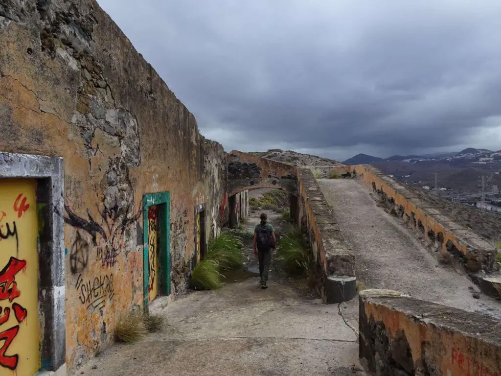
The strategic position of the compound means that there are great views of Las Palmas and the surrounding bay from up there. While the architecture of the battery itself is nothing special, there is plenty of interesting graffiti around that make for a fun half hour of exploring.
The Batería de San Juan sits on top of the hill of the same name, directly to the south-west of the city’s historical centre, and can be reached from there in about 30 to 40 minutes. Be aware that it is a steep climb to the top of the hill, though.
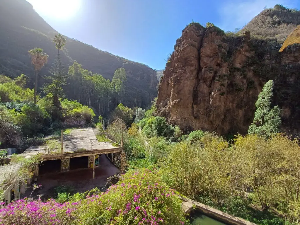
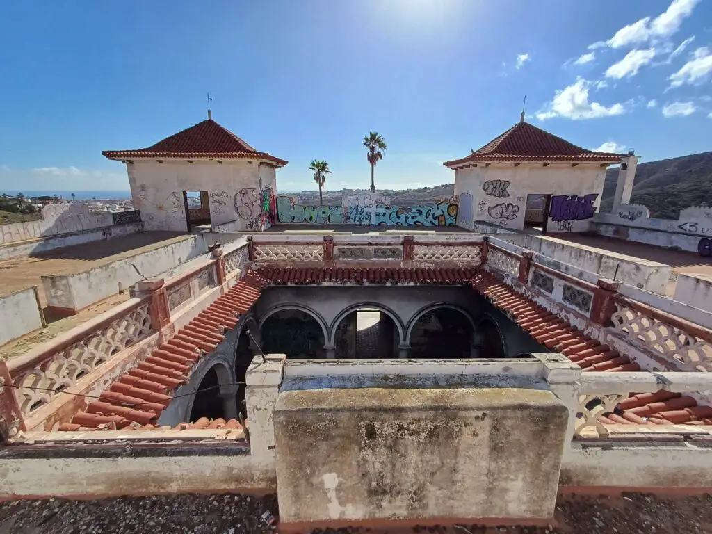
Azuaje Spa Hotel
The Azuaje Spa Hotel is probably the most famous abandoned site on the island. It was built in the 1860s and quickly became a popular retreat for wealthy guests, promising health benefits from its supposedly therapeutic waters.
The hotel was closed during the Spanish Civil War in 1938 has successively been reclaimed by nature ever since. Large parts of the gardens and the roof are completely overgrown by vines, and there are pretty bougainvillea blossoms all around.
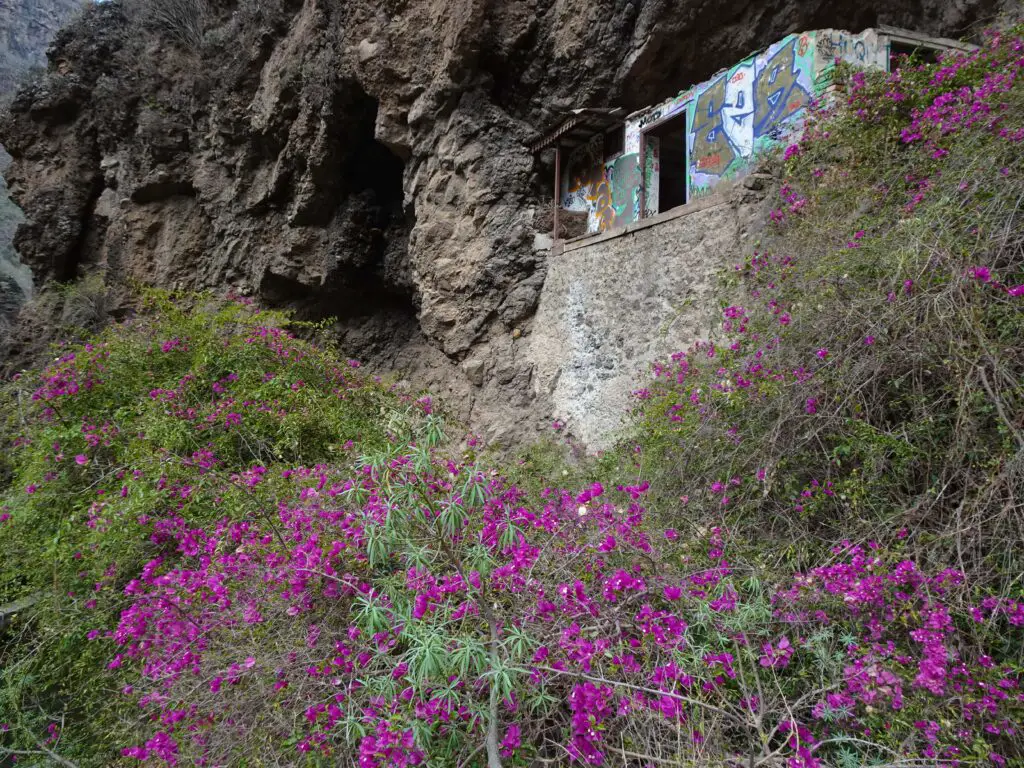
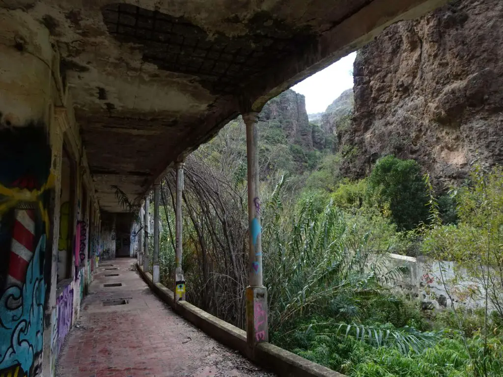
The romantic state of decay and some of the architectural details make for some great photo opportunities. Make sure to watch your step while exploring, as there are lots of open shafts and in some places the floor doesn’t look too good any more, either.
The hotel can be found at the northern end of the Barranco de Azuaje, to the west of the town of Firgas. The whole canyon is a nature reserve and super pretty, so it’s well worth exploring a little further from the hotel, as well.
While hiking through it, we had to scramble a lot and needed to constantly cross a little stream on a series of rickety wooden bridges, but we had lots of fun and ended up at a tiny waterfall surrounded by dense vegetation.
Pozo del Guincho
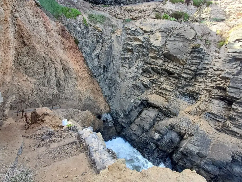
Built into the cliffs of the island’s northern coast, the ‘Well of Guincho’ is an abandoned water extraction site that used to pump seawater up to a large reservoir on top of the cliffs. The water was used to irrigate nearby fields, but the site was eventually closed as a more modern water infrastructure took over.
Getting to the remains requires a walk down a narrow path along the cliffs and should under no circumstances be attempted during windy or rainy weather, or if you have any problems whatsoever with heights. Don’t go alone and if you’re unsure, better skip it altogether.
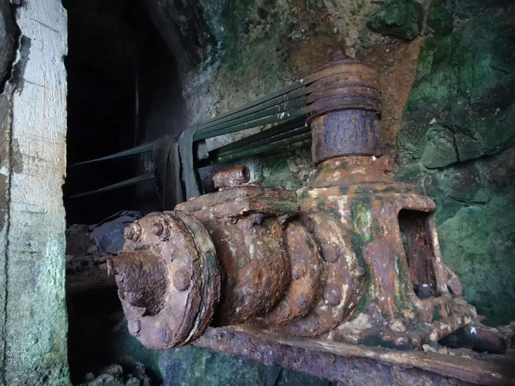
If you actually decide to visit, you’ll find two smallish rooms of rusting machinery cut into the cliff wall. In my opinion, the real star attraction lies even deeper in the complex, though.
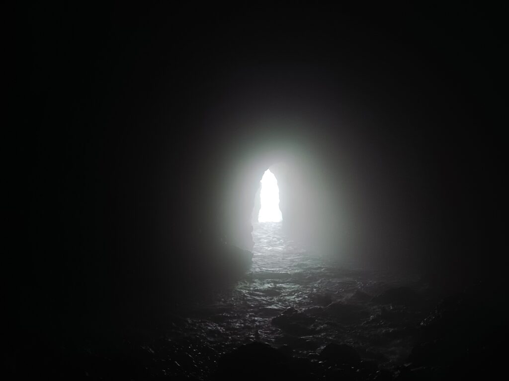
In the back wall of the lower room is a hatch, which is not easy to climb through, but after doing it, we ended up in a natural sea cave with constant crashing waves rolling in, which kind of made us feel like we were pirates or rum smugglers.
The site lies off the GC-3 between Tinocas and Bañaderos. There is a place to park a car near the access road to some greenhouses east of the well, but to approach the complex, you’ll have to walk in from the west and follow the descending path along the cliffs until you reach a crumbling set of stairs leading down to the well.
Arinaga Military Bunker
Located inside the prominent hill north of the fishing town of Arinaga, this huge underground bunker complex is another relic of Gran Canaria’s military history. It was part of the island’s coastal defence system, though apparently it never saw any real action.
I couldn’t find a lot of information on its exact history, except that like many military structures on the island, it was built in during WW2 and abandoned in the early 1970s. If you’re into war history or (like me) just like exploring eerie underground spaces, it’s an interesting stop.
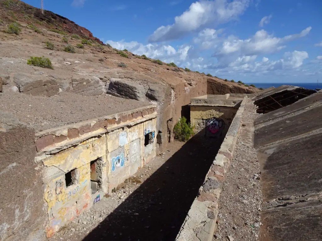
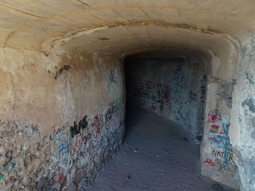
There’s a veritable labyrinth of subterranean tunnels, with lots of stairways and dead ends and some creepy echoing halls that make it sound like someone’s walking there with you. Anyone exploring it should really watch their step, as there are lots of open shafts with very deep drops. Also, you’ll need a good flashlight as it’s pitch black down there.
You can also walk through a trench zig-zagging it’s way up the hillside and through a small tunnel cut in the rock to end up in an old gun emplacement with a nice view over the coast. There are a few overground buildings around, too, but they’re not nearly as impressive as the subterranean parts.
The Montaña de Arinaga lies directly north of the town, opposite the lighthouse, and the entrance to the underground bunker is directly to the east of the big crumbling building on its southern slope.
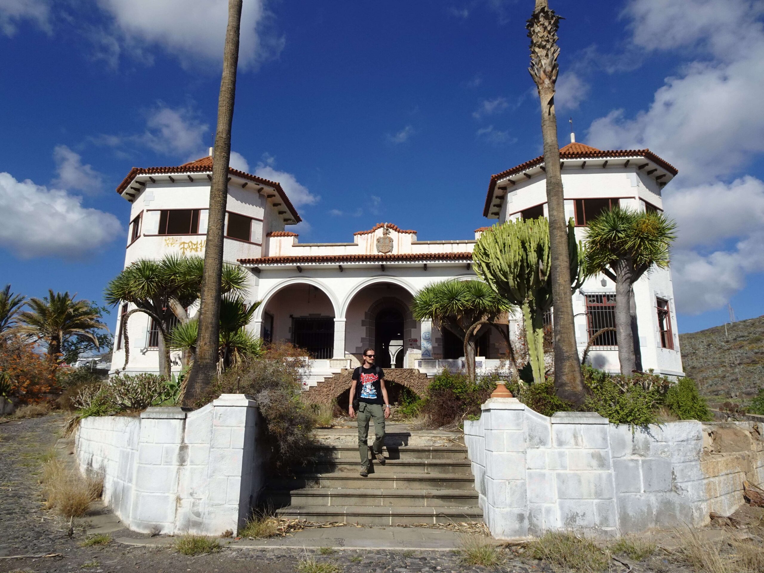
Finca San Rafael
This large mansion might be my favourite abandoned site in all of Gran Canaria and would be even more so, if it hadn’t fallen victim to a lot of vandalism. It used to belong to a (clearly) well-off family from nearby Telde and was abandoned in the early 2000s.

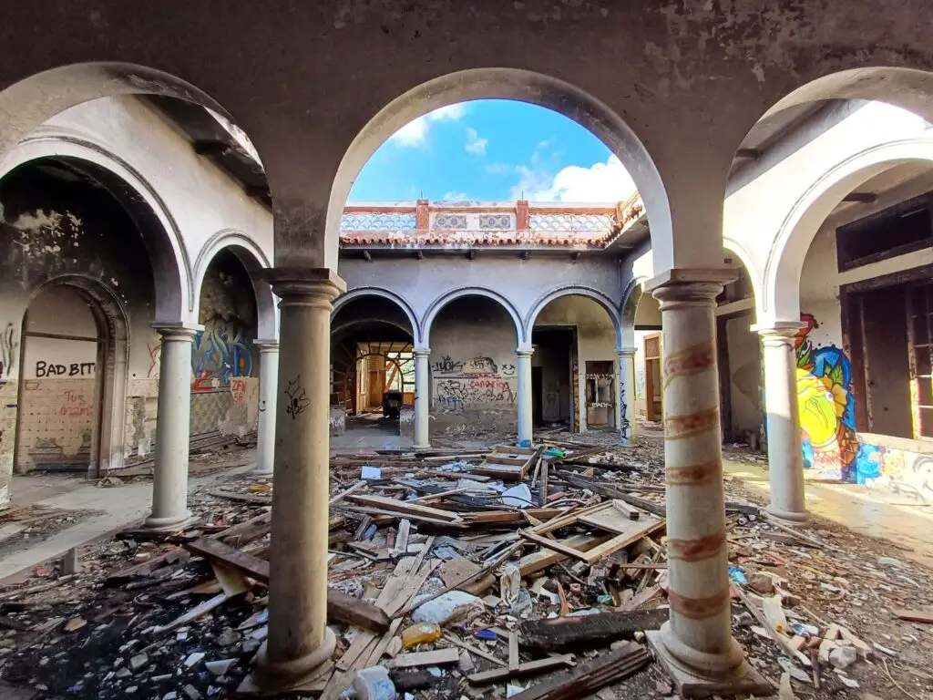
One of the owners over time was Jesus Ferrer Jimeno, a colonel of the Francist regime, and apparently, Francisco Franco stayed here on a few occasions himself, too. There are still a few remaining pieces of furniture in the huge villa, but a lot of the interior has unfortunately been destroyed.
We spent quite a while seeking out some of the still remaining ornamental details (for instance, check out the crest of arms over the entrance and the unfortunately headless crocodile statue that at one point likely spewed water into the fountain at its foot).
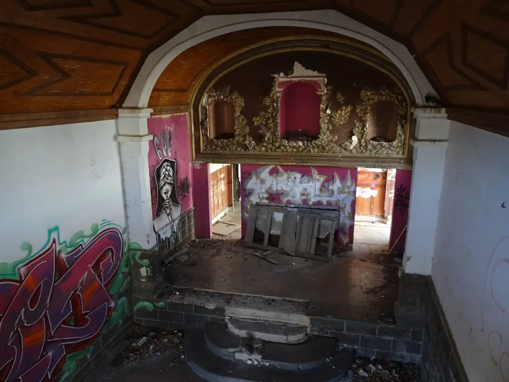
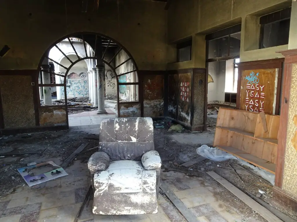
Some of our favourite spots in the villa were the large arcaded patio behind the entrance and the little chapel at the back of the property with its stucco cherubs and carved wooden ceiling. There are also various outbuildings, a huge overgrown garden and several empty swimming pools.
The Finca lies in the hills west of Telde, off the C-320. You can’t miss it when driving down that road.
San Roque Water Factory
Once a key facility for bottling and distributing local mineral water, the San Roque Factory now sits abandoned in the hills near Telde, its rusting machinery and empty halls slowly being overtaken by huge numbers of roosting pigeons.
Again, I couldn’t find a lot of information on this place, other than that it apparently closed in the late 1990s due to financial debt. The company seems to have existed since the 40s, but judging by the architectural style of the factory, I’d say the plant you can see today was constructed around in the 1960s or 70s.
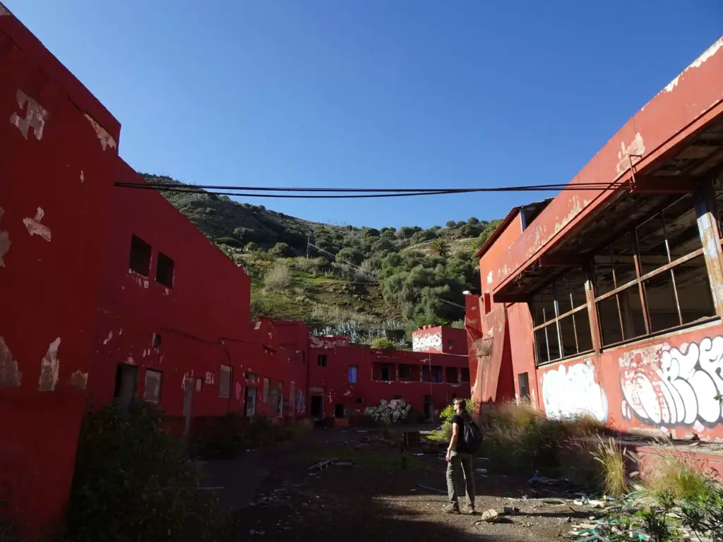
What’s left today is an industrial ghost town, with broken pipes, old water tanks and lots of graffitis. There are a few large halls, where the water was bottled and some smaller rooms in a separate building, which were likely offices.
As you would assume in a bottling plant, there is also a lot of broken glass, so watch your step. Altogether, the place is less spectacular than some of the other spots I mentioned, but it’s still worth a look, plus it’s a great place to take some pictures of the industrial decay.
The factory lies in a ravine off the GC-810, which leads from the GC-80 to Valsequillo.
Map of Gran Canaria’s Abandoned Sites
All of the Urbex locations described above can be found in this map of the island.