
As an archaeologist, the impressive Senegambian Stone Circles were one of the main reasons I wanted to explore little-visited upriver Gambia. Scattered across a region of about 30,000 km2, there are more than a thousand of these structures, both in The Gambia and across the border in Senegal.
I sought out quite a few of these while traveling the country, and spotted even more accidentally by the side of the road. In 2006, four of the more impressive sites were inscribed as UNESCO World Heritage Sites, two of which lie in The Gambia.
If you’re interested in the prehistoric culture of the region, I recommend visiting at least the most famous stone circles at Wassu, although there are definitely other ones worth checking out, too. Here’s everything you need to know about some of the most important archaeological sites in West Africa.

This post may contain affiliate links, and I might earn a small commission at no additional cost to you. For more info, click here.
Some General Information
A note on the sources: There aren’t many papers about the Gambian sites available (in fact, hardly any scientific literature on them exists). The information related in the post is mostly based on the statements of my guide in Wassu, the information signs in the Wassu and Kerr Batch Museums as well as the National Museum in Banjul and my own on-site observations.
Apart from that, I also consulted the 1965 Research Report from The Anglo-Gambian Stone Circle Expedition by Paul Ozanne and the 2018 paper: Augustin F.-C. Holl, Senegambian megaliths as world cultural heritage. Arts & Humanities Open Access Journal 2018/2, 2018, 179-185.
How Old Are the Senegambian Stone Circles?
The circles and rows of laterite pillars are generally believed to have been constructed sometime between 300 BC and 1600 AD. There are two reasons for this huge time span: Firstly, they are almost impossible to date accurately.
The stones themselves don’t contain any organic matter that could be used for radio carbon dating and there’s not enough potassium in laterite for it to be dated using the Potassium–argon dating method, which can be employed on volcanic rocks.
In Wassu, radio carbon dates have been established using a human remains found inside one of the circles, however it’s impossible to tell whether they are actually from the same time period as the stones or were placed there at a later (or even earlier) date.
At the same time, it’s very likely that the circles actually have been constructed over a long time and that later generations simply continued the traditions of their predecessors. Thus, the circles probably are the result of a longer construction and usage process spanning several centuries at the least.
What Was the Purpose of the Circles?
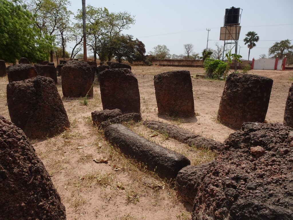
The exact purpose is even harder to determine than the age. The main hypothesis seems to be that the circles served primarily as burial monuments. However, up until now, only a handful of the structures have been excavated – most of them in the 1960s under the coordination of Paul Ozanne.
Some of them harboured single graves, some mass burials and some just dislocated body parts, while others didn’t contain any human remains at all. As outlined above, it’s also hard to determine whether the burials happened at the same time as the construction of the monuments and if this was their only or at least their primary purpose.
For instance, some of them might have also been used as meeting places or communal monuments to reinforce a group’s collective cultural memory. If their importance was tied to the identity of a certain group of people, it might explain why there are single circles in a lot of places and concentrations of them in some locations.
The latter might have been close to bigger settlements with a more heterogenic cultural makeup, or they might have grown over time and each circle was used by a single generation of the village.
In my opinion, it’s likely that the monuments served different functions, either at the same time or depending on their chronological and geographical distribution. Future excavations might help to shed some more light on the purpose of these monuments, but I think a certain level of mystery (which is generally hard to avoid in prehistoric archaeology) also adds to the intrigue of these places.
Visiting the Senegambian Stone Circles in The Gambia
Wassu is the most famous site and the one that you shouldn’t miss in my opinion. Kerr Batch is fascinating as well, plus you’re likely to have the place to yourself, but it’s also a lot harder to reach. Both are listed as World Heritage Sites and contain the highest concentrations of circles in the country.
Finally, there are a number of smaller circles on the north bank of the river that might only be worth visiting if you are a big archaeology buff or are passing through the area anyway.
Wassu Stone Circles
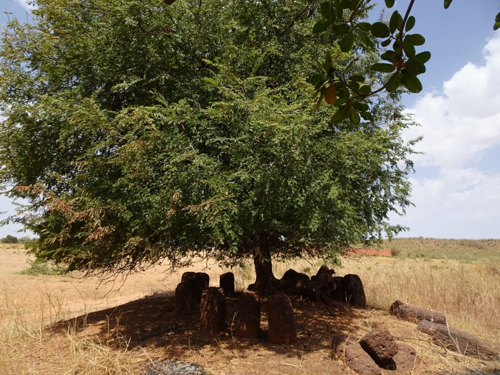
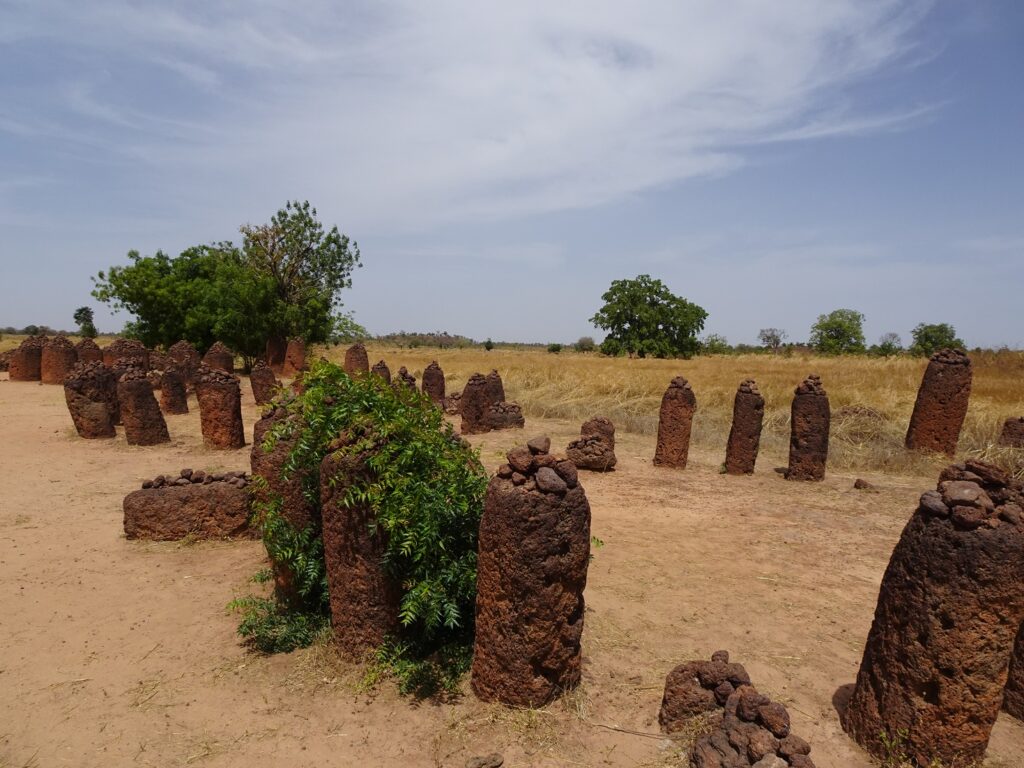
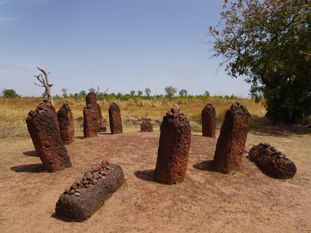
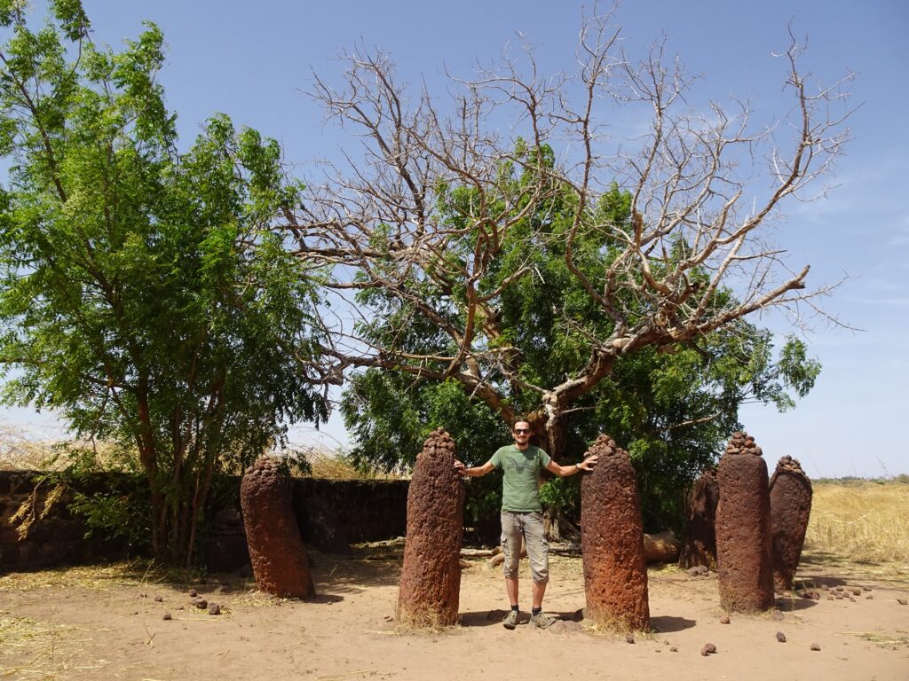
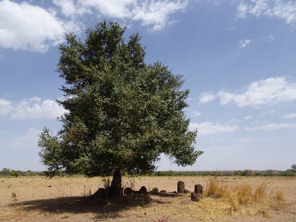
If you only visit one set of circles, make it Wassu. It’s the biggest and best preserved in the country, and also the one that’s easiest to reach. The site has 11 separate circles and a few single standing stones scattered around.
There are volunteer guides hanging around on site, who will tell you about the excavation history and interpretation of the circles, but you have to take some of what they tell you with a grain of salt. A lot of what my guide presented as fact turned out to be mere hypothesis, when I asked some more questions.
Still, he was very enthusiastic and happy to answer all my questions, so I was glad I took him up on his offer. The guide service is free, but make sure to give a tip of 50 to 100 Dalasi.
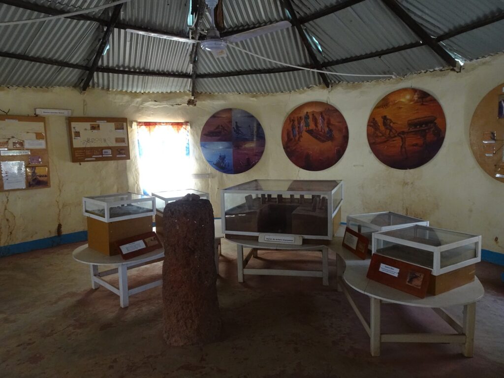
The tallest known monolith (2.59 m) in all the Senegambian sites can also be found here, as well as a quarry east of the circles, where the rocks were carved from the local laterite. There’s also a tiny museum consisting of one room with a few panels explaining the history as well as some pottery fragments found on site.
Entrance Fee
I paid 200 Dalasi, which included access to the site and the small museum as well as the tour (although not the tip for the guide, obviously).
How to Get There
Wassu is located near the village of the same name, about 20 km northeast of Kuntaur. The best base to visit the circles is Janjanbureh, from where you’ll first have to take the ferry to the north bank of the river (10 Dalasi) and then take a bush taxi from Lamin Koto (this should be about 30 Dalasi). The whole trip shouldn’t take more than an hour one-way.
Kerr Batch Stone Circles
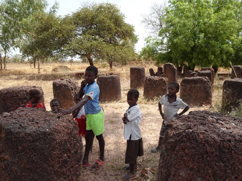
Kerr Batch is the less famous cousin of Wassu, but personally, I found it almost more atmospheric – mainly because it’s a lot more isolated. It’s also much less popular with tourists than Wassu and the caretaker told me that I was the first visitor in a couple of days. The local kids were delighted, and about twenty of them followed me around the site.
Kerr Batch contains 9 single circles and a double circle, all of which are quite well-preserved. There’s also an unusual V-shaped stone referred to as the ‘lyre stone’. Again, there is a small visitor centre with a one-room museum, although this one’s focus is more on local traditions than the stone circles themselves.
The Fula lady, who served as a caretaker, was once again super friendly and enthusiastic, and did her best to answer all my questions.
Entrance Fee
The fee is 100 Dalasi and includes access to the site and the museum.
How to Get There
Kerr Batch is located near Nyanga Batang, on the North-Bank road between Farafenni and Janjanbureh. Unfortunately, it’s rather out of the way and impossible to reach by public transport. I rented a car for my last three days in the country to visit this site and other places I couldn’t reach by gelly-gelly.
Without your own wheels, you can take any GTSC Bus, gelly-gelly or bush taxi running along the North-Bank road and ask them to drop you at Nyanga Batang. There, you’ll have to either find someone willing to take you to the site or walk for about 8km (one-way). I didn’t meet any other cars or motorcycles while driving there and back, so hitch-hiking doesn’t really seem to be an option.
Alternatively, you can try to hire a tourist taxi in Janjanbureh, although this would be a little pricier (at least 2000 to 3000 Dalasi, I’d assume).
Other Stone Circles in The Gambia
If you’re still hungry for more stone circles after Wassu and Kerr Batch (or if you just like finding places nobody else seems to visit), there are several smaller, lesser-known sites dotted around. Most of them are spread out between Farafenni and Basse Santa Su on the north bank of the River Gambia.
For instance, there’s a small circle about 1.5 kilometres north of Lamin Koto directly to the east of the road in a copse of trees (N 13° 33.501 W 14° 45.858). It’s not really worth a detour, but if you have your own car, it makes for a nice short stop on the way from Janjanbureh to Wassu or Kuntaur.
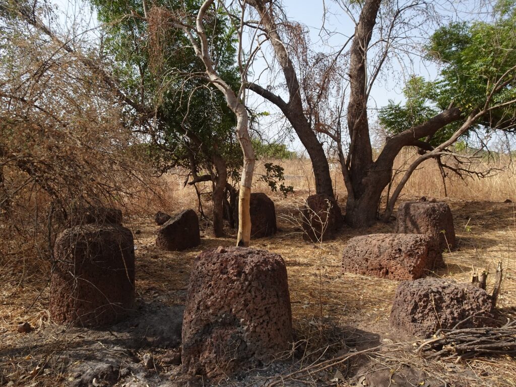
Some more circles are located near the small town of Kau-Ur further west along the North-Bank Road. You can find them in the fields surrounding a couple of small villages about 3km west of town. To get there, turn north off the highway at the village of Jahaur, directly west of the wetlands, and follow the dirt track north through a few villages.
The first circle (N 13° 42.395 W 15° 22.160) lies in a field east of the road after passing through the first village after Jahaur. Two more circles (N 13° 42.790 W 15° 22.672) can be found a little further north after passing through another village. One of the latter is part of a local legend, claiming that the stones were once a human wedding party that was spontaneously turned to stone.
None of these circles are signposted or have any kind of visitor infrastructure. For me, their isolated location and the tiny villages I passed along the way that I’m sure hadn’t seen a toubab in ages were a big part of the appeal.
Senegambia Stone Circles Map
All of the sites mentioned in my post can be found in this map of Central Gambia.