The northern Lake District is one of the most spectacular parts of the National Park, and in my opinion, there’s no better place to base yourself than pretty Keswick. From here, you can reach the trailheads of many amazing hikes – either by foot or with the great regional bus network.
Around Keswick, there are hikes suited to every level of fitness, from the easy walk along the Threkeld Railway Path, to short but steep climbs like Catbells, to more demanding full-day hikes like the one up Skiddaw mountain. Stefanie and I have explored the area over several visits and scaled quite a few summits around here.
From easy to tough: Here’s our list of the best hikes to do around Keswick.

This post may contain affiliate links, and I might earn a small commission at no additional cost to you. For more info, click here.
The 8 Best Hikes Around Keswick
Best Easy Walks Near Keswick
Threkeld Railway Path
This gentle 5km or 3mi. walk along a former railway line is one of the easiest hikes in the area. It follows the traces of the old Keswick to Penrith railway, so it’s flat and very easy to navigate. Along the way, you’ll cross the meandering Greta River several times, which opens up some really nice views.
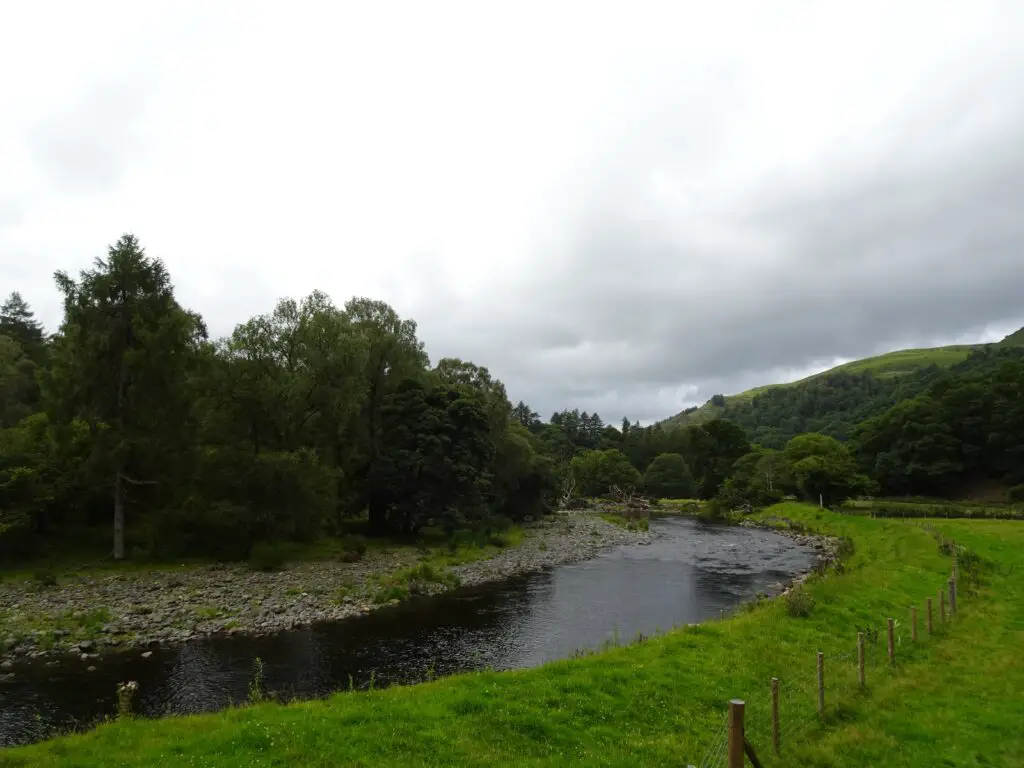
Additionally, you can read up on the local history and nature on signboards along the way. The trail starts at Keswick’s old train station and ends in Threkeld, where you can catch a bus back to Keswick. Alternatively, you can circle back via the Castlerigg Stone Circle, although that requires some walking along roads.
Castlehead
Castlehead is the small hill to the south of Keswick, that you can see from various points along the shore of Derwentwater. At 165m or 541ft., it’s pretty miniscule compared to the surrounding mountains, but it makes for a nice destination if you have an hour or so to kill, and the views from the top are well worth the short climb.
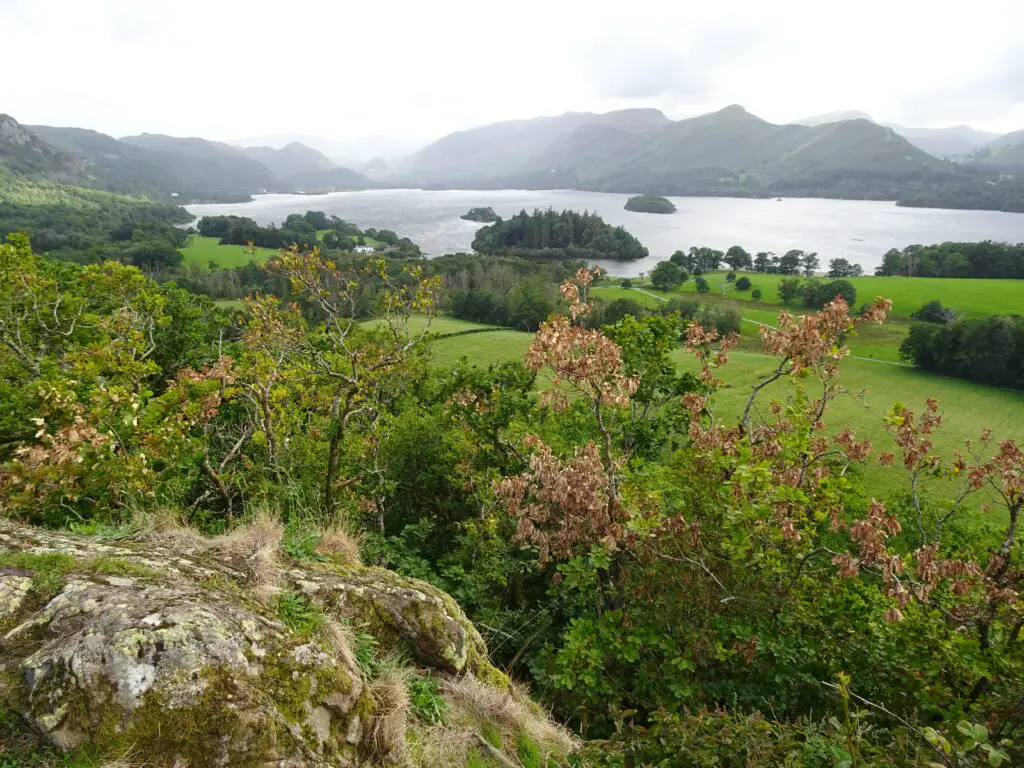
The best way to get there is to walk east through Cockshot Wood near Keswick’s Pier at the northeastern edge of Derwentwater. Follow the path through the fields, before starting the short, but steep ascent. From the top, there are nice views across Derwentwater to the Catbells.
Whinlatter Forest
Whinlatter is a large mountain forest at the south-western tip of Bassenthwaite Lake. There are several hiking and mountain-biking trails, some pretty amazing nice viewpoints as well as chances to spot local fauna, including endangered Red Squirrels.
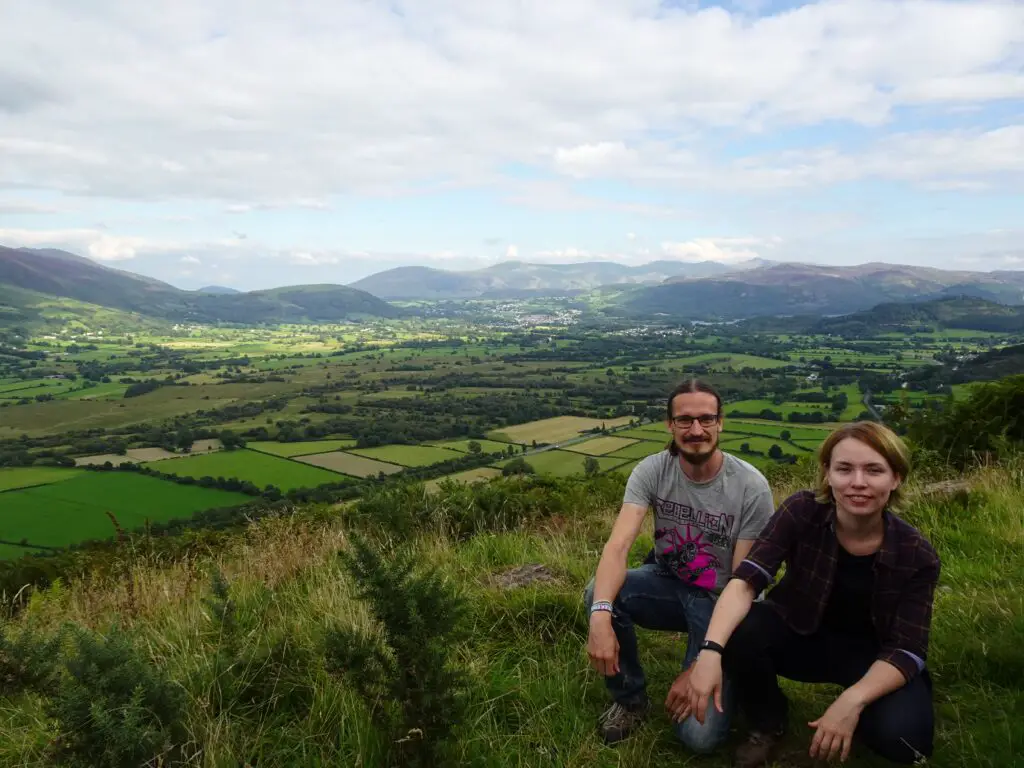
We can recommend the 7.5km (4.5mi.) Wow Trail, which shows you some of the nicest parts of the forest and is pretty easy to navigate. To reach Whinlatter Forest from Keswick, take Bus 77 from the Bus Station near the Booths Supermarket and return by Bus 77e.
You can check the bus schedule on this site, but be prepared to wait for the return bus, especially in summer, when there’s a lot of traffic.
Best Medium Difficulty Hikes Around Keswick
Latrigg
If you’re looking for some great views of Keswick and Derwentwater from the north without too much of an effort, Latrigg is the hill to climb. The easiest way to get there, is to follow Spoonygreen Lane off Briar Rigg Road near the old train station and then to turn right after rounding a switchback in Whinny Brow Wood.
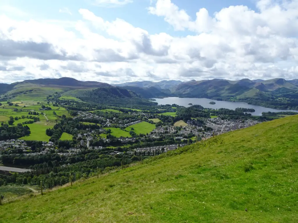
After enjoying the views, you can either return to Keswick, or do like we did and continue on to climb Skiddaw Mountain.
Dodd
Like Latrigg, the Dodd is another fell that is completely dwarved by nearby Skiddaw mountain, but which is well worth climbing in its own right. The path to the summit starts near the Mirehouse Bus Stop, which is served by buses X4, 554 and 73 at the time of writing. You can check the bus schedule on this site.
There are some cool views of Derwentwater and Bassenthwaite Lake from the top and if you’re lucky, you might even spot one of the Bassenthwaite Ospreys – the first pair of Ospreys nesting in the Lake District for over 150 years.

There are two watch stations on the western flank of Dodd Mountain, where you can use telescopes and binoculars to look for them, but we actually managed to spot one of them without any optical enhancements on our descent.
Catbells
The Catbells are one of the most popular hiking destinations in the area, and it’s easy to see why. It’s a rather short (albeit steep) climb to the top for amazing views of Derwentwater and the Keswick Valley to the north.
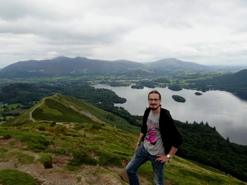
The Catbell’s popularity means that it can get rather crowded, so I suggest you climb them early in the morning, when most people are still sleeping off last night’s Pub Hangovers.
To get to the trailhead, you can simply take the 77e Bus, which circles the Buttermere Valley clockwise from Keswick’s main bus terminal. You’ll have to get off at the Gutherscale Lodge Bus Stop. You can check the bus schedule on this site.
Check out my full guide to climbing Catbells here.
Walla Crag
Walla Crag is on the eastern side of Derwentwater, almost exactly across from the Catbells. Interestingly enough, we met much fewer people here than on the Catbells hike, even though we went later in the day. The hike is a bit steep in parts, but in my opinion, the views from the top of the cliff are even better than the one’s from Catbells.

The panorama of Keswick backed by the Skiddaw Massif, framed by Derwentwater with its tiny islands, must be as quintessential as Lake District views get. It’s certainly one of my favourite spots in the National Park.
To get to the trailhead, you can simply walk south along the eastern shore of Derwentwater until you reach the pebbly shore of Calfclose Bay (the one with the artwork fashioned from a big erratic boulder cut in two parts). Cross the Borrowdale Road to the east and follow the trails through Great Wood south until you reach Cat Gill Gorge, where the ascent to Walla Crag begins.
Best Challenging Hikes Around Keswick
Skiddaw
Skiddaw is the impressive fell towering over Keswick on its northern side. As you might imagine, climbing to the top is quite a slog, but it’s well worth the effort for the amazing views of Bassentwhaite Lake and towards the Cumbrian Coast beyond.
The weather can be quite changeable, so even if the views aren’t that great at first, stick around for a while and it might clear. When we arrived at the summit, it was shrouded in clouds, but ten minutes later they parted, and we even managed to see Scotland and the Isle of Man in the distance.
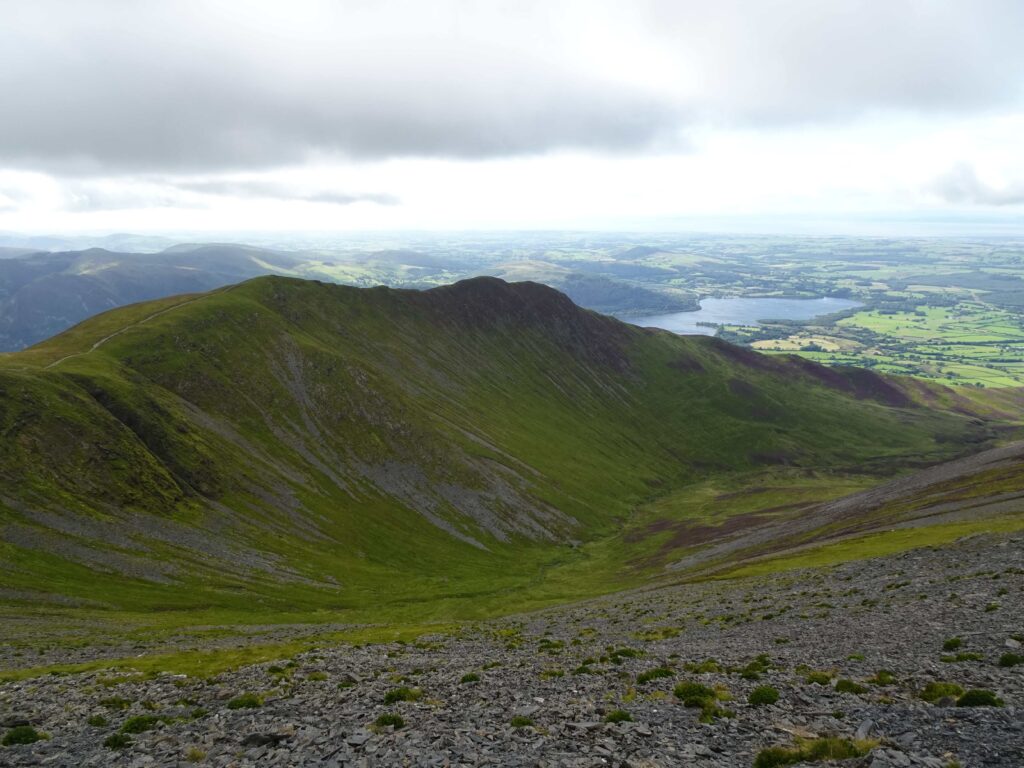
To find the trailhead, follow the route towards Latrigg (see above) and simply continue north to reach the southern flank of Skiddaw. For the return hike, you can either retrace your steps, or take a more challenging route via Carl Side – it’s slow going, with lots of loose rocks, but the views of Derwentwater are incredible.
Check out my full guide to climbing Skiddaw here.
Other Challenging Hikes
Skiddaw was the only more challenging hike we did in the area, but if you like to push yourself, you can reach the trailheads of several other tough hikes in the area. Some possibilities include Blencathra to the east of Skiddaw, as well as Helvellyn to the south-east. Honestly, you could spend months in the area without running out of summits to climb.
Map of Hikes Around Keswick
Have a look at this map of the area surrounding Keswick to see where the mountains and walks described are located.
Practicalities
The Best Hotels and Accommodations in Keswick
Keswick has plenty of accommodation options for different travel styles. If you’re on a budget, YHA Keswick Hostel offers affordable dorms, while the historic George Hotel is a good mid-range option. If you’re looking for a bit of luxury, try The Inn on the Square in Keswick’s Market Square.
Have a look at the map below for more options.
How to get to Keswick and Away
Keswick has regular bus connections to other places in the Lake District, like Grasmere and Windermere (Bus 555) as well as from towns just beyond the border of the National Park, like Cockermouth and Penrith (Bus X4 and X5). Check this site for schedules and connections.
See also
15 Fantastic Things to Do In and Around Keswick in England’s Lake District
The Ultimate 5-Day Itinerary for England’s Lake District National Park

Really enjoyed these lovely photos – such a stunning part of the UK. Haven’t been to the Lake District since I was a wee girl so it brought back lots of memories. I don’t do hiking but I do walking, so thank you for including the easy hikes 🙂
Hello Carole,
I’m glad you liked it! The Lake District is such a cool area of England and you don’t really need to do any of the tough hikes to experience it, sometimes the gentle lakeside strolls are just as spectacular.
The landscapes and views look amazing from all these hiking trails! But you got my attention on that demanding trail at Skiddaw Mountain.
Yes – Skiddaw is a tough hike, but very rewarding. The nice thing about the area is that there really are activities for all levels of fitness, so everyone can explore in their preferred pace.
Living in Windermere, I have actually done quite a few of these hikes. Catbells is probably my favourite as the views are so fabulous. However, I have not yet done Skiddaw – never had quite the right weather when we have been over there. Have you done Blencathra and Sharp Edge? Scared myself silly on that one! Much more challenging than Striding Edge.
Hello Jane,
what a great place to live – no wonder you know a lot of these hikes. We were very lucky with the weather on Skiddaw, actually: The days after our hike, the summit was constantly cloaked in clouds. We haven’t done Blencathra yet, although Sharp Edge looks spectacular (and a bit nerve-wracking 😅). It’s definitely on the to-do list for our next visit.
I grew up not far from the Lakes so I know it’s a beautiful place. I haven’t hiked there for a very long time but this is inspiring me to make a special trip. Good that you’ve graded the hikes too!
Hi Nancy,
I’m glad that you’re feeling inspired to visit again after reading my post. That’s my number one goal! I also think it’s important to rank hikes by required skill, so people know what to expect and not get too frustrated during the hike. It’s all about expectations;-)