Mount Korab sits right at the border between Albania and Northern Macedonia and at 2,764m or 9,068ft., its summit is the highest point of both countries. During our recent trip to Northern Albania, Stefanie and I decided to tackle the amazing climb to the top from the village of Radomirë.
We found the hike to be slightly exhausting, but for the most part not technically difficult, and we thought the awesome views from the top were more than worth the climb. Here’s everything you need to know about climbing Mal i Korab.

This post may contain affiliate links, and I might earn a small commission at no additional cost to you. For more info, click here.
Practicalities
How to Get to the Trailhead
We rented a car to explore Albania, as public transport is not always an option, especially in the more remote areas, including around Mount Korab. You can have a look at the best current options for rental cars below.
At the time of writing, there doesn’t seem to be a bus connection to Radomirë, leaving you with the option to take the occasional bus running between Kukës and Peshkopi, get off at Ceren village and walk the remaining 4km from the turn-off to Radomirë.
Alternatively, you can join a guided hiking tour to the top of Mount Korab, which includes transport to the trailhead. You can have a look at some available tours below.
Where to Stay Near the Trailhead
We stayed in Peshkopi, which is the nearest bigger town, but doing it again we would opt to sleep in Radomirë itself, as that gives you the chance to start the hike earlier and without a longer drive to the trailhead.
There are two hotels and one guesthouse in Radomirë, all of which have very good reviews.
When to Start the Hike
As usual, the earlier you start the hike, the quieter the trail will be. As we had to make our way to the trailhead from Peshkopi, we only started around 9am, but at that time we still only overtook maybe 10 or 15 other people on the way up and met a few more at the summit.
On the way down, on the other hand, we met at least a hundred people coming up. If we had stayed in Radomirë, we would have started earlier, maybe 7.30am or 8am, and that way would have had the entire trail mostly to ourselves.
The alternative way to go would be to start late in the afternoon, when most people have already left, but you’d need to make sure that you have enough time to get down again before it gets dark.
What’s the Distance and Elevation Gain?
Starting from Radomirë, the distance to the summit is about 9 to 10km (5 to 6mi.), depending on what exact route you choose. We took a slightly different route back for the last bit and ended up walking about 20km (12.5mi.) total.
You’ll have to climb and descend about 900m or 3,000ft., respectively during the hike.
How Long Does the Hike Take?
With a few stops along the way and a longer break on the summit, the whole hike to the top and back down took us about 6 hours.
How Tough is the Hike?
It’s a bit of a slog, as there are almost no parts of the trail, where you’re not climbing up (there’s really only a short level section about two thirds of the way up).

That said, we climbed slow and steady with a short break now and then, and if you do the same and are reasonably fit, you shouldn’t have any problems.
Do You Need a Guide?
We did it on our own and while we met a few people with guides, getting one really is not necessary in my opinion. The trail is mostly well-marked and well-maintained, and except for a short stretch right before the summit, easy and safe to navigate.
What to Bring
Obviously, you’ll need some decent hiking shoes, but nothing too fancy. I prefer lighter ones, while Stefanie always goes for higher ones with better ankle support. You’ll also need a jacket as it can get quite chilly and windy even in summer, especially at the summit.
On the way up, there are no restaurants or shops, so you’ll need to bring all snacks and water that you need. There is a small spring right before the summit, but the water was only trickling out when we passed by in mid-September, so filling a bottle there might take a while, depending on the season.
A Description of the Hike
The entire trail lies within the large Korab-Koritnik Nature Park, which protects a large part of Albania’s border region with North Macedonia and Kosovo. We drove to Radomirë and parked our car at the southern end of the main road Rruga Tejes, very close to the start of the trail.
The trailhead is opposite the Hotel Restaurant Korabi. Almost immediately after the start, the trail splits and the way to Mount Korab isn’t clearly marked here. The reason is that both ways lead to the summit, although the southern one (on your right) is a little bit more direct and therefore slightly steeper.
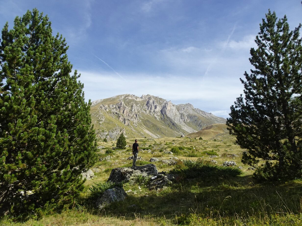
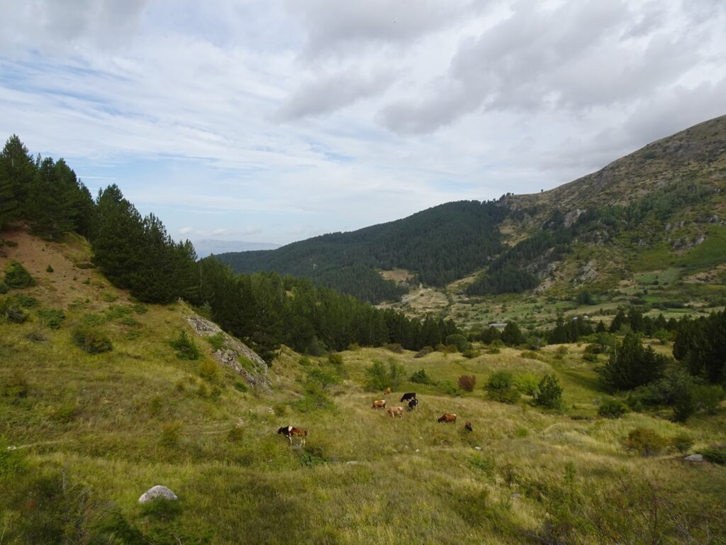
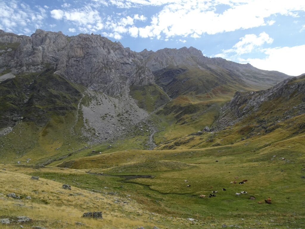
We picked the southern option on our way up the mountain and the northern one on the way back. The first part of the trail leads past some hilly pastures with grazing cows and through some small, pretty patches of pine trees. It’s worth turning around once in a while, as the view back west to Radomirë and beyond is pretty good right away.
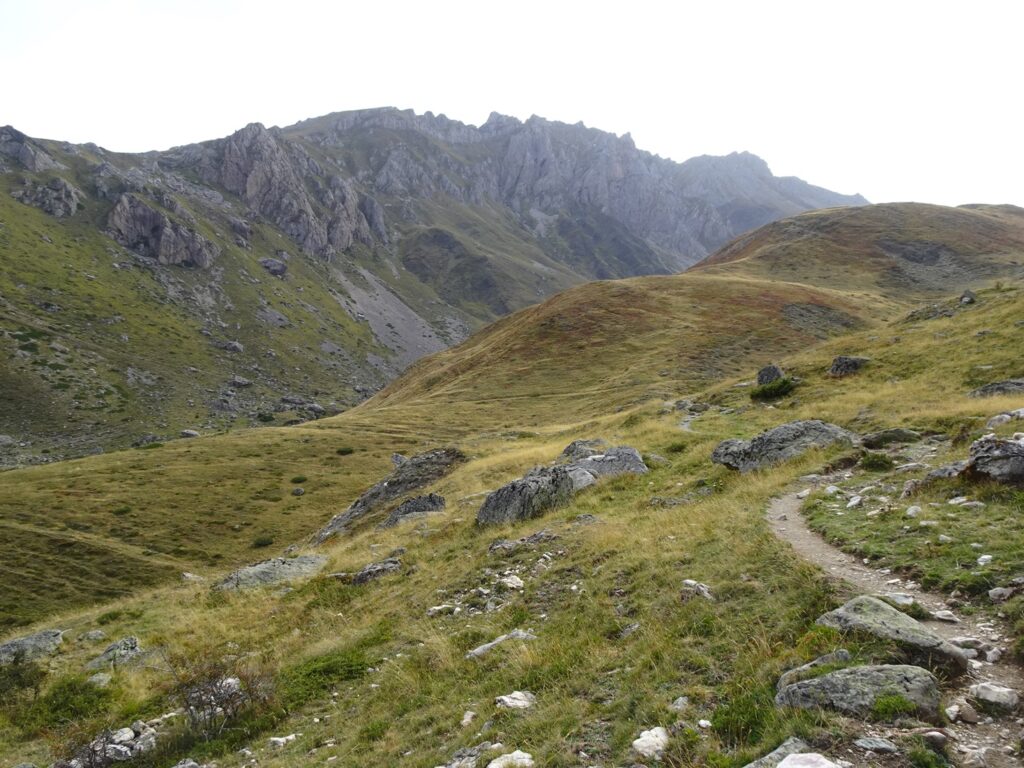
At one point, you’ll have to cross a small stream, but as there are enough rocks to step on, it’s easy enough. Soon after, the two trails that split at the beginning merge and continue climbing together south-east into more rocky alpine terrain.
There’s a shortish section leading around Korabi Plain, a circular glacial valley, which is the only part of the hike where the trail doesn’t climb. When we were there, there was a small seasonal cattle herder’s camp set up, and in combination with the sheer slopes of Mount Korab looming in the background, I thought this was the most atmospheric part of the hike.
Afterwards, the trail starts climbing again and pretty much continues to do so until you reach the top. A few hundred meters from the summit, there is a small water spring, which was a nice place to gather our strength before the final push.
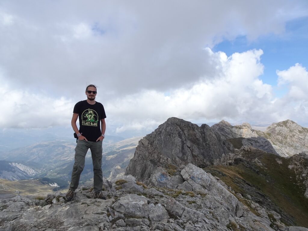
Afterwards, the trail first climbs to a viewpoint right at the border with North Macedonia, and then turns sharply left, where it follows the rocky ridge to the summit. In this section, you’ll have to be especially careful not to slip, as there’s a steep slope on the left-hand side of the trail, so make sure to take your time.
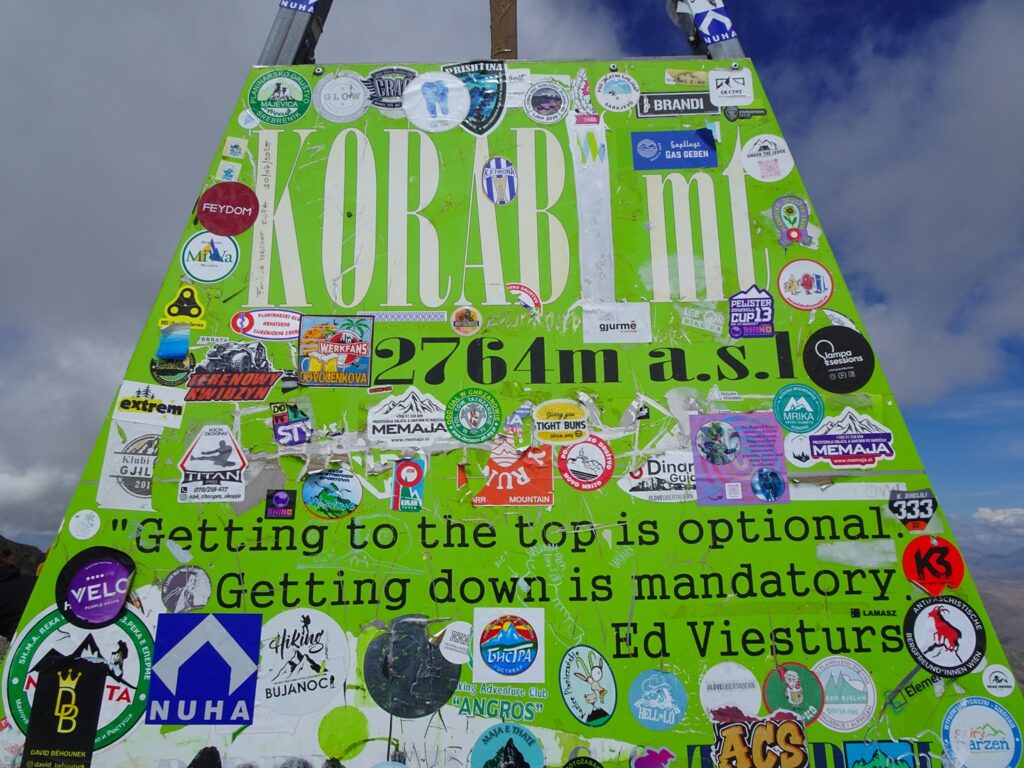
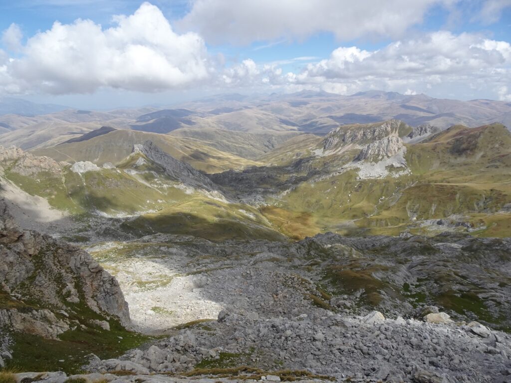
Eventually, you’ll reach Mount Korab’s 2,764m or 9,068ft. high summit, which is marked with a sticker-plastered green sign. From the top, there are great views in most directions, both back into Albania and to the somewhat wilder-looking Macedonian side of the mountain slope.
Afterwards, you can either return the way you came, which is what we did, or continue on a longer loop around the northern side of the mountain, which is said to be technically more difficult. If you walk back the way you came, I recommend sticking to the right branch of the trail, instead of re-crossing the stream you crossed on the way up to see some other nice views before you come back into Radomirë.
Map of the Mount Korab Hike
This map shows the trail from Radomirë to the top of Mount Korab.