
La Gomera is the fourth Canary Island we’ve visited after Lanzarote, El Hierro and Gran Canaria, and once again we were surprised by how many different landscapes and vegetation zones are squeezed into such a small area. The island only has a size of about 270 km², but there are a ton of things to see.
Similar to El Hierro, a lot of people only visit La Gomera on a day trip from nearby Tenerife, but in my opinion that will only give you the most superficial glimpse of the island.
To really get to know the place, you’ll need at least four days to explore the different parts of the island, do some hikes in the beautiful Garajonay National Park and have a bit of time to relax. Here’s my 4-day itinerary for this beautiful island.

This post may contain affiliate links, and I might earn a small commission at no additional cost to you. For more info, click here.
Organized Tours of La Gomera
If you prefer the company of a guide or don’t want to sort out the visit yourself, there are plenty of guided tours of the island available. I’ve added a few of those to the itinerary, in case you want to check them out.
How to Get Around La Gomera Independently
La Gomera has a good local bus network, but having your own rental car makes things a lot easier. Some bus connections are very infrequent, and some must-see places like the Mirador de Abrante can’t be reached by bus at all. The same goes for the trailheads of some great hikes.
Personally, we always rent a car on the Canary Islands, as the daily fees are very low compared to other places, and it gives us a lot more flexibility. You can have a look below for the best deals.
A 4-Day Itinerary for La Gomera
We spent a total of 10 days on the island, did loads of hikes and explored almost every village and hamlet there is. I’m aware that most people tend to travel a little faster than we do, which is why I’ve combined the absolute highlights and some more off-the-beaten-path places into 4 days.
I’ve also included suggested hotels and guesthouses for the different parts of the island. If you only stay a few days, you might want to pick a base and explore the island from there. However, if you decide to stay a little longer, I think it pays to change the place you stay at least once, especially as driving across the island takes longer than you might think, because of the craggy terrain.
Also, it’s best to keep your itinerary flexible, as the weather can be very changeable and when it rains in the centre and north, it can be perfectly sunny in the southern part of the island. So it’s best to keep an eye on the weather forecast and to switch days around, if necessary.
Day 1: San Sebastián and Eastern La Gomera
San Sebastián de La Gomera
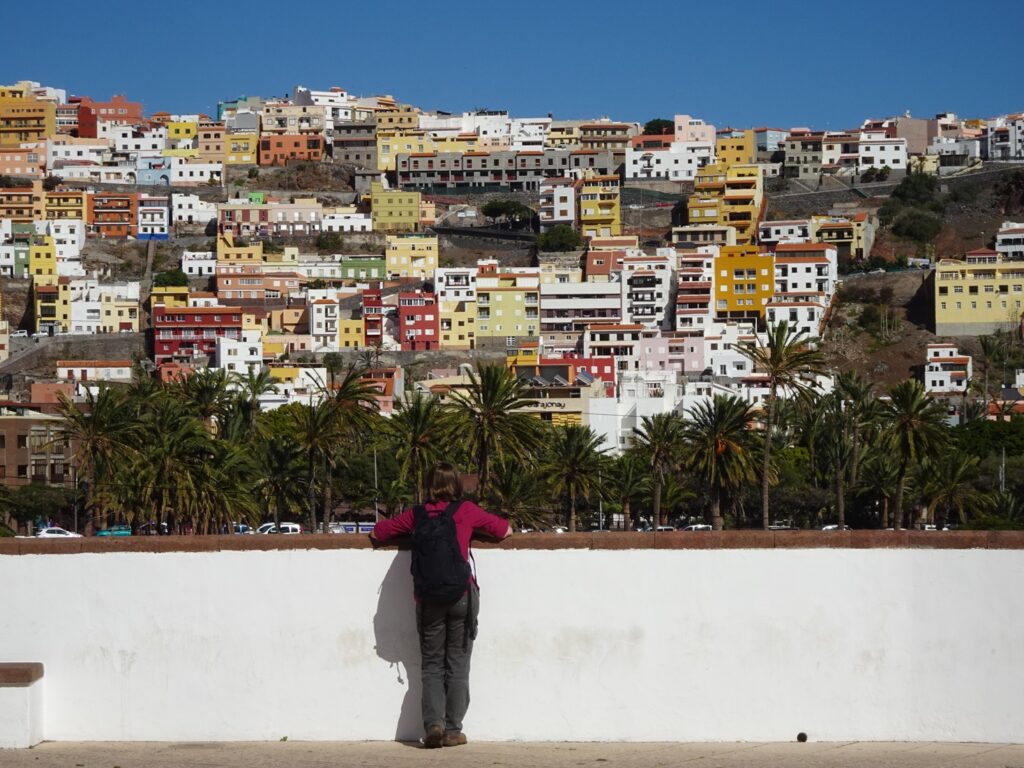
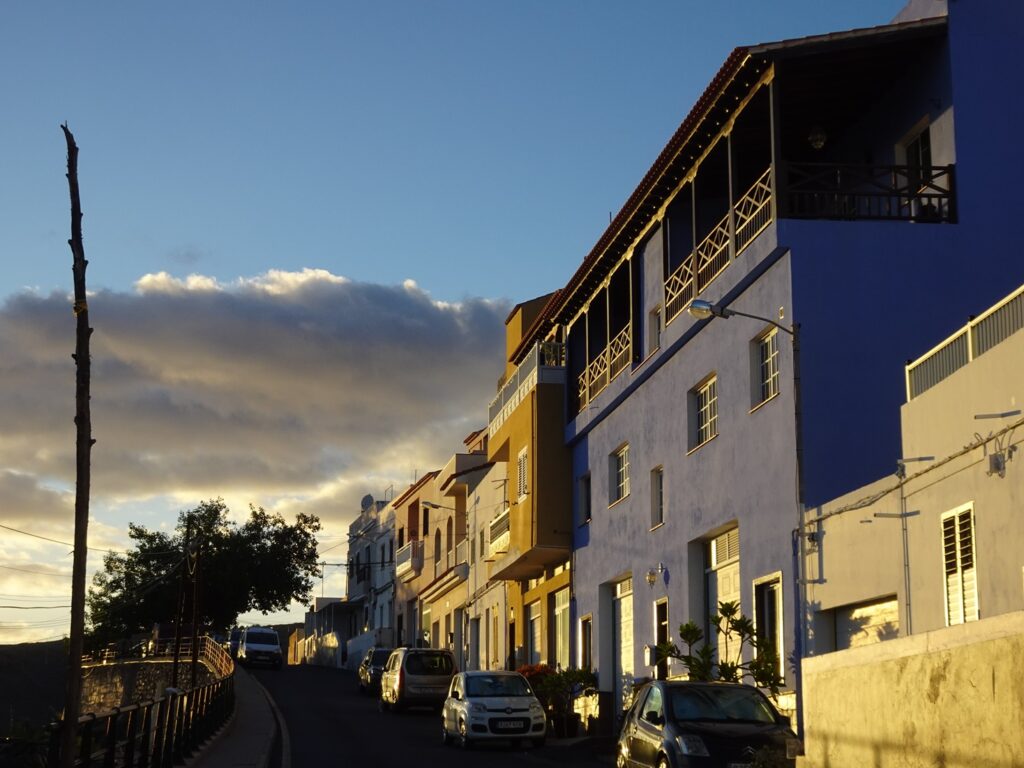
San Sebastián is La Gomera’s tiny capital, and we found it to be a good introduction to the island’s laid-back pace. It’s worth spending a few hours exploring the small alleyways and tiny museums before heading into the mountains.
The historic centre is very compact and super easy to explore on foot. Most of the interesting stops are along the central Calle Real or around the Plaza de las Américas at its southern end. There are several places connected to Christopher Columbus, who stocked up on food and water here before sailing to America.
These include the Casa de la Aduana (the old customs house) and the Casa Colón, which stands at the site of the house where Columbus supposedly spent the night and nowadays contains an exhibition on Pre-Columbian pottery (which I liked as an archaeologist, but which might not be of much interest for some other people).
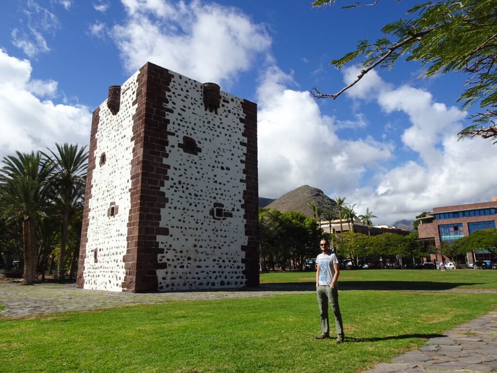
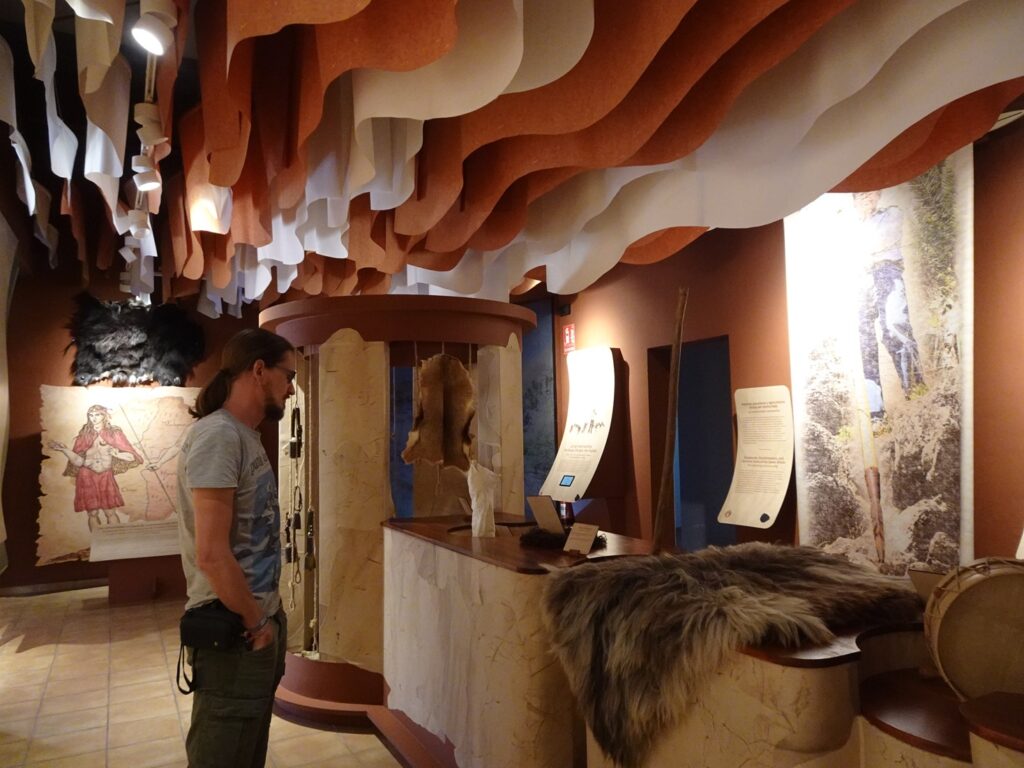
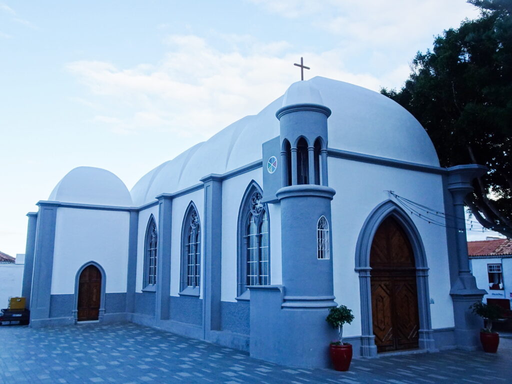
There’s also a small archaeological museum about the prehistory of La Gomera itself, which I thought was really informational. Apart from that, we liked San Sebastián’s historic main church Iglesia de La Asuncíon and the 15th-century Torre de Conde at the western edge of the old town.
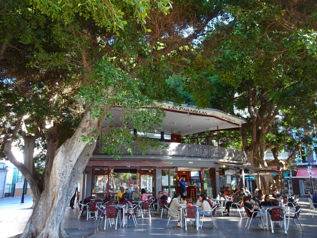
Finally, San Sebastián is a good place to grab a café cortado and a bite to eat before setting off into the centre of the island. We liked the café at the Kiosko Las Carabelas opposite the customs house, but there are plenty of alternatives, if you need something more substantial.
Mirador de las Roques and Other Viewpoints
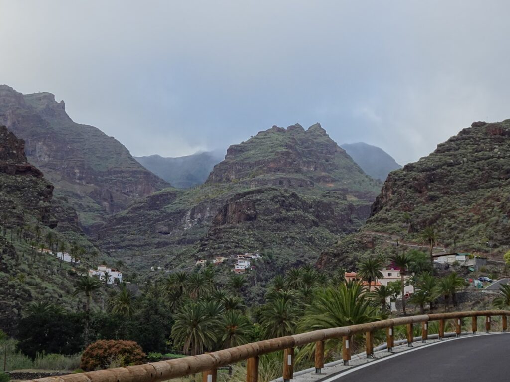
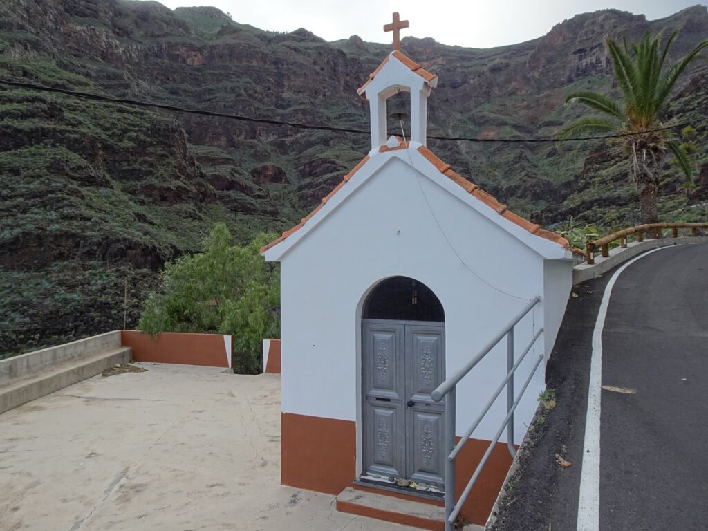
From San Sebastián, the GM-2 road climbs quickly into the interior, past some pretty viewpoints, like the Mirador de La Laja, which looks into the Barranco de la Valle and past the small, pretty Ermita de Las Nieves, which can be reached by a short detour from the main road.
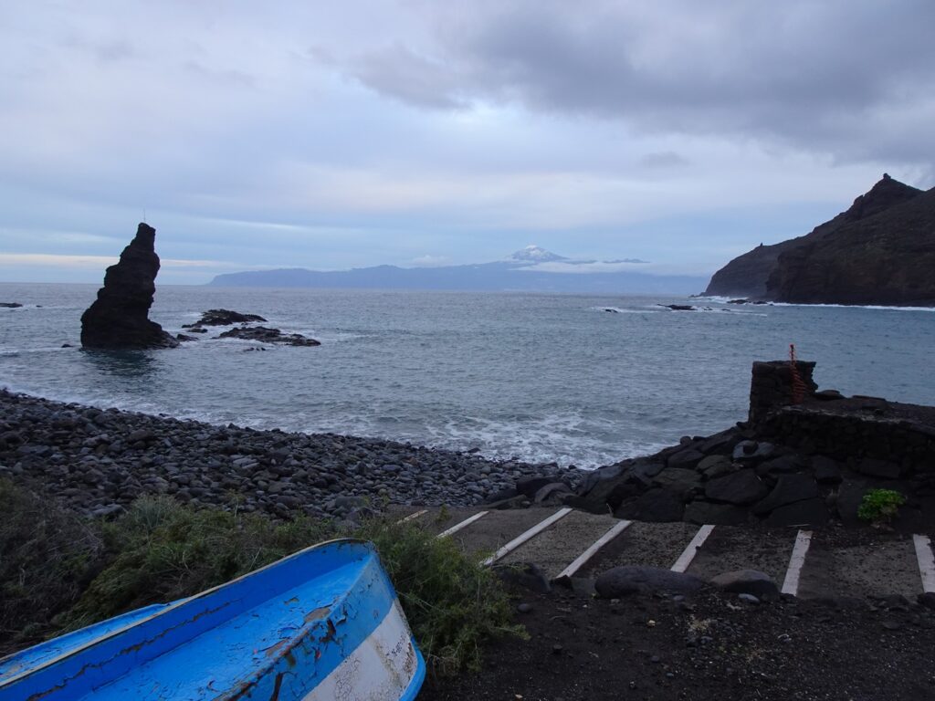
The Mirador de las Roques, my favourite viewpoint on La Gomera, comes a little later. From one side of the road, you’ll have a good view of the imposing Roque de Agando, a dramatic volcanic plug, which is said to have been an important ceremonial site for the native inhabitants of the island
A lot of people we saw only stopped for this view, but you should definitely make sure to cross the road to the northern side, where an even more impressive panorama of three other volcanic plugs opens up, with El Teide on Tenerife looming in the background.
I would have loved to stay a little longer here to enjoy the scenery, but when we were here it was so cold and windy, that we had to quickly flee into our car again and drive on to our next destination.
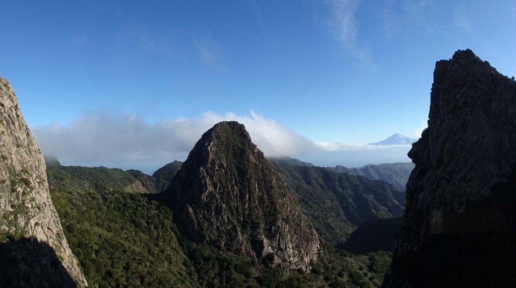
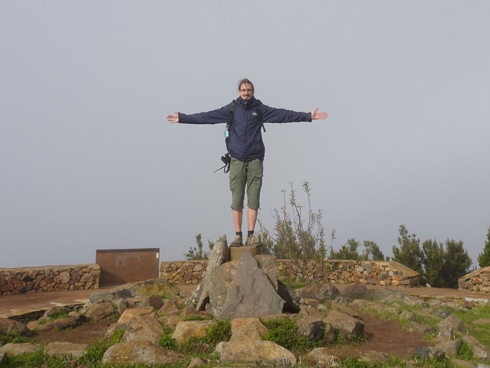
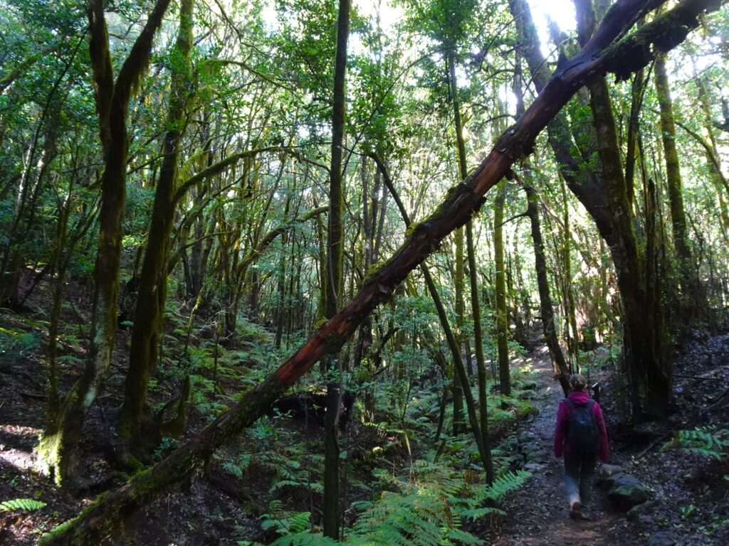
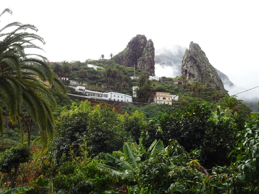
Alto de Garajonay
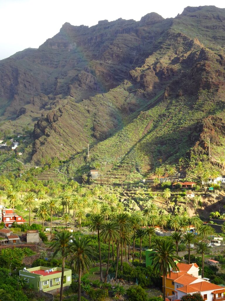
At the Mirador de Las Roques, you’re already at the edge of the Garajonay National Park, which covers the centre of the island. You can continue along the GM-2 to the El Contadero Car Park, which is the best trailhead for the hike to the top of Alto de Garajonay.
At 1,487m or 4,879ft., this is the island’s highest point and the views on a clear day are awesome, but as you’re already pretty high up, the climb isn’t too exhausting and took us only about half an hour one-way. I suggest sticking to the left-hand path when the trail splits, to get an introduction to the beautiful evergreen laurisilva forest that covers large parts of the island.
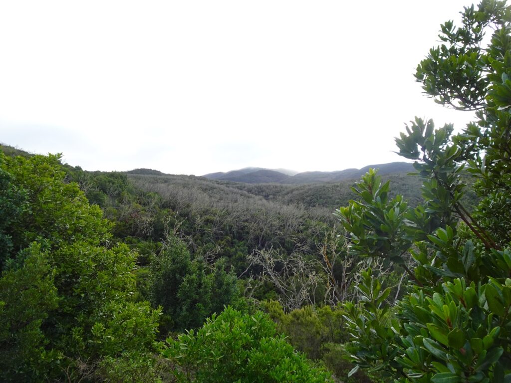
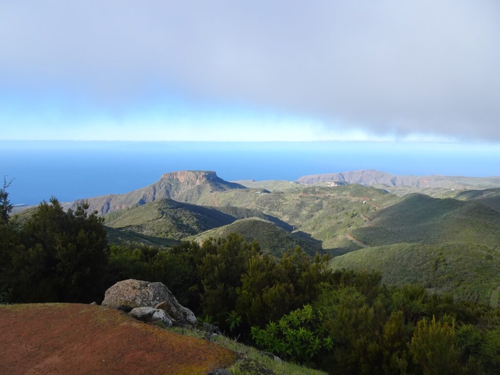
If the weather is good, you can see the entire island from up here, including the impressive La Fortaleza mesa to the south and of course the pretty sea of trees that covers the entire National Park. If the views are really clear, you can also see Tenerife, El Hierro and La Palma in the distance.
If it’s cloudy, however, it’s best to come back another day. We actually came here twice, as the clouds suddenly moved in the first time we climbed the mountain, and we only saw glimpses of the surroundings. Two days later, we decided to try again, and this time the views were awesome.
Afterwards, you can either backtrack or continue on a slightly longer loop that leads first to the north-west and eventually back to El Contadero in about 45 minutes. Afterwards, you can head back to San Sebastián for dinner and to stay the night, or continue south to Playa Santiago instead.
San Sebastián Hotel Tips
Budget: Apartmento La Peatonal
Midrange: Hotel Torre del Conde
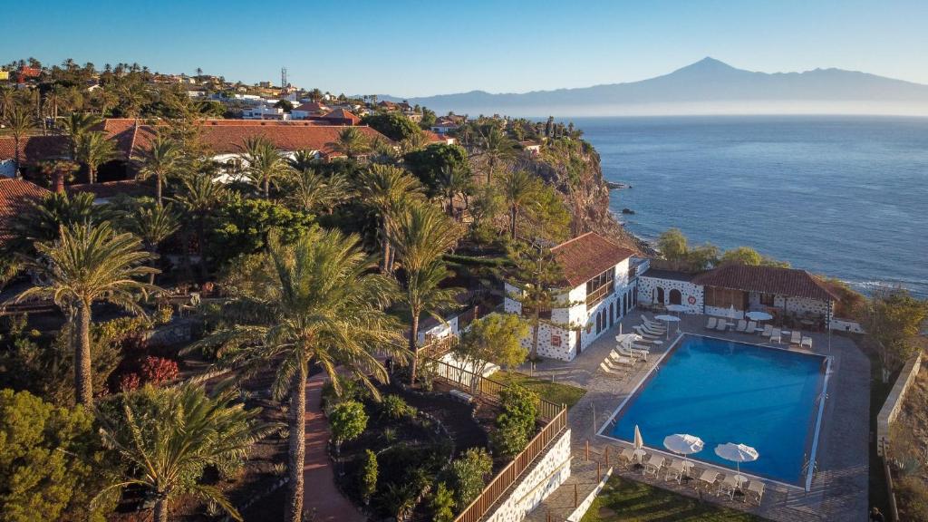
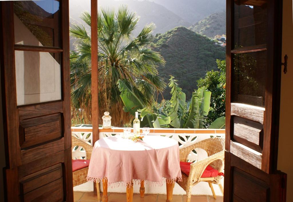
Luxury: Parador La Gomera (pictured)
.
Day 2: Southern La Gomera
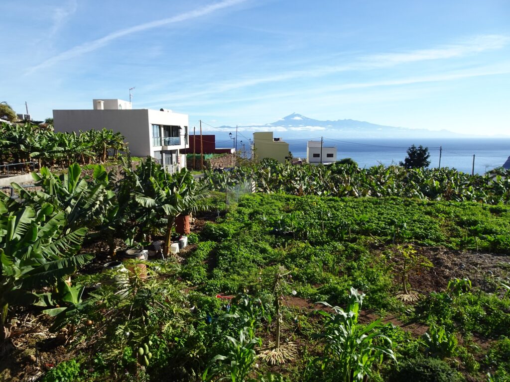
This day is all about the sunny south of the island. We read that the landscape is supposed to be rather monotonous here, due to the dry weather, but if you come in the winter like we did, the landscape will still be pretty green.
Start with a breakfast in San Sebastián (or wherever you spent the night) and then make your way to the tiny village of El Cercado.
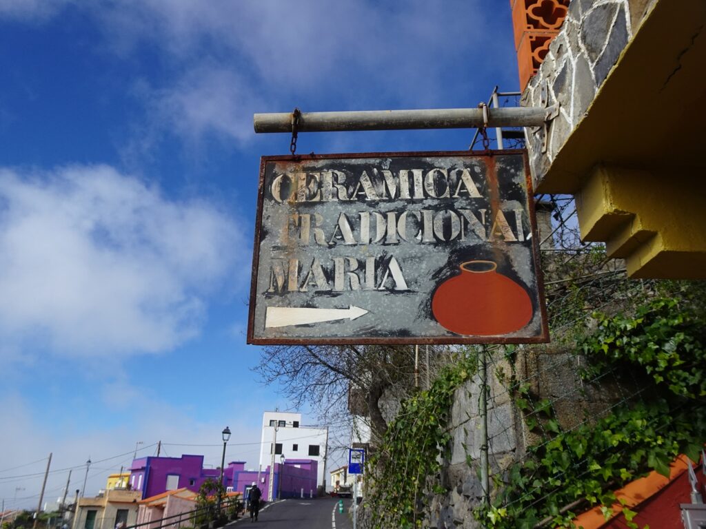
El Cercado and Pottery Museum
This small village is famous for its long tradition of pottery production, which is still made using pre-Hispanic techniques without a potter’s wheel. There are three workshops along the main road where you can see where the magic happens and buy the products if your luggage allows (we traveled carry-on only, so we had to refrain).
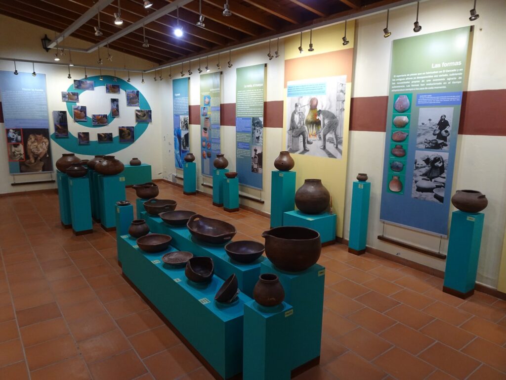
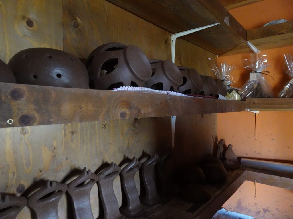
There is also the Las Loceras Visitor Centre, a tiny one-room pottery museum, which explains the production process and has plenty of examples of different traditional vessels. There is no entrance fee, and you can check the current opening times here.
Drago de Agalán
La Gomera’s only fully-grown Dragon Tree can be found a 15-minute drive south-east of El Cercado on the way to Playa Santiago near the hamlet of Agalán (well, it’s really only a collection of three houses). There’s a turn-off from the CV-11 road maybe 2km north of Alajeró, which ends in front of a ruined house, where we left our car.
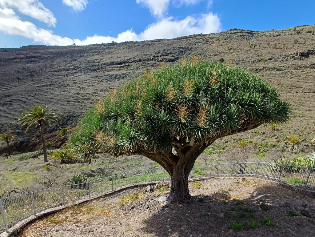
From there, it’s a 10-minute walk down a steep path with plenty of switchbacks to the fenced tree. As we had seen plenty of dragon trees before, it didn’t necessarily blow our minds, but the surrounding barranco is super beautiful, and we didn’t meet a single other soul on the way there and back.
Alajeró
Just a bit further south is one of the cutest towns we came across in the southern part of the island. Alajeró (not to be confused with Alojera in the north!) has a pretty main square with a historic church under a large laurel tree and great views to the Calvario Hill to the south, which is topped by a small chapel.
At the northern end of town is the Centro de Interpretación del Queso y el Pastoreo, a brand-new museum about the island’s herding traditions and the production process of the famous local goat cheese. Once again, the entrance is free. You can check the opening times here.
Barranco de Santiago
The Barranco de Santiago is the very green canyon running north from Playa Santiago. There are no real must-see sights here, but we liked checking out the hamlets along the way, including tiny Guarimiar, which has some great views back to the coast.
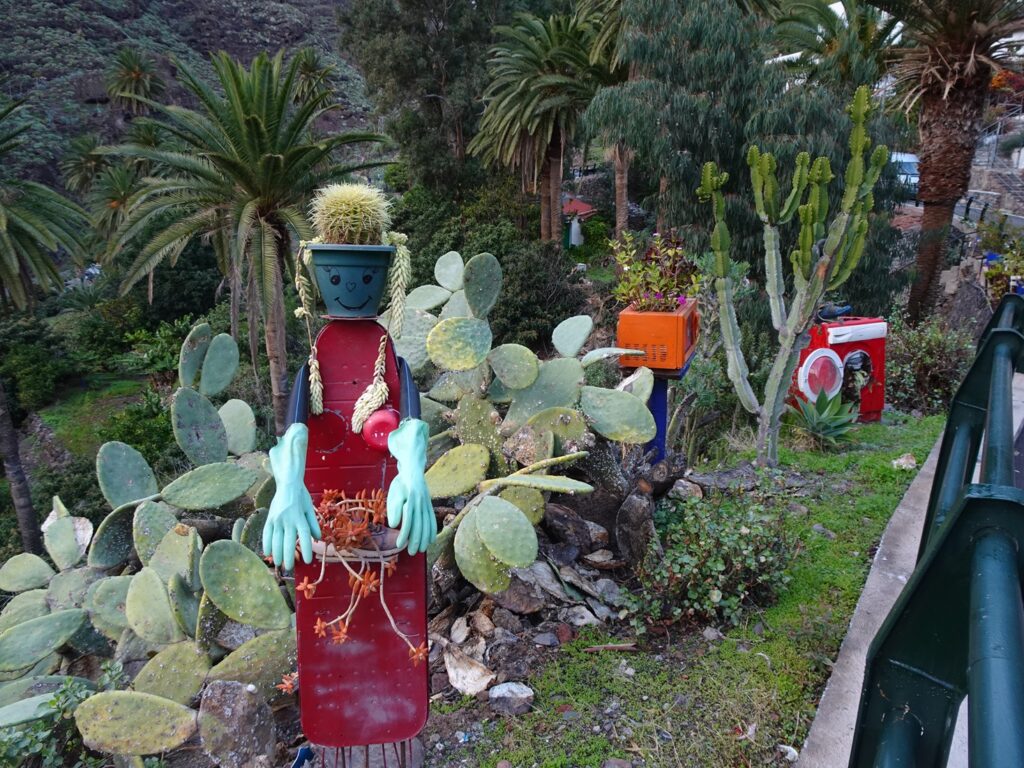
The prettiest place we came across in the Barranco was Pastrana, which has a cute, very small church square, some interesting artworks made from everyday objects along its ‘main street’ and lots of friendly, curious cats.
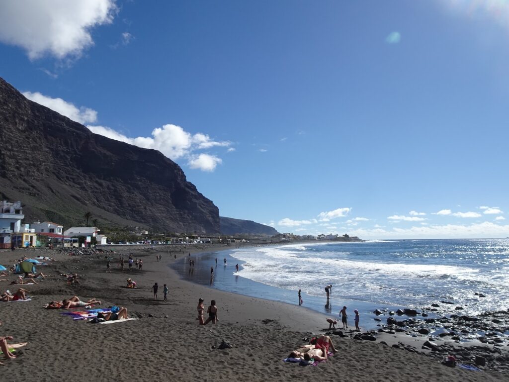
Playa Santiago
Playa Santiago, which is one of the island’s more relaxed coastal towns, is a good place to end the day. There’s a small beach, a pretty promenade and a tiny chapel to the Virgen de la Guadeloupe, which is carved right into the rock of a cliff.
There are also several places to eat overlooking the Ocean. We really liked Los Castaños near the main square, which had very friendly staff and an amazing fish of the day with loads of garlic (which is always a plus in our book).
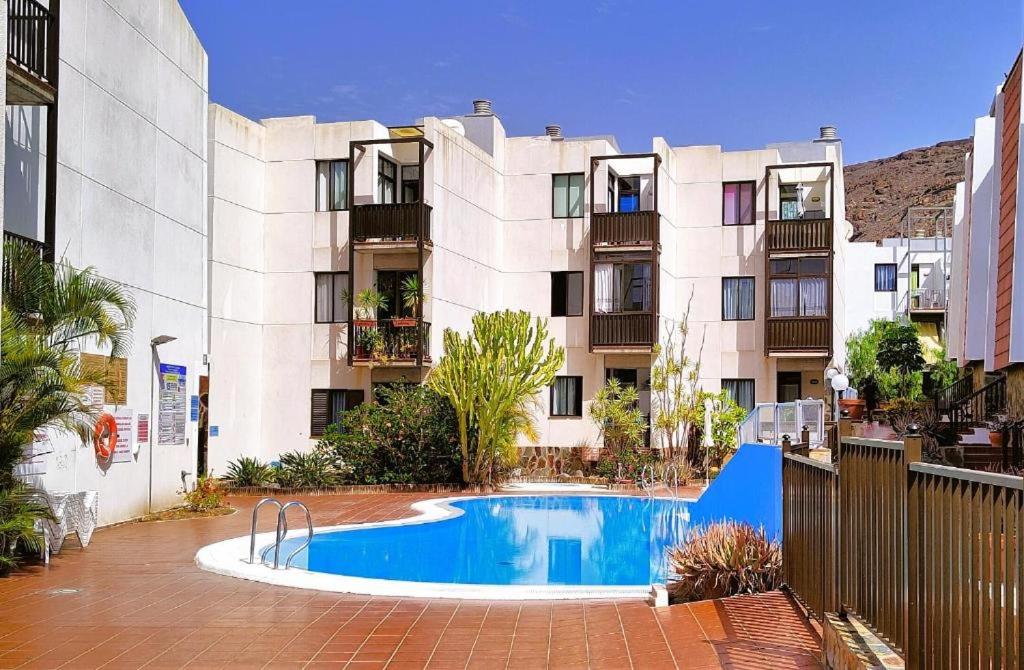
Playa Santiago Hotel Tips
Budget: Apartmentos La Banda
Midrange: Brisa del Mar (pictured)
Luxury: Apartmento Sol Dorado
.
Day 3: Central and Western La Gomera
Las Creces Hike
This short 1-hour hike leads through a beautiful section of Laurisilva evergreen forest in the western part of the National Park. The only better section we encountered is the one on the long day hike from the El Contadero to El Cedro, but if you’re pressed for time, the Las Creces loop is nearly as beautiful.
It starts near the small church in Las Hayas and right away enters a wonderland of gnarly trees, ferns and dripping moss. In about an hour it leads to the Las Creces picnic site and back to the starting point on a different branch of the trail. When we did the hike, we only met three other people here, which made the place even more atmospheric.
Alojera
Nope, this is not Alajeró from the second day – just a place with a confusingly similar name. This is another pretty village and another one with an interesting little museum, this time focused on the local palm honey production.
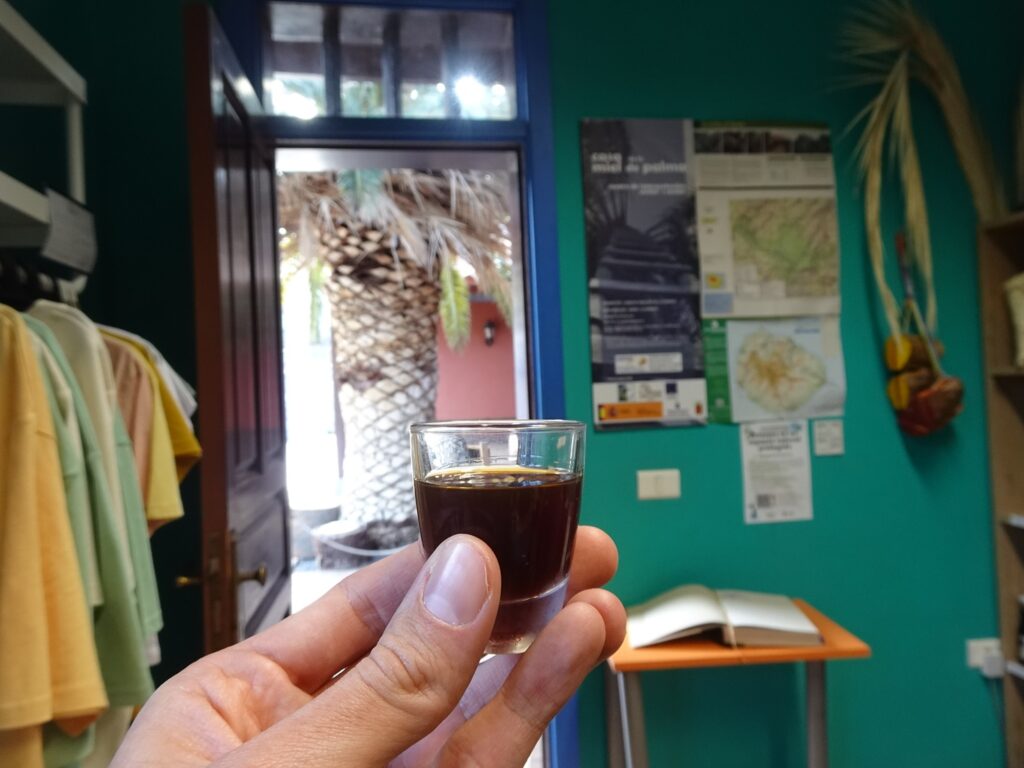
The entrance to the museum is free, but for 1€ you can try both the palm honey (which is actually a syrup made from the palm sap) and the Gomerón, which is a local drink made from palm honey and grapevine brandy.
Chorros de Epina
This water spring in the mountains is an important place in local lore. The water flows out of seven spouts in the rock and drinking from the correct ones is supposed to bring you love, luck, wealth and so on.
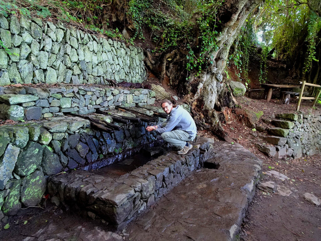
Counted from the left, men are supposed to drink from the odd and women from the even ones for them to work, but women who’d like to turn into a witch are supposed to have a sip from the odd ones as well, so if that’s your aspiration, go for it!
This is far from a must-see sight, but we’re always a sucker for local legends and the like, so I decided to include it. A little further down the trail is an abandoned bar or restaurant with great views to the northern coast from its terrace and on the 5-minute trail from the highway to the spring sits another cute church.
Mirador de Alojera
If you follow the highway south towards Arure, you’ll pass the Mirador de Alojera, which sits just inside the National Park boundary and makes for a good short stop along the way.
This is my favourite viewpoint showing you the western part of the island, and you can see both Alojera and the nearby coast, as well as over the tops of the dense laurisilva forest in all other directions. It’s just a one-minute walk from a small signposted car park on the highway.
Barranco de Arure
Making your way down to the Valle Gran Rey, you’ll pass a few other nice viewpoints. The famous Mirador de El Santo in Arure was closed because of rockfalls, when we were there, but there are a few more along the GM-1 on the way down the valley, including the amusingly named Mirador de la Curva del Queso.
Once you reach the hamlet of El Guro, you can leave your car by the side of the road, and make your way by foot into the Barranco de Arure. You’ll have to first climb the stairs that lead through the prettily decorated houses of El Guro and then follow a path north into the Barranco.
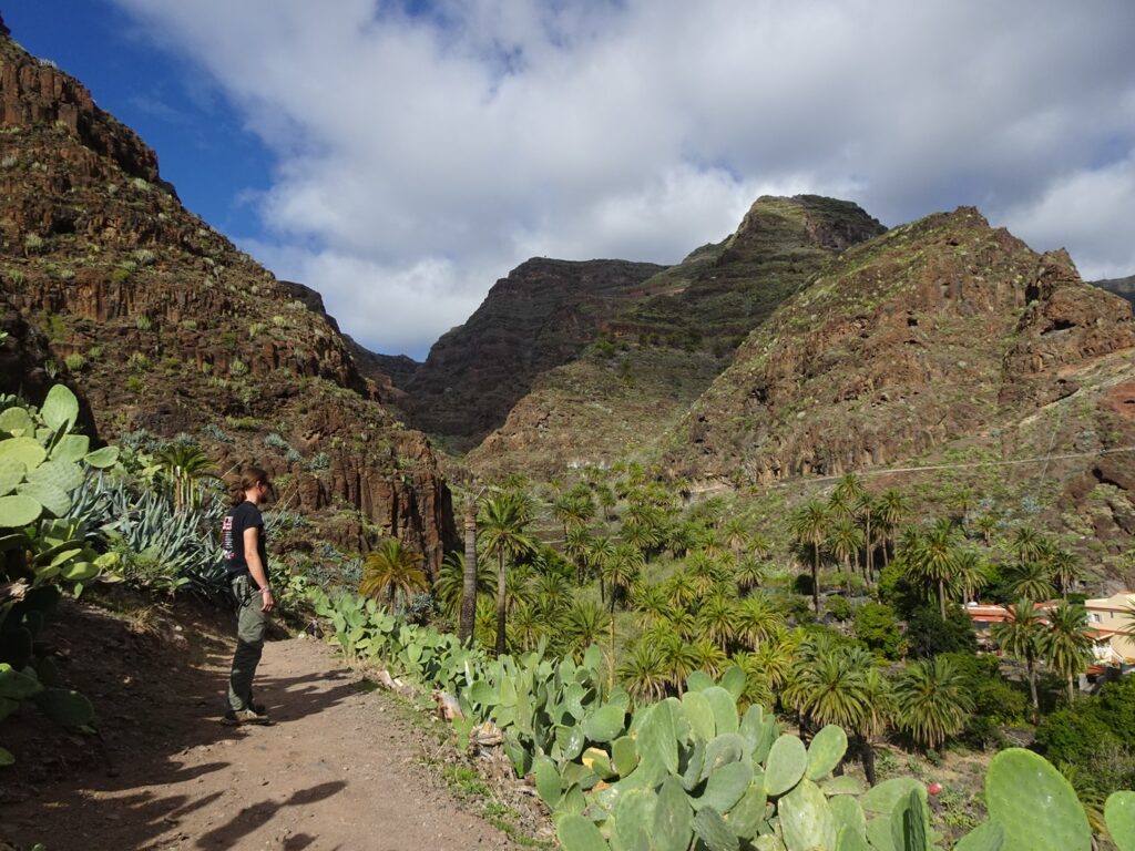
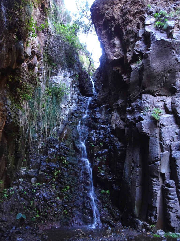
This is one of the drier parts of the island, but because of the small stream flowing through the canyon, the Barranco is very green with lots of palm trees and cane growing all around. You can follow the trail all the way to a small waterfall at the end.
The way is mostly flat, but a bit adventurous. You’ll have to cross the stream a few times (there are boulders, but they were always a little slippery). There’s also a section where you’ll have to climb up the rock with a rope, although it’s easier than it sounds and you can also avoid that section by choosing a higher section of trail directly to the west.
The hike is pretty short, but because of the not-so-easy trail it took us about an hour each way.
Valle Gran Rey
This is the most touristy settlement on the island and it seems to be firmly in the hands of our fellow Germans (well actually, it’s not just tourists, but also loads of expats). It’s spread out across several neighbourhoods, mostly along the coast.
In my opinion, the prettiest part of Valle Gran Rey was La Calera – the one neighbourhood which is away from the sea. In the cute alleyways there’s also the Museo La Alameda, a tiny museum that is crammed full of every kind of object imaginable, local or not, but it’s only open until 1 PM and only on some days.
Otherwise, there’s a series of beaches in the area, which get increasingly prettier the farther north you get. The tiny Playa de Vueltas at the southern end is basically in the harbour basin, while the nicest one is the Playa del Inglés, which is a 10-minute walk north from the La Playa neighbourhood.
There are also tons of restaurants in Valle Gran Rey, especially in the La Playa Neighbourhood and around the harbour. We liked Restaurante El Puerto, which sits right by the entrance to the harbour area and has great seafood.
Valle Gran Rey Hotel Tips
Budget: Casa Rural Guadá
Midrange: The Gomera Lounge
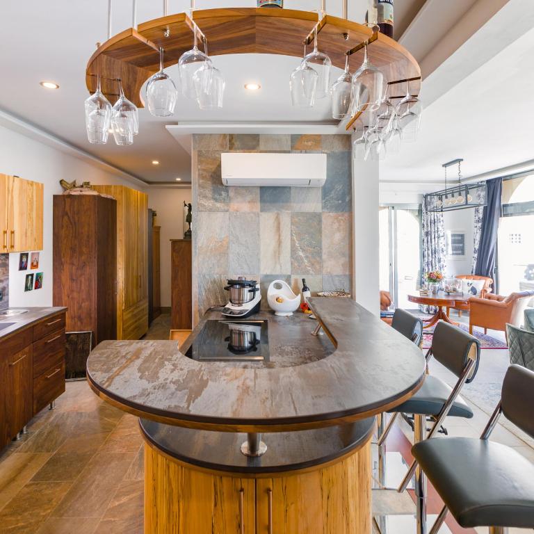
Luxury: Eigner Suite (pictured)
.
Day 4: Northern La Gomera
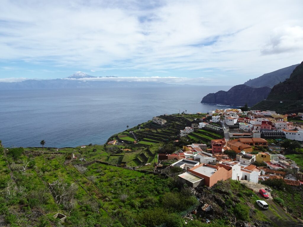
Vallehermoso
This is a pretty full last day, so it’s best to start early or otherwise skip a stop to make it less crammed. You can start by driving down to Vallehermoso, which – true to its name – lies in a beautiful green valley in the island’s north-western part with the sheer Roque Cano towering above.
There’s a cute main square and a pretty Cathedral, plus on the way to the Ocean lies a small Botanical Garden, which we found worth checking out for 30 minutes or so. If you continue north for a few more minutes, you’ll reach the pretty, but stormy (and therefore dangerous) town beach.
Juego de Bolas (National Park Visitor Centre)
The visitor centre for the Garajonay National Park lies about halfway between Vallehermoso and Hermigua. There’s aninteresting exhibition about the nature and the conservation efforts in the park, as well as a small botanical garden and two viewpoints on a hill behind the exhibition hall.
You can also watch a 15-minute film about the park, which we found quite interesting. There are posted times for showings in different languages, but when we were there, we just had to tell the lady at the information counter and she started it for us.
There’s also a small ethnographic display, which is supposed to show a 19th century Gomeran house, but it was closed when we visited. Finally, we can recommend the small café behind the centre, which sells tasty gofio cookies. The visitor centre has no entrance fee and you can check the current opening times here.
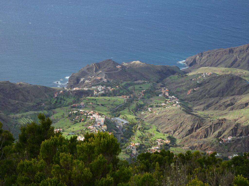
Mirador de Abrante
If you follow the road behind the visitor centre by car for maybe 5 minutes, you’ll get to the Mirador de Abrante. Judging by the numbers of other people we met here, this is the most popular viewpoint on the island.
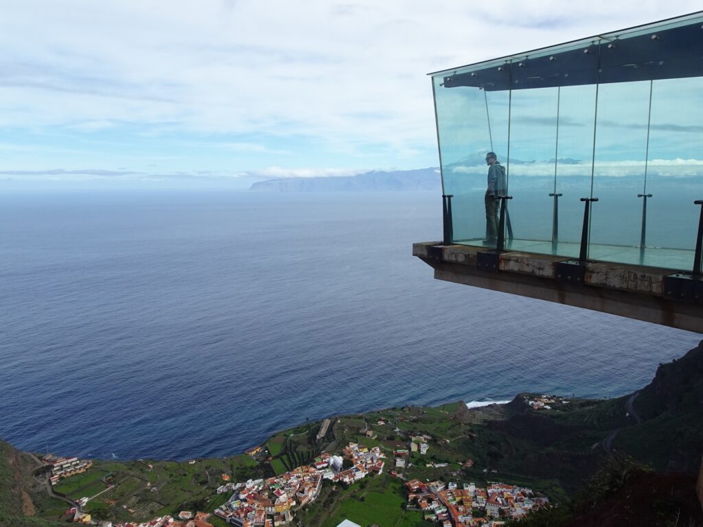
It’s easy to see why, as both the view and the mirador itself are quite spectacular. The viewpoint is a glass construction that juts out over the high cliff and you can see both El Teide on neighbouring Tenerife island and the northern coast of La Gomera with the village of Agulo a few hundred meters below.
Agulo
Cute Agulo was our favourite village on the entire island, as it’s full of historic houses, cute alleys and great views over the surrounding landscape. There’s a small historical trail that leads through the village’s two neighbourhoods and takes about half an hour to complete.
Something I found especially interesting was the Iglesia de San Marcos on the tiny main square. It’s built in a Moorish style, which reminded me of the architecture of southern Spain. It has a series of cupolas and an unusual clock tower, and as a result looks more like a mosque than a church.
There’s also the Museo de José Aguiar – a museum containing works of a local painter – but it was closed when we dropped by. Finally, if you still have time and energy, you can walk north past the picturesque cemetery and down the cliffs to the wild Playa de Agulo.
Hermigua and the Ethnographic Museum
Hermigua is a very spread-out town in a very green valley and we found it to be a good final base for our tour of the island. The main sight here is the Los Telares Ethnographic Park, which is built around an old Gofio Mill.
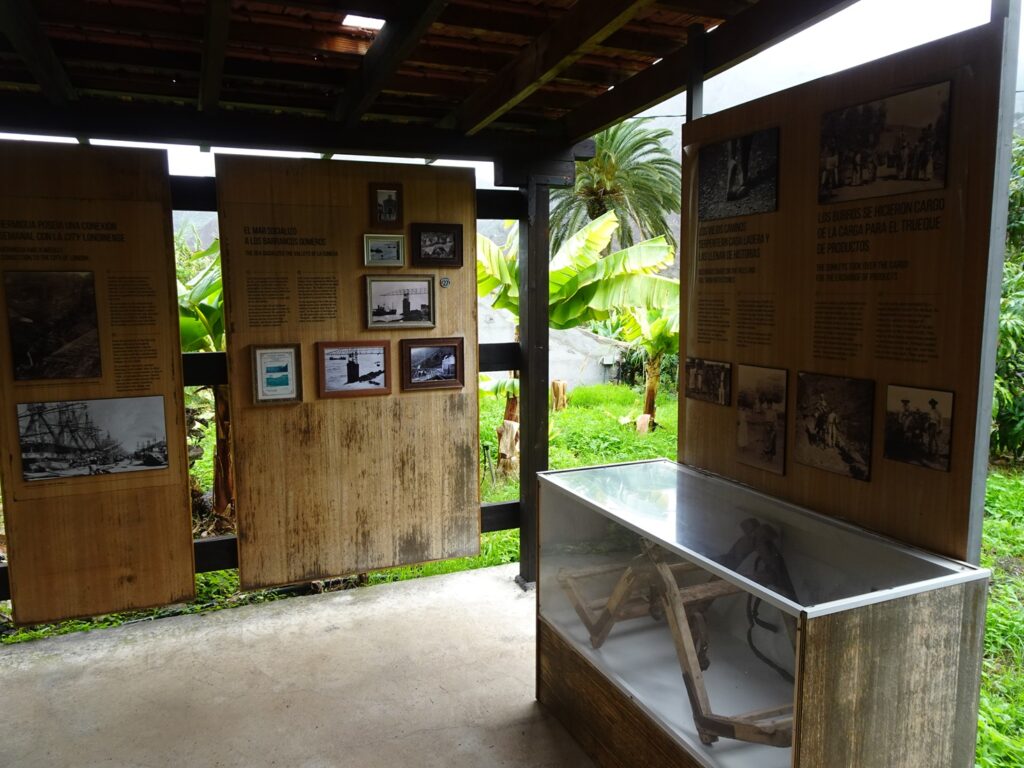
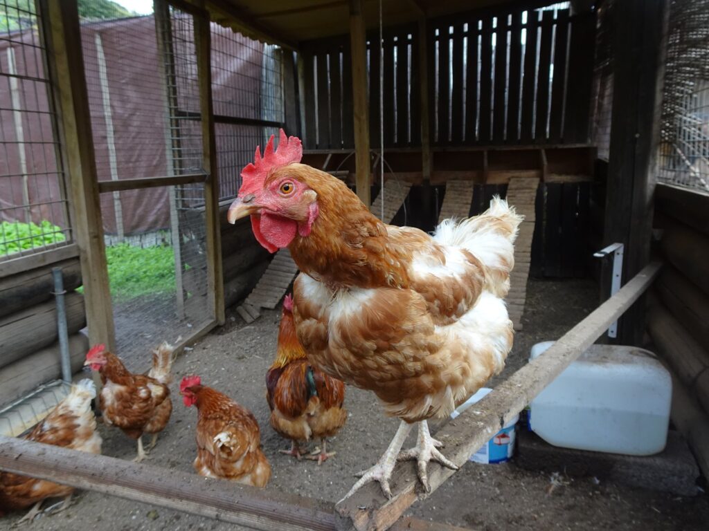
There are three exhibition rooms about the island’s handicrafts, its cultural and economic history. Surrounding these is a pretty garden full of local and imported fruit trees and a small enclosure with goats and chickens to illustrate the farming life of the first inhabitants of La Gomera. You can check the opening times here.
Apart from that, Hermigua has a few pretty Colonial-era buildings, especially around the town hall in the lower part of the valley and there are also a couple of good cafés and restaurants. We can recommend the Café in the Casa Creativa, which also has a terrace overlooking the valley.
Playa de La Caleta
If you’ve still got enough daylight left, you can follow a narrow, winding road east through the hills to reach Playa de La Caleta, which is one of the most famous beaches on the island. The sea was super rough when we dropped by, but we found the scenery impressive and there are once again great views of El Teide on Tenerife.
If you’re not in the mood for the drive, you can also check out Hermigua’s own Santa Catalina Beach or just drop by Restaurante El Faro, where we had a really good fish dinner and nice chat with the super friendly lady who runs the place.
Hermigua Hotel Tips
Budget: Casa Creativa (pictured)
Midrange: Apartmentos Playa
Luxury: Casa Tajaraste
.
La Gomera Itinerary Map
You can find all the places and hikes that I’ve described above on this map of La Gomera. I’ve used different colours for different days of the itinerary.
See Also
The Ultimate 5-Day Itinerary for Gran Canaria
The Ultimate Three Day Itinerary for El Hierro, Canary Islands