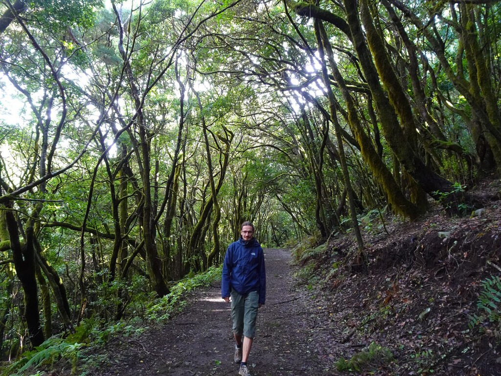
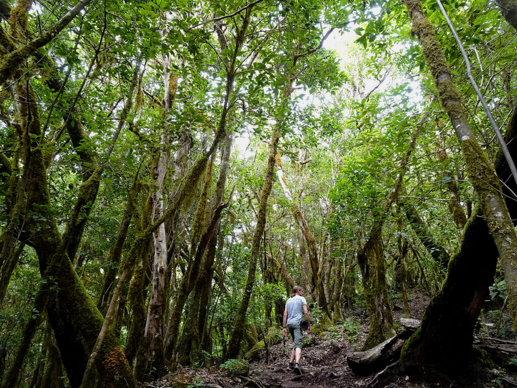
Garajonay National Park, which protects the central mountains of La Gomera, was declared a UNESCO World Heritage Site in 1986. A large part of the park is covered by beautiful evergreen laurel forests, which made it by far our favourite area for hiking on the island.
Apart from that, there are some impressive volcanic rock formations, an interesting visitor’s centre and tons of fantastic viewpoints. We explored every corner of the National Park during our stay on the island. Here are our recommendations of what you shouldn’t miss.

This post may contain affiliate links, and I might earn a small commission at no additional cost to you. For more info, click here.
Guided Tours of Garajonay NP
If you’re short on time or don’t feel like renting a car, a guided tour of the National Park might be an option for you. You can have a look below for some well-rated options.
What to See in Garajonay NP
Las Roques
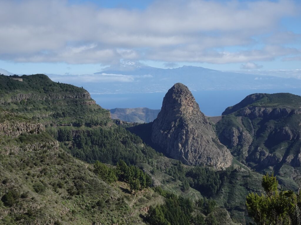
To me, this group of tall volcanic plugs is the most impressive sight in the park. They are the basalt cores of ancient volcanoes, whose outer layers have eroded over time and now they tower dramatically over the surrounding forest.
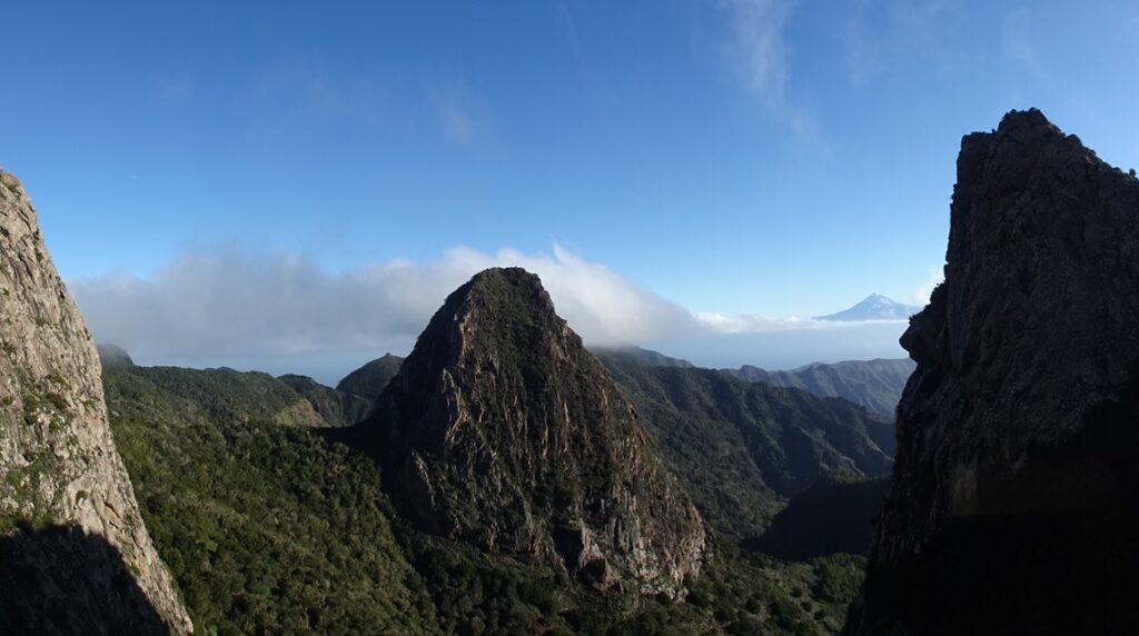
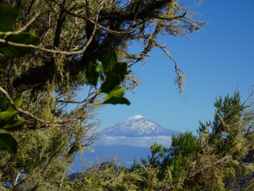
The most prominent of the bunch is the Roque de Agando, but I almost found the group to its north more impressive. This consists of the Roque de Zarcita and Roque de Ojila and if the views are clear, you can see El Teide on Tenerife in the background, too.
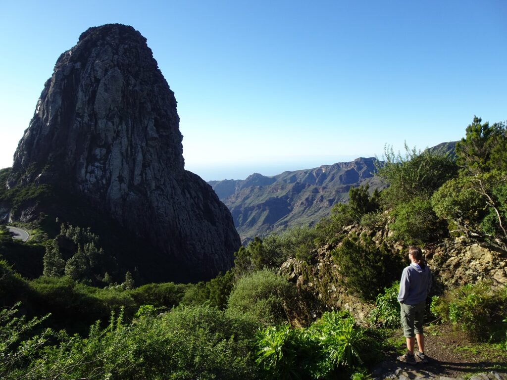
The best viewpoint to see the entire group is the Mirador de Las Roques at the eastern edge of the National Park. There’s a parking lot with a great view of the Roque de Agando on the south side of the GM-2 Highway and if you cross it to the other side, you’ll reach a platform with awesome views to the other formations.
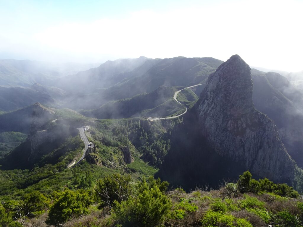
Another good viewpoint of Las Roques, this time from the other side, is the Mirador del Bailadero a little further north along the CV-14, which leads to Hermigua. Apart from that, there are a few other good viewpoints further west along the GM-2, including the Mirador de Morro de Agando, with a good view of Roque de Agando from above.
Alto de Garajonay
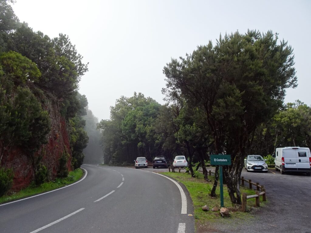
A little further west along the GM-2 from Las Roques is the El Contadero car park. This is the most convenient starting point for the short hike up to Alto de Garajonay, which at 1,487 metres is the highest point on the island.
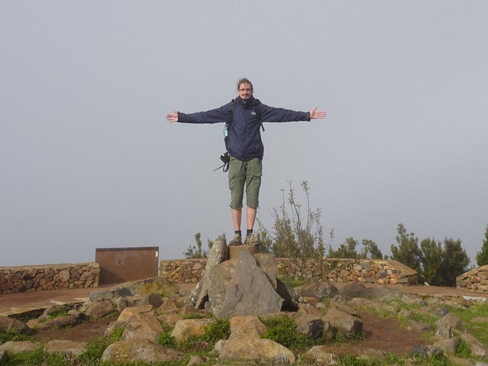
The views can be incredible on a clear day, when you can see almost all of La Gomera from the top, including La Fortaleza Mountain rising in the south and the sea of trees that fills the national park, as well as Tenerife, La Palma and El Hierro on the horizon.
That said, clouds move in super quickly up here. We ended up climbing it twice, because the views were suddenly gone when we reached the top for the first time. Luckily, the climb from El Contadero is pretty short, as you start already quite high up, so you can be spontaneous about it.
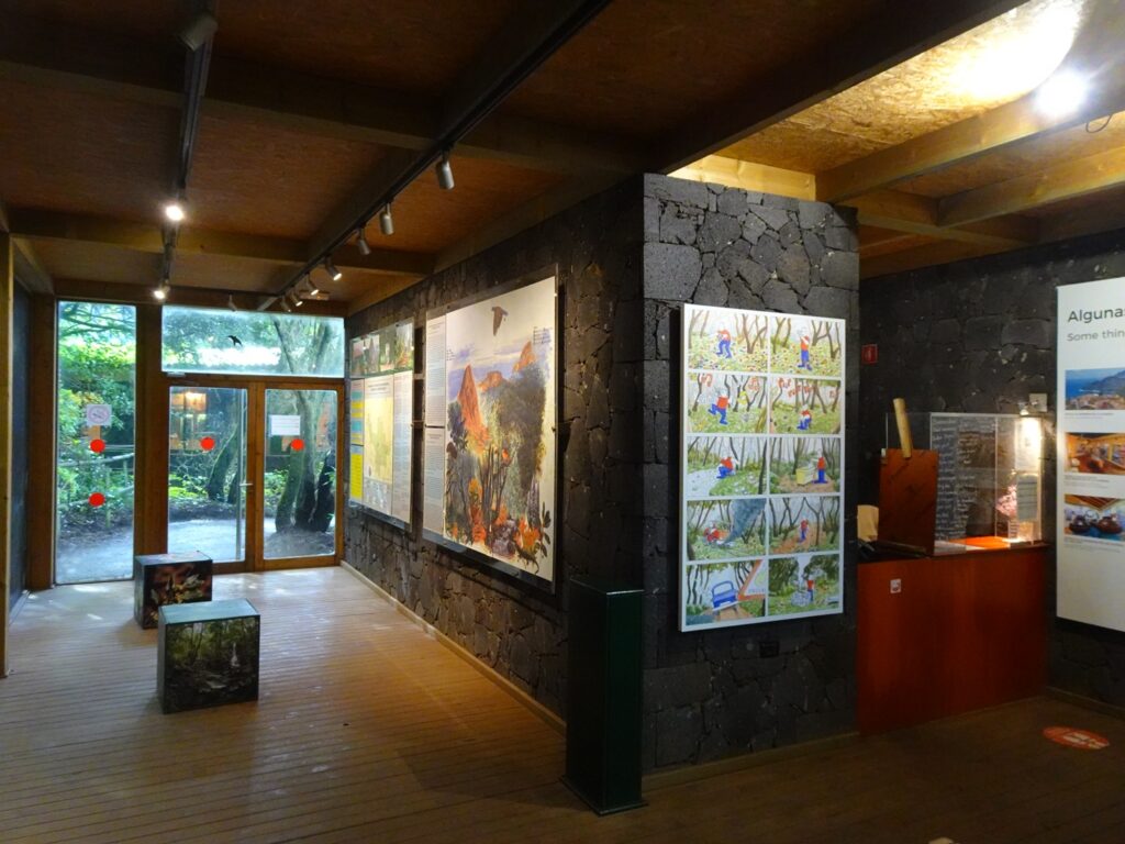
Juego de Bolas Visitor Centre
The National Park’s visitor centre is actually slightly outside its boundaries about halfway between the towns of Vallehermoso and Hermigua in the northern part of the island. Inside, there’s a modern exhibition about the park’s landscapes, wildlife and conservation work, which we found quite interesting.
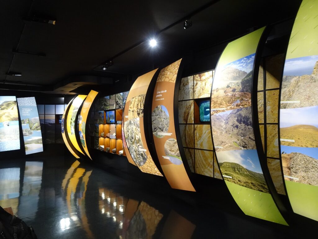
You can also watch a short film about the park, which runs for about 15 minutes and is worth checking out. There are scheduled showings in different languages, but when we visited, we just asked at the information desk, and they happily started it for us.
Behind the visitor centre are a small botanical garden and a couple of viewpoints on the hill just behind the building. There’s also supposed to be an ethnographic display recreating a traditional 19th-century Gomeran home, but it was closed during our visit.
One thing that definitely was open (and very welcome) was the little café behind the centre, where we had some Café Cortado and tried the excellent Gofio cookies. There is no entrance fee and you can check the current opening times here.
Laguna Grande
Don’t expect an actual lake here, unless there was heavy rain before your visit. Despite the name, this is really nothing more than a pretty picnic spot, centred on a large clearing in the forest. The place is connected to a few local myths and for instance it is said that witches dance here after dark.
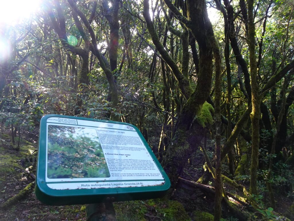
We didn’t join them, but came here during the daytime instead to walk the short nature trail through the beautiful forest, where we learned about the different trees making up this type of forest (not just laurel trees, like we thought beforehand, but also tree heath and wax myrtle).
It’s an easy 10-minute loop and a good alternative to the longer hikes, if you have mobility issues or are really short on time. Apart from that, there’s also a café and restaurant and a small one-room exhibition about the National Park, although the Juego de Bolas Visitor Centre is much more thorough.
Chorros de Epina
Chorros de Epina is a small mountain spring that’s wrapped up in local legend. Water trickles out of seven little spouts in the rock, and according to tradition, drinking from the correct ones is meant to bring love, luck, wealth and the like.
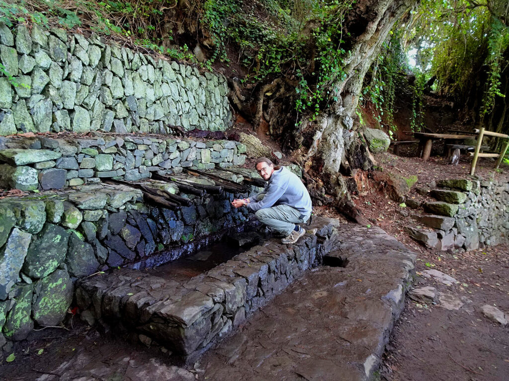
Men are supposed to drink from the odd-numbered spouts and women from the even ones for it to work. That said, women who fancy becoming a witch are encouraged to drink from the odd ones too – so if that’s on your bucket list, you know what to do.
It’s far from a must-see sight, but if you’re – like us – suckers for a good local legend, it’s worth dropping by. It’s also close to the Mirador de Alojera, so it’s easy to combine the two places.
Mirador de Alojera
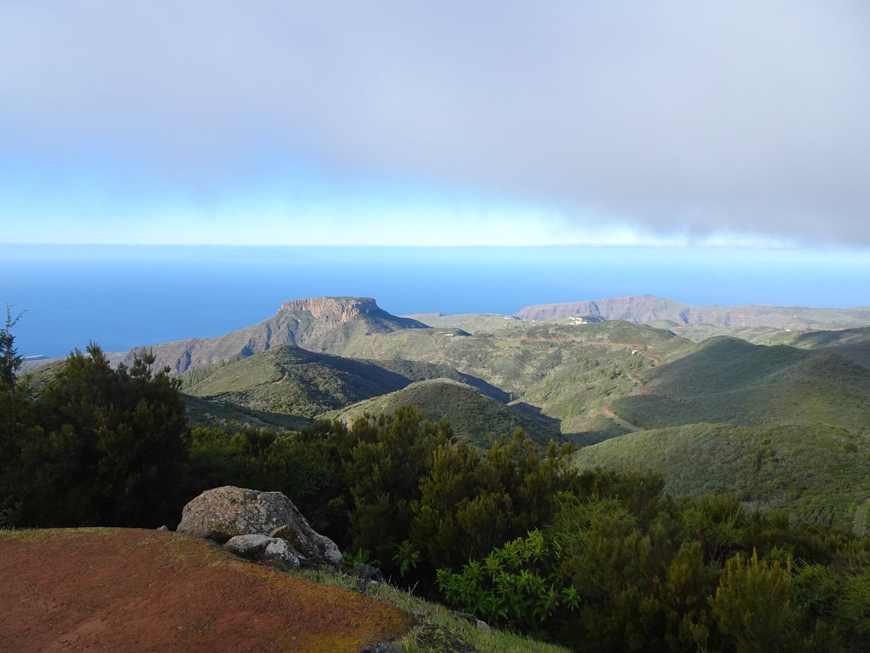
If you drive south toward Arure, you’ll pass Mirador de Alojera, which sits right on the edge of the National Park and is worth stopping for what is, in my opinion, the best view of the western part of the island.
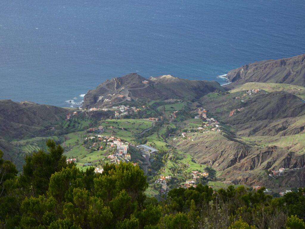
From up here, you have a great view down to Alojera and the coast below, plus views across the sea of laurisilva forest in pretty much every other direction. You can park at the small signposted pull-off along the road and walk about a minute to the viewpoint.
The Best Hikes in Garajonay National Park
The National Park is the most rewarding area for hiking on the island, and we did a total of six hikes here during our stay. I’ve described all of them below, starting with the longest (and in my opinion best) hike and ending with the shortest one, so you can pick the ones that suit you best.
El Contadero to El Cedro
Trailhead: El Contadero Car Park
Length: 13km or 8mi.
Altitude Gain: 630m or 2060ft.
Duration: 6 hours
Difficulty: Medium
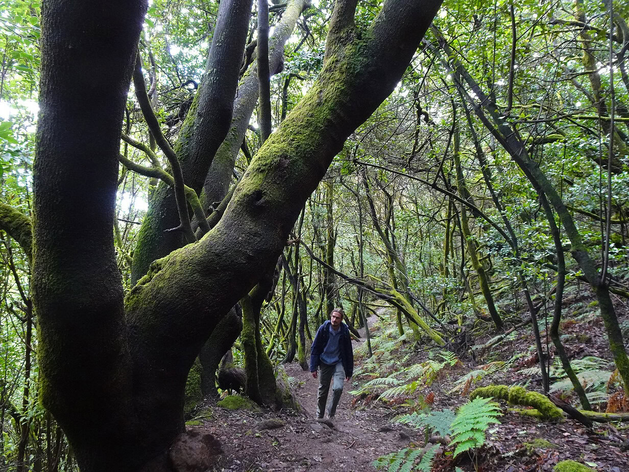
This is the longest hike among the bunch, but it also was by far our favourite hike in the area. It goes from the Contadero Car Park on the GM-2 to the tiny village of El Cedro and up again. Alternatively, you can continue down to Hermigua and catch a taxi back to where you left your car.
Another option to make it a one-way hike would be to do the whole thing by public transport. Bus Line 1 runs along the GM-2 and could drop you at the Pajarito Car Park, from where you could walk to the start. Bus Line 2 passes through Hermigua on the way from Vallehermoso to San Sebastian. You can check the current schedules here.
The upper section leads through the most beautiful stretch of evergreen forest that we came across on La Gomera. If you’re short on time, I’d say it’s even worth just walking the first kilometre or so and then turning around and heading up again.

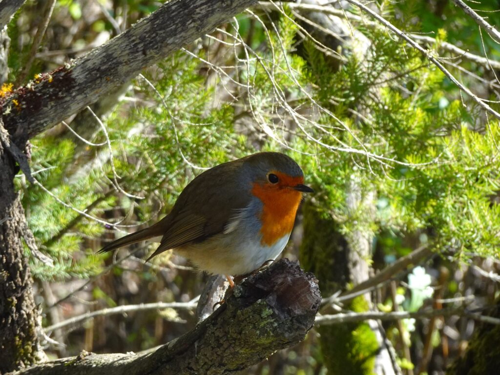
That’s not to say that the rest of the hike is not attractive – far from it. After the first half hour or so, we passed a small viewpoint, where we were immediately visited by several robins and endemic chaffinches and a little farther on, we crossed a beautiful little stream in the forest (there are enough rocks to step on).
Eventually, you’ll come to an intersection, where you can either follow a small path straight down the valley, or follow a larger trail along the western slope of the valley. If you’re hiking one-way, it’s best to take the path, but otherwise I recommend making it a little loop and picking the broader trail first.
You’ll have to follow it for maybe 20 minutes, before a small trail branches off and descends steeply to El Cedro. From this trail there are amazing views over the sea to Tenerife and El Teide mountain, which makes for some great photographs, especially if you frame it with the branches of the laurel trees.
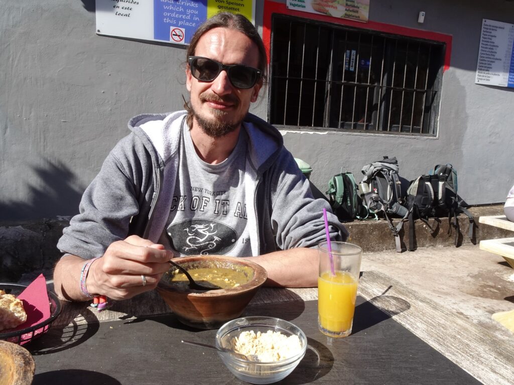
In El Cedro it’s a good idea to stop at Restaurant La Vista. After the first part of the hike it was nice to sit on their terrace in the sun and try the famous localPotaje de Berros (a thick watercress stew served with gofio powder).
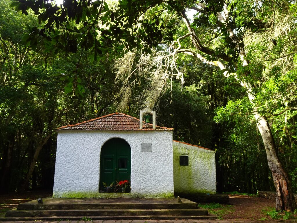
Afterwards, you can walk south through the village, turn right at the first possibility and follow the little trail leading up to the intersection that you passed before. On the way, you’ll pass the tiny Ermita de Lourdes church in a little clearing in the forest.
Except for a small section, where you can choose to stick to the right-hand trail instead of crossing the stream again (which is what we did), the rest of the trail is the same as on the way down.
Alto de Garajonay from El Contadero
Trailhead: El Contadero Car Park
Length: 6.2km or 3.7mi.
Altitude Gain: 260m or 850ft.
Duration: 1.5 hours
Difficulty: Medium
El Contadero is also the best start for a hike to La Gomera’s highest mountain. Even though the summit is at 1,487m (4,879 ft.), we found the hike pretty easy, as the trailhead is already quite high up. It only took us about half an hour to reach the top, and the trail is very easy to walk, too.
When the trail splits, I recommend sticking to the smaller path on the left-hand side, as it leads through a pretty stretch of laurisilva forest and there are two smaller viewpoints on the way. Naturally, it’s best to pick a clear day, when the views from the summit are amazing all around.
Afterwards you can either return the same way or continue on a slightly longer loop that heads off to the north-west and circles back to El Contadero in about 45 minutes. To do that, you’ll have to follow the bigger paved path down the mountain and turn left (west) at the first possibility.
After walking down for a bit, you can turn right on a tiny path, that looks like it would peter out after a few meters. Instead, it leads through a tunnel in the dense vegetation and past a series of smaller viewpoints, before meeting up with a broader trail again.
Here, you’ll have to turn right and stick to the main trail until you almost reach the GM-2 road. The final part of the loop follows a small path right next to the highway, until you emerge very close to your starting point at El Contadero.
Pajarito Loop
Trailhead: Pajarito Car Park
Length: 5.4 km or 3.3mi.
Altitude Gain: 160m or 530ft.
Duration: 1.5 hours
Difficulty: Easy
For the most part, this hike leads through rather open terrain, which means that you should really only attempt it when the weather is good. It also means that there are some great views along the way.
The trailhead is the Pajarito Car Park near the roundabout east of El Contadero. From here, you’ll follow the trail south-east and ignore the first trail branching off to the left. After that, you basically always stick to the left-hand option, whenever the trail splits.
That way, you’re circling a plateau at the south-eastern edge of the National Park, which first gives you some good views of the southern coast of the island.
For us, the best view came a little later, though. After about two thirds of the way you come to a little ridge which has awesome views of the Roque de Agando with Tenerife’s El Teide in the background. A little later the trail splits at a huge eucalyptus tree, where you’ll have to stick to the left.
The path continues up to the highway, where you can turn left and follow a trail through the trees past some more nice viewpoints until you end up at El Pajarito Carpark again.
Las Creces Loop
Trailhead: Las Hayas Church
Length: 4.4km or 2.7mi.
Altitude Gain: 115m or 380ft.
Duration: 1 hour
Difficulty: Easy
This easy one-hour loop takes you straight into a really beautiful patch of laurisilva forest in the western part of the park. It’s almost as atmospheric as the forest on the long hike from El Contadero to El Cedro, and if you’re short on time, I’d say Las Creces is a fantastic alternative to that one.
The trail starts near the small church in Las Hayas and pretty much immediately drops you into a fairytale-like forest of twisted laurel trees, giant ferns and moss hanging from the trees. When you come to the first intersection, you can either follow the big trail to the right or continue straight ahead down a small trail.
We picked the first option, but as it’s a loop from here on out, so it really doesn’t matter. In any case you’ll reach the small Las Creces Picnic Spot in a pretty clearing in the forest after about half an hour. If you came by the big trail like us, you’ll have to take a sharp left here and follow on a narrow path through the dense forest until you get to another intersection, where you have to stick left again.
Eventually, you’ll reach the intersection from the start, from where you can either continue the way you came or stick to the left and loop back to the church along the edge of some palm-studded fields, which is what we did.
Raso de La Bruma Loop
Trailhead: Raso de La Bruma Picnic Site
Length: 3.1 km or 1.9mi.
Altitude Gain: 90m or 290ft.
Duration: 1 hour
Difficulty: Easy
This is another short walk through the forest and again there are some nice sections of evergreen forest featuring lots of moss-covered laurel trees. The starting point is the small Raso de La Bruma Picnic Site in the western part of the National Park.
There’s only room for 5 or 6 cars here, so if it’s full, you’ll have to come back, but when we did it, there were just two other cars here. We chose to walk the loop in a clockwise direction, which meant that the prettiest part came at the end.
From the partking spot, you’ll have to follow a small trail west, which runs next to the highway first, before turning south-west into deeper forest. After some time on a broader path, you come to an intersection, where you’ll have to turn left.
From here on, the path climbs through the small Cañada de Jorge ravine, which to me was the most attractive part of the hike. After maybe 15 minutes on this trail, you’ll arrive back at the trailhead.
Presa de Meriga Stroll
Trailhead: Parking Spot near La Palmita Hamlet
Length: 1.4 km or 0.9mi.
Altitude Gain: 50m or 150ft.
Duration: 30 minutes
Difficulty: Very Easy
This is a very short loop hike that you can easily fit into a longer day of exploring the northern part of the island. The small Presa de Meriga Reservoir sits at the northern edge of the National Park near the Visitor Centre.
There’s a small parking spot near La Palmita, which you can get to by turning left off the road connecting the Visitor Centre and Laguna Grande. From there, the trail runs south and loops once around the reservoir.
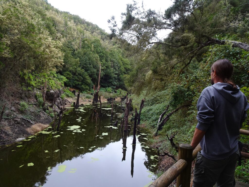
I’m sure it depends on the water level, but when we were there in December, the reservoir was full and quite atmospheric. With some patches of duckweed and lots of dead trees sticking out of the water it reminded me more of a swamp than a reservoir.
Like almost everywhere in the National Park, the surrounding forest is quite magical and full of ferns, moss and gnarled trees. We were also completely alone here, which is always a plus in our book.
Garajonay National Park Map
All the points of interest and the routes of the different hikes that I’ve described above can be found in this map of the National Park.
How to Get Around in Garajonay National Park
By Rental Car
We rented a car, which is by far the easiest way to get around here. It gave us the flexibility to start hikes when and where we wanted and we could spontaneously come back another day when the weather was better or there were fewer people around. We also liked that we could always just stop when we spotted a particularly nice viewpoint along the way.
Rental cars on the Canary Islands are pretty affordable and you can have a look for the best deals below.
If you’re driving yourself, there are three main car parks, which serve as trailheads for different hikes along the GM-2, which is the main highway running through the National Park from San Sebastian to Valle Gran Rey (and Vallehermoso).
From east to west, these are: Pajarito Roundabout, El Contadero Car Park and Laguna Grande. From all of these, there are hiking trails going in different directions, some of which I’ve described above. There are also some picnic sites and viewpoints with parking spots along the way.
If you want to check out a view, make sure to not just stop in the middle of the road (hazard lights or no). We saw some people doing that, and it always was super dangerous, because the roads are narrow, twisted and some of the locals have got a bit of a lead foot.
By Public Transport
Exploring the National Park by bus would be possible to a certain extent, but it definitely requires more pre-planning and there are some places that buses just don’t go to (like Laguna Grande or Presa de Meriga).
At the time of writing, Bus Line number 1 runs from San Sebastián to Valle Gran Rey via the eastern part of the National Park. You could use it to reach Las Roques and the Pajarito Car Park (from where you could also reach Alto de Garajonay on an alternative route).
Bus Line 4 runs through the very western part of the park on the way from Vallehermoso to La Dama and if you ask the driver, he might let you out at the Raso de La Bruma Picnic Site to do the loop trail there. You can check the bus schedule here.
The entire section of the GM-2 between the turn-off to Las Hayas and the Pajarito Roundabout isn’t covered by public buses at the moment and the only way to go there would be by getting a pricey taxi. If you want to do them, I still think you’d be better off renting a car.
Where to Stay Near the National Park
We stayed at Jardin Las Hayas for two nights before moving on to Hermigua. Staying in the centre of the island is good to get an early start on some of the hikes and the views are great, but because of the elevation, it can get quite chilly, especially in winter.

Where to Stay in Central La Gomera
Budget: Casa Rural Arure
Midrange: Jardin Las Hayas (pictured)
Luxury: Casa Pavón
.
Restaurants in the National Park
The only restaurant inside the park is the one at Laguna Grande. We only stopped by for a coffee at the bar next door, so we can’t give you any first hand information, but it seemed to be mainly frequented by tour groups.
Otherwise, there are plenty of restaurants in the villages surrounding the National Park, like Las Hayas, Epína or El Cedro.