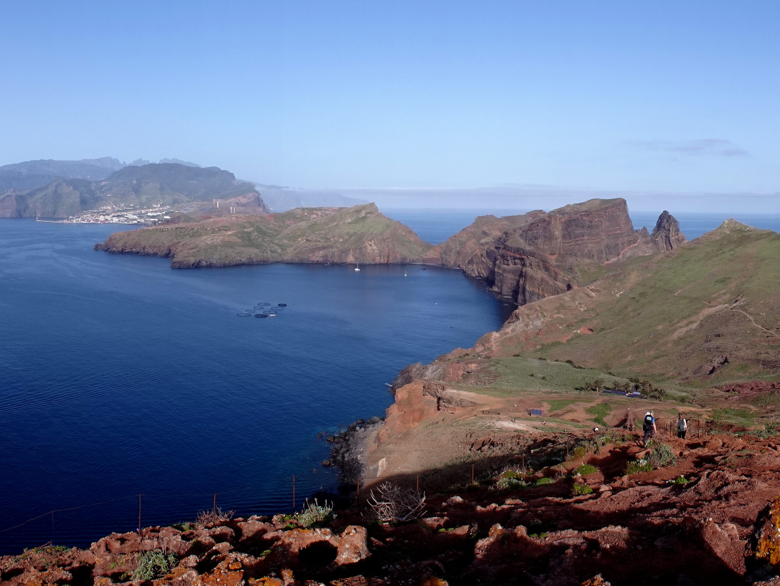
The hike along the São Lourenço Peninsula is one of Madeira’s most popular hikes and we found it easy to see why. It runs along the peninsula of the same name to the easternmost tip of the island and the views of the cliffs and tall rocks rising out of the Ocean along the way are absolutely spectacular.
Geologically, this part of the island is much older than the island’s central mountains. The peninsula was formed by volcanic eruptions about 9 Million years ago, and over time, erosion has shaped the area in very dramatic ways.
The fact that the hike is so popular also means that you need to time your visit pretty well to avoid the worst of the crowds. Here’s everything you need to know about the PR8 Hike.

This post may contain affiliate links, and I might earn a small commission at no additional cost to you. For more info, click here.


Guided Hikes of the PR 8
We did the hike on our own, but if you prefer to hike the trail with a guide, there are lots of options available. You can have a look below for some well-rated tours.
A Description of the Trail
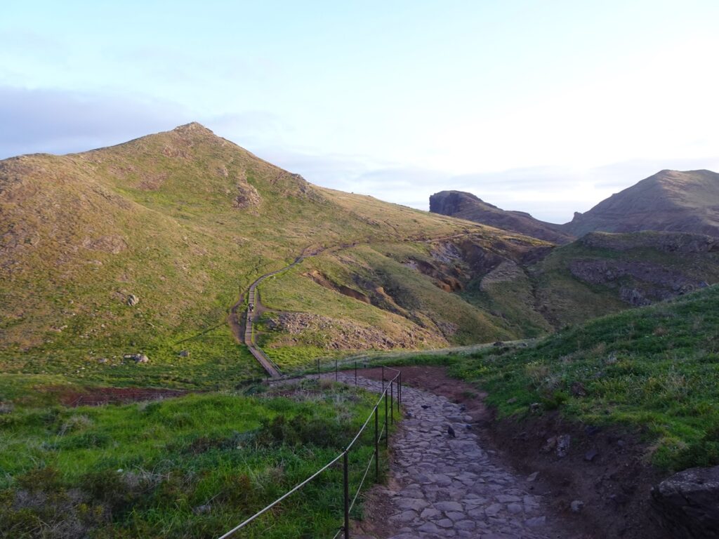
The trail starts at the eastern end of the ER109 road, where there’s a big car park. From there, the path leads first north-east and then south-east along the spine of the peninsula, which is much more arid than most of Madeira.
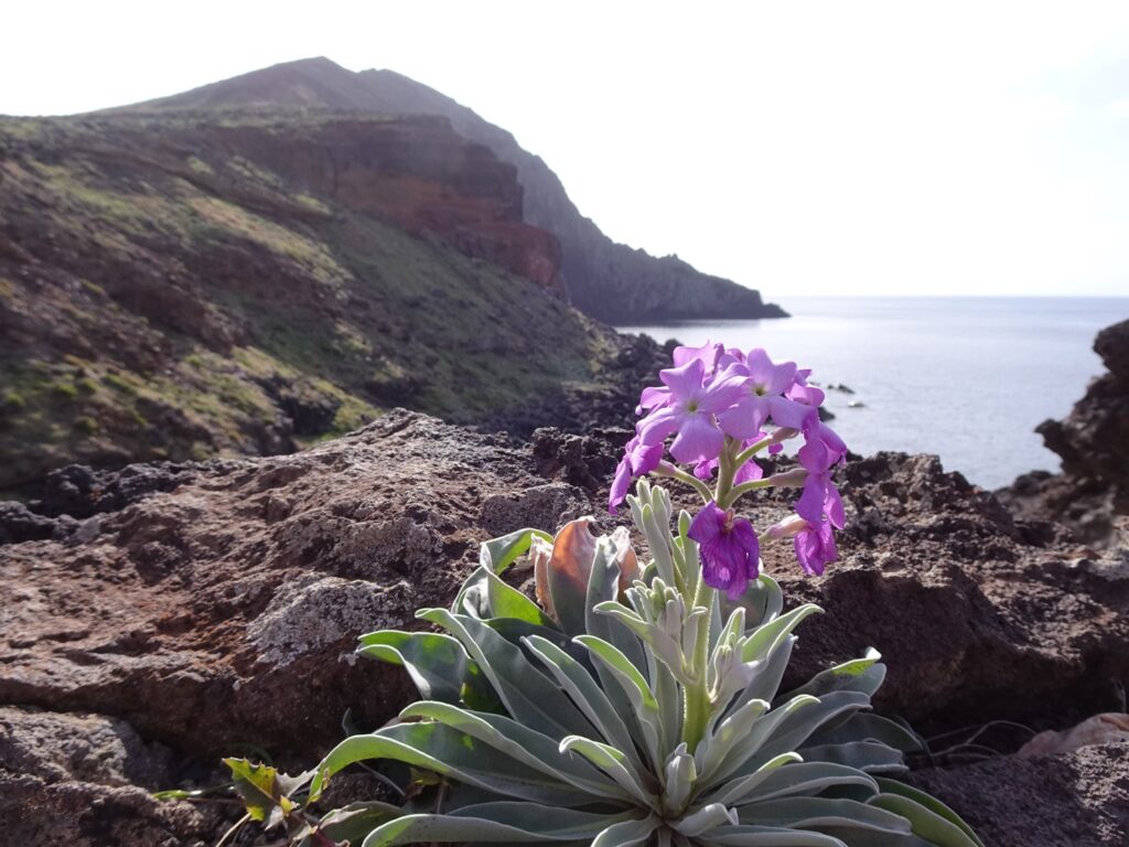
It’s true that there aren’t any trees or bushes along the way, but when we did the hike in late February, the slopes were still covered in grass and it looked very pretty and by far not as dry and cracked as we had imagined beforehand. That might change later in the year, though, and I can imagine that the area becomes quite dusty in the summer.
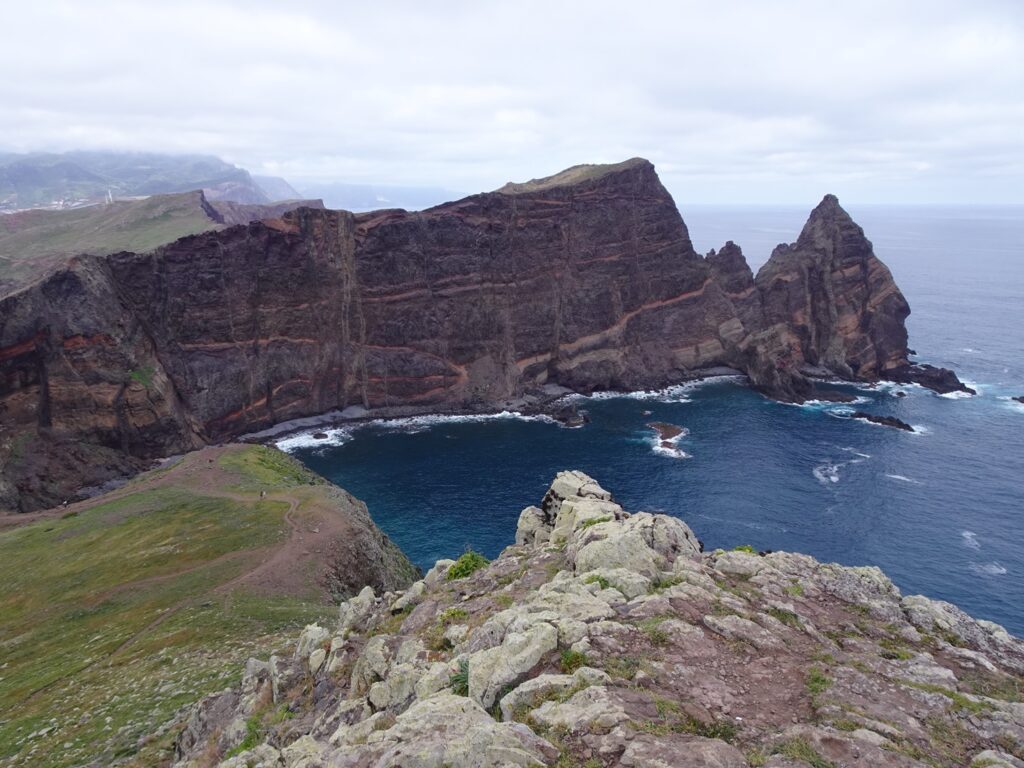
After crossing a small valley, the trail runs close to the northern coast, where there are some nice viewpoints looking out over the cliffs and islets off the coast, like Pedro Furada and the impressive rock stack called Ilhéu da Pocariça.
As the trail continues, it curves its way around some smaller bays and ravines. The most memorable stretch for us came approximately at the midpoint of the hike, where the trail runs atop a narrow ridge with steep drops on both sides (don’t worry, there are railings on both sides).
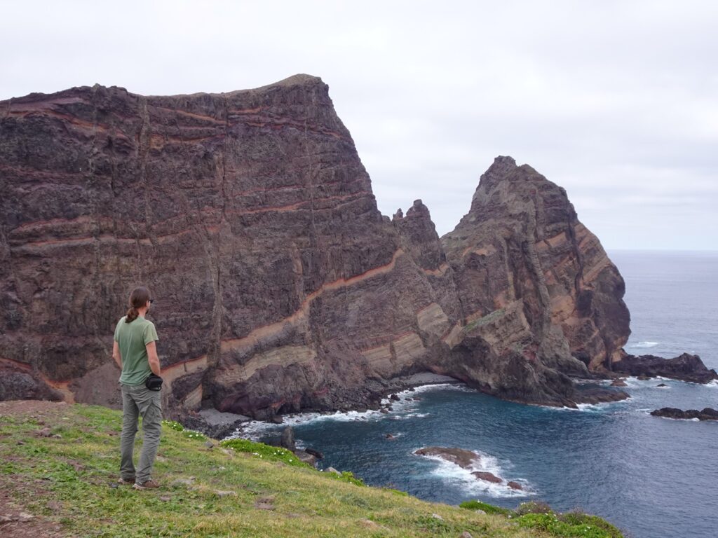

Right after that part, it’s worth taking a short detour north to an awesome viewpoint over the tall cliffs. You can also continue east and climb to the top of the ridge here and walk east along the cliff edge for more great views of the eastern tip of the peninsula.
Back on the main trail, the path soon splits. It doesn’t really matter which branch you take, as you can just walk a loop and take the other one on the way back. We walked it in a clockwise direction, while most people coming after us did it the other way around.
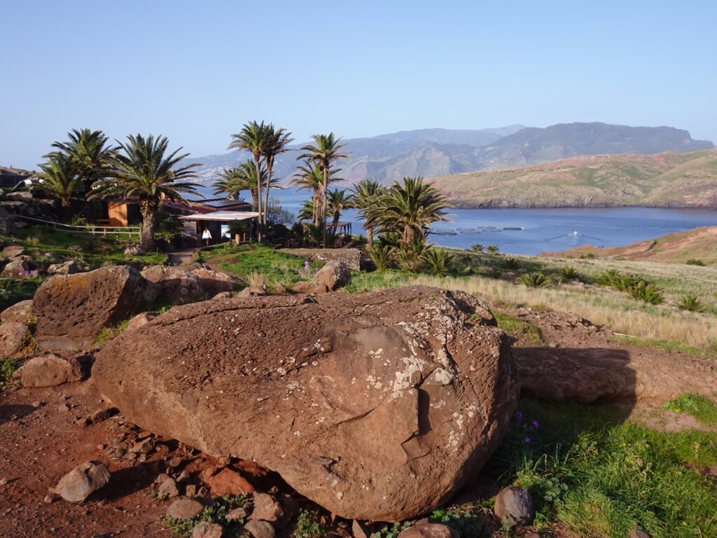
Eventually, you’ll reach the Casa do Sardinha Nature Spot Café, which sits in a pretty, palm-shaded valley. It’s probably a nice spot for a drink before starting on the way back, but it was still closed when we returned from the viewpoint, so we couldn’t try it out. This is also where the only toilet along the hike is located.
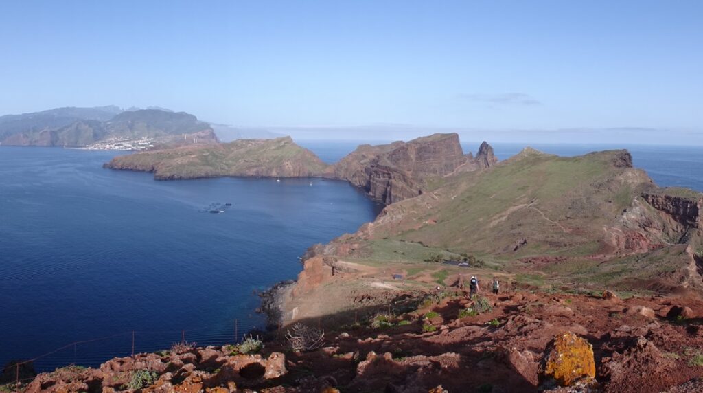
From the café it’s maybe another 300m or so up a very steep hill to the Ponta do Furado Viewpoint at the eastern tip of the peninsula. From here you can see the two small islets, Ilhéu da Cevada and Ilhéu do Farol, with Madeira’s easternmost lighthouse.
As the sun was still pretty low in the east, the view back west along the southern edge of the peninsula with Caniçal and Machico in the background was actually much better for us. After taking in the view, you can finish the loop and then return the way you came along the peninsula.
Eastern Madeira Hotel Tips
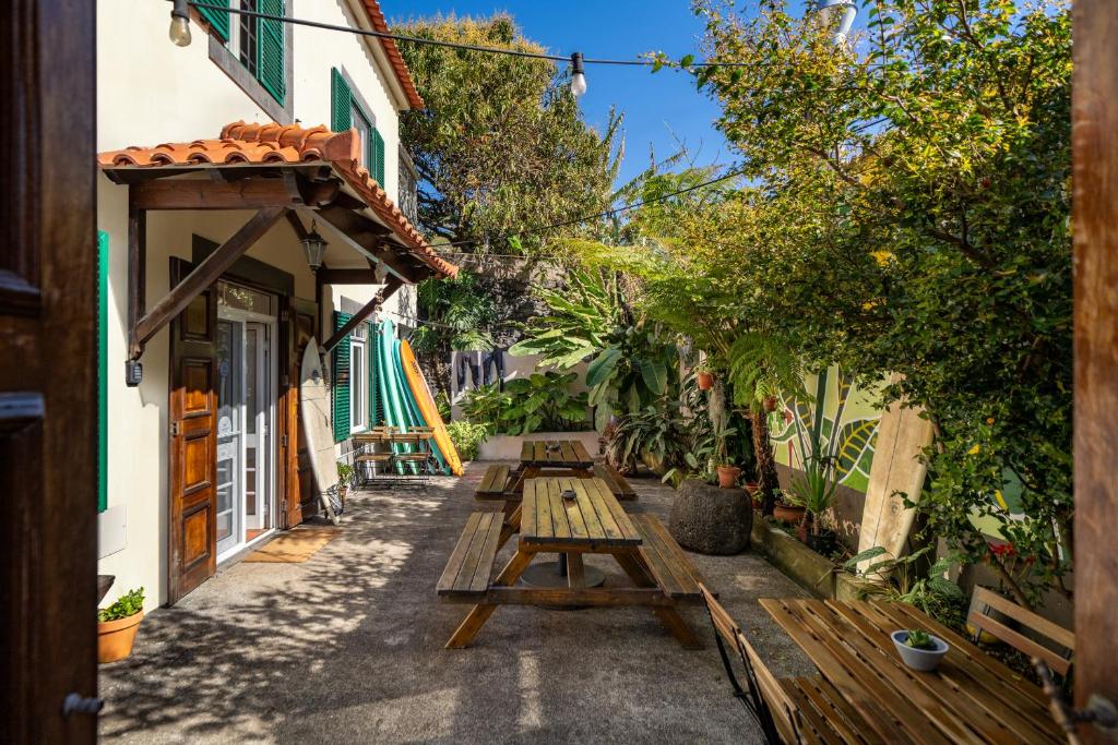
Budget: Jaca Hostel in Porto da Cruz (pictured)
Midrange: Stay Lombinho in Porto da Cruz
Luxury: Casa da Olides in Santana
.
Map of the Ponta de São Lourenço Hike
This map of the São Lourenço Peninsula shows the exact route we took, including the small detour along the northern cliff edge.
Practicalities
How to Get to the Trailhead by Car
If you’re driving, the trailhead is at the eastern end of the ER109 road near Caniçal. There’s a reasonably large parking area right at the start of the hike, which was almost empty when we arrived around dawn and completely full when we returned around 11am.
How to Get to the Trailhead by Public Transport
It’s also possible to reach the trailhead by bus from Funchal and other places along the south-eastern coast of Madeira.
The SAM bus company runs routes towards to the trailhead via Caniçal. The stop at the trailhead is called Baía d’Abra. At the time of writing, you could get there by taking the SAM Bus No. 113. You can check the current connections and schedules on this site.
Entrance Fee & Booking
Like with many hikes on Madeira, you now need a paid permit to hike the São Lourenço trail. The fee is €4.50 per person, and you’ll need to book a time slot online in advance through the official Madeira government hiking portal.
Distance and Elevation Gain
The whole hike (there and back) is about 7.5km or 4.5mi. with a total elevation gain of about 300m or 1,100ft.
How Long Does It Take?
It took us around 4 hours return with plenty of stops to take in the scenery and a few detours along the way.
Places to Eat Along the Way
There’s a small café at Casa do Sardinha near the eastern end of the trail, but it only opens at 10am, so if you start early it might still be closed.
Toilets
The only toilets along the trail are at the same café and rest area. There are no facilities at the trailhead or along the way, and as the whole area is very open and exposed, there’s no option to discreetly step behind a tree, so keep that in mind.
When to Go and How to Avoid the Crowds
This is one of the most popular hikes on Madeira, and it really shows later in the day. I’d strongly recommend going mid-week and starting as early as possible, ideally around sunrise. We started at dawn, when the trail was pretty quiet (although we already met a few other people).
When we made our way back around 10am, there were long lines of people coming in. The difference in atmosphere was very noticeable. The trail is sometimes quite narrow, so the fuller it is, the more exhausting it will get.
Late afternoon to early evening is probably also a good option. We did some other popular hikes on the island (like the Balcões Viewpoint or Pico Ruivo) in the evening and sometimes it felt even quieter than in the morning.
Something else to consider (especially for photographers) is the position of the sun. In the morning, the views west back to the eastern coast were better, while in the evening the views east to the off-coast islands will be better.
What to Take
There’s almost no shade anywhere along the trail, so don’t forget to take sunscreen and maybe even bring a hat (especially in the summer). Also, bring enough water and some snacks to tide you over until you reach the café.