Like many Caribbean islands, Dominica has a grim history of slavery, but while many of the traces of this dark period document people’s systemic exploitation by colonial forces, Jacko Steps serves as a reminder that there also were resistance movements to the oppression.
The area near Pont Cassé used to be home to a camp formed by maroons (escaped slaves) who for decades successfully fought against slavers and the colonial administration by employing guerilla-style tactics. The site is named after their leader, Jacko, who was killed in 1814, when the camp was discovered and razed by government troops
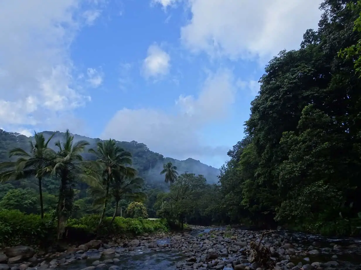
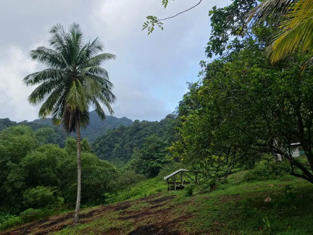
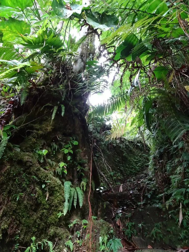
Today, the only remaining trace is a set of huge stone steps cut into the rock, which were meant as an escape route from the camp. Apart from that, there’s little evidence of the camp left, but I still found it a fascinating historic destination for a hike and, as always, liked the opportunity to explore more of the island’s jungly interior.

This post may contain affiliate links, and I might earn a small commission at no additional cost to you. For more info, click here.


Description of the Hike
The trail starts at the small school in Belles. Follow the road west to the Layou River and cross it. There’s a series of Rocks you can use, or you can right away get used to wading through the river, which is unavoidable if you plan on doing the entire hike.
Climb up the bank on the other side and follow the trail until you reach a small wooden house. This is where Mal and Eunice live, who maintain the trail. Say hi, if they’re around, and consider a small donation for using the path. The trail continues behind the house and climbs gradually until it reaches a plateau.
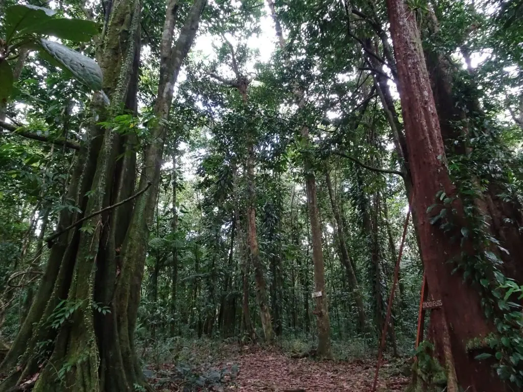
A sign informs you that you’ve reached Jacko Flats, the location of the former maroon camp. It’s well worth taking some time to soak up the unique atmosphere and try to imagine the lives of the people who once hid up here. Another sign points in the direction of Jacko Steps, the only remaining vestige of the camp.
Once you’ve reached them, take your time descending, as they are very tall and can be super slippery. Once you reach the bottom near the bank of a small river, you have to make the decision if you want to continue on for the second, more adventurous part of the hike or return the way you came.
If you choose the former option, you’ll have to continue along the small river, until it flows into the bigger Layou River. Turn left and follow the river upstream. In the beginning, I was mostly able to climb across rocks and sandbanks, but occasionally I had to step into the water. Be careful, as the current can be swifter than it looks on the surface.
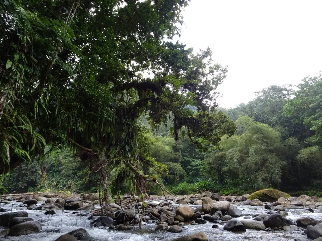
At a certain point, it’s unavoidable to walk through the river, as it’s hemmed in by high cliffs on both sides. Sometimes it’s possible to hold on to the southern (right-hand) rock face to steady yourself.
More often than not, though, I found that the water was deeper near the cliff, and I had to veer closer to the centre of the river, where the current is stronger. Just assess the best way to go, take it slowly, and you’ll be fine. This is the part of the hike where a walking stick really comes in handy.
While you need to watch your step, don’t forget to stop and enjoy the surrounding nature once in a while. For instance, there’s a small waterfall in a narrow cave in the northern (left-hand) cliff-face at one point.
Eventually, I had to cross the river to the left bank, as other tributaries will flow into the Layou on the right-hand side, creating swift currents.
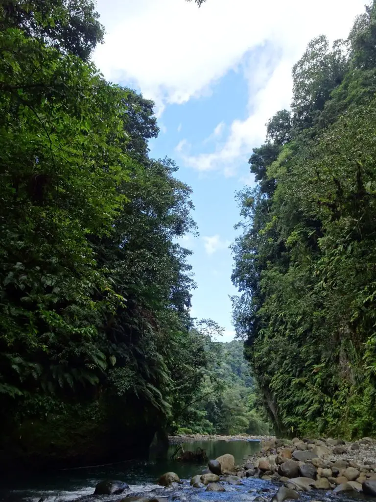
By that time, I was able to mostly walk over boulders and sand along the northern bank of the river. Once you reach a junction of two big rivers, turn left and follow the river a bit further until you reach the point where you crossed it at the very beginning of the hike. Climb up the right bank and walk back to the highway, where you started your hike.
Practicalities
How to Get to the Trailhead
The hiking trail starts near the tiny village of Belles on the Pont Cassé-Marigot Road. As minibuses are a bit infrequent, I ended up hitchhiking from the roundabout in Pont Cassé, which worked out pretty well since this is one of the main roads through Dominica’s interior.
If you’ve rented a car, you can park it near Belles Primary School, where the trail begins.
Do You Need a Guide?
If you’re planning on doing the whole trail, it’s probably a good idea. I went there on my own and was fine, but the second half of the trail involves hiking through the Layou River through sometimes thigh-high water, which can be a bit scary (and is certainly dangerous and not to be attempted in the rainy season!).
The other option would be returning the same way you came after you’ve reached Jacko’s Steps, but where’s the fun in that? For me, the complicated track through the Layou River was the most attractive part of the hike nature-wise, so if you think you can manage it, you should definitely do the whole loop.
If you want to take a guide, it’s probably best to ask people at your accommodation or in Pont Cassé for a recommendation. I didn’t meet anyone at the trailhead, whom I could have asked to come along, even if I’d wanted to.
How Long Does the Hike Take?
Plan about 3 hours for the round-hike, and 2 if you return the way you came once you’ve reached Jacko Steps.
The first half is a straightforward jungle hike. The second half is the real adventure – wading through the Layou River, scrambling over rocks, and figuring out the best route through the current.
What to Bring?
Needless to say, take snacks and water for the entire hike, as there are no shops around.
If you plan on doing the second half of the hike through the Layou River, I highly recommend taking shoes that can get wet: some trekking sandals would probably be the best. I did it with Flip-Flops, which wasn’t ideal to say the least (the surprisingly fast current claimed one of them eventually).
As the water can get thigh-high, I recommend wearing swimming trunks for the second half of the hike. A towel comes in handy after you’ve left the river. If you have a walking stick, bring it along, as it will be especially useful in the river. Otherwise, you could try and look for a suitable stick before starting the second half of the hike, which is what I did.
Finally, a dry bag would also be a very good idea to keep your phone or camera safe and dry during the second half of the hike.
How Much Does it Cost?
Technically, hiking to Jacko Steps is free, but you should consider giving Mal and Eunice, the couple maintaining the trail, a small donation of 10 to 15 ECD.
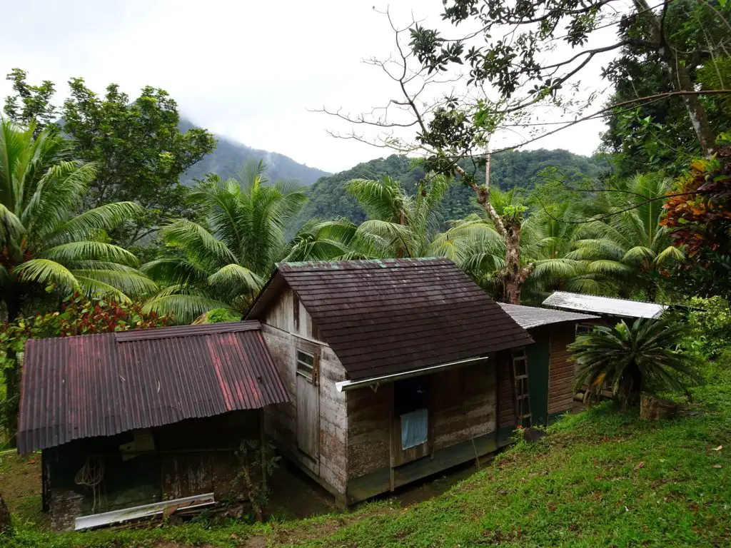
They live in a small wooden house that you’ll pass before reaching Jacko Flats. They weren’t around when I did the hike, so I left some money with Dawn at D-Smart-Farm in Pont Cassé who knows them personally. While it’s not compulsory, I found it to be a small price to pay for such a cool hike.
See Also
The Emerald Pool, Morne Trois Pitons Mountain and other great destinations in Central Dominica
Victoria Falls, Secret Beach and other great Destinations in Southeastern Dominica