A small section of Dominica’s northeastern part is administrated by the Kalinago, who’ve populated the Lesser Antilles since at least the 13th century. It’s one of my favourite parts of the island, as it gave me the chance to learn more about Dominica’s pre-colonial history.
I especially liked the fascinating open air museum where I learned about the traditions and culture of the Kalinago, as well as a sacred Pagua Rock. Apart from that, there’s the typical selection of amazing deserted beaches I had already come to know and love during my time on the island.
Here’s everything you need to know about exploring the Kalinago Territory.

This post may contain affiliate links, and I might earn a small commission at no additional cost to you. For more info, click here.


Who Are the Kalinago?
The Kalinago have lived on some of the Lesser Antilles for at least 800 years after likely acculturating the indigenous Igneri.
There is still some debate, but the most common hypothesis is that the Kalinago migrated to the Leeward Isles from the northeastern part of South America’s Mainland (from the area of today’s Venezuela and the Guianas).
Nowadays, Dominica’s Kalinago territory is self-governed by a chief and a council of six people, who are elected every five years.
Where to Stay in the Area
Budget: Danglez Bed and Breakfast
Midrange: Happy Nest Dominica
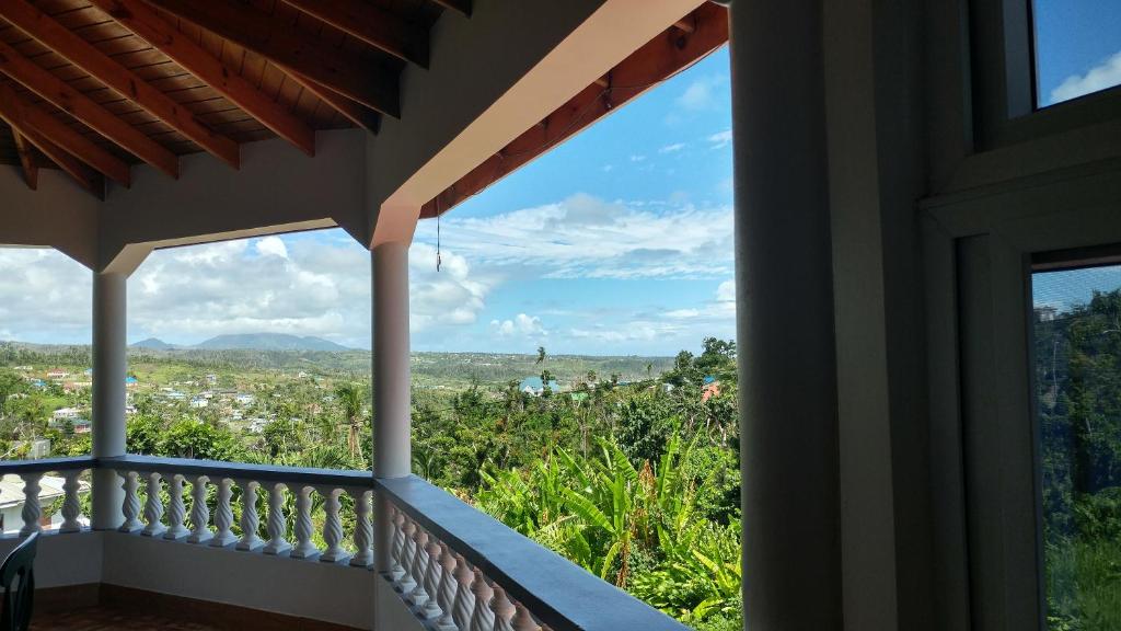
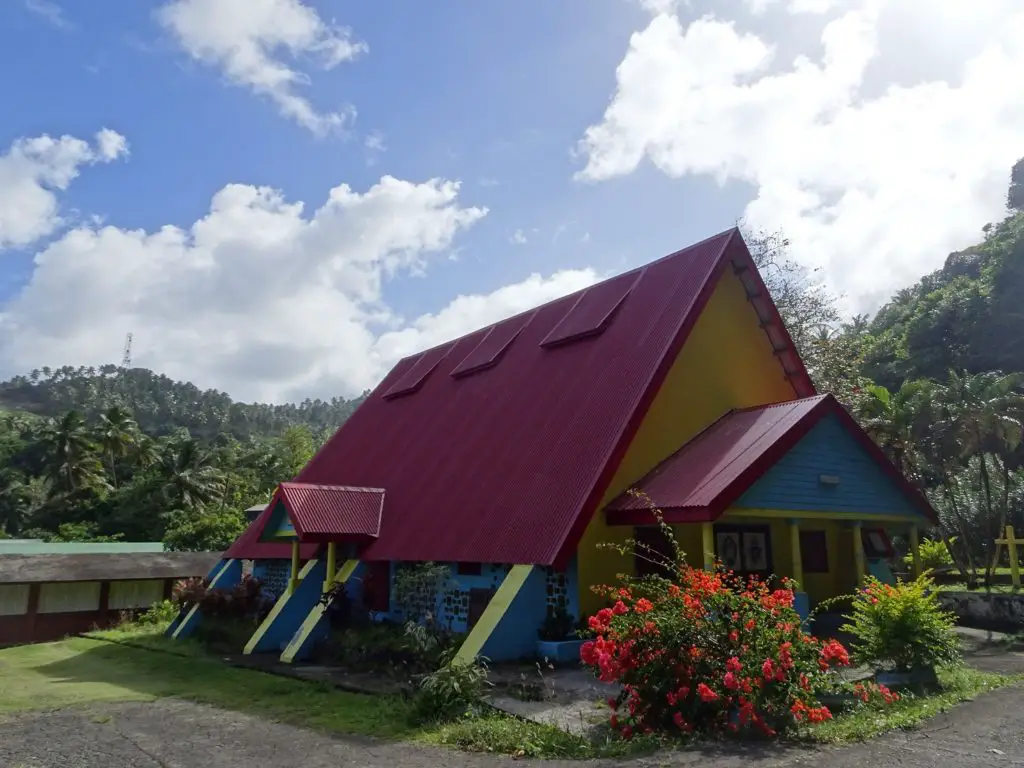
Luxury: Classique International (pictured)
.
Where is the Kalinago Territory located?
Dominica’s Kalinago Territory lies on the island’s northeastern coast, between the villages of Bataka in the North and Sinecou in the south. The highest concentration of interesting places is around Crayfish River in the northern part of the territory.
Organized Day Trip to the Kalinago Museum
If you’re short on time, these folks offer a Day Trip to the Kalinago Village, including round-trip transportation, a tour of the village and a live cultural performance in the museum. This would surely be the easiest way to visit the area, especially if you’re just here on a day trip from a cruise.
What to See and Do in the Kalinago Territory
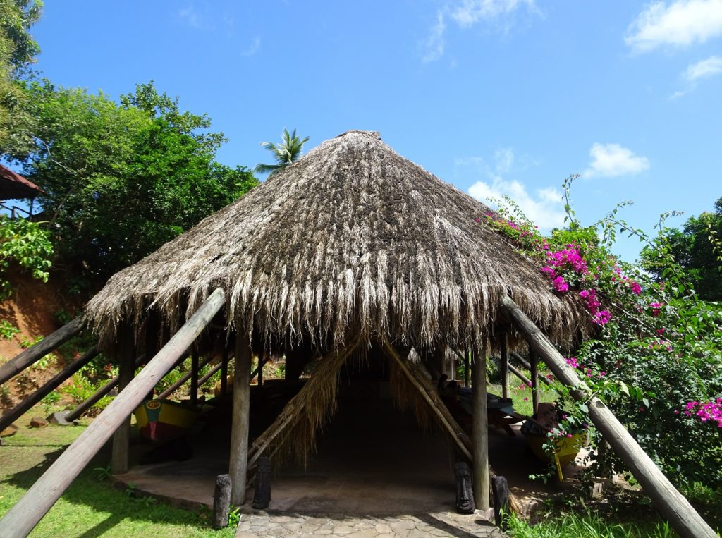
Kalinago Barana Auté
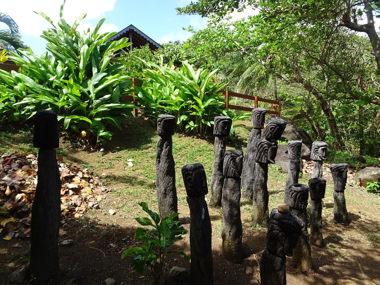
This cool open-air Museum recreating a traditional Kalinago village was my favourite sight in the area. Translating to “Kalinago village by the sea”, it’s located on a cliff, with great views down to the Atlantic Ocean.
It’s meant to recreate the lives of the Kalinago people before the arrival of the Europeans in the 15th century. There are a number of smaller buildings called Ajoupas, which surround the reconstruction of a Karbet – a large communal building that was used exclusively by the male Kalinago.
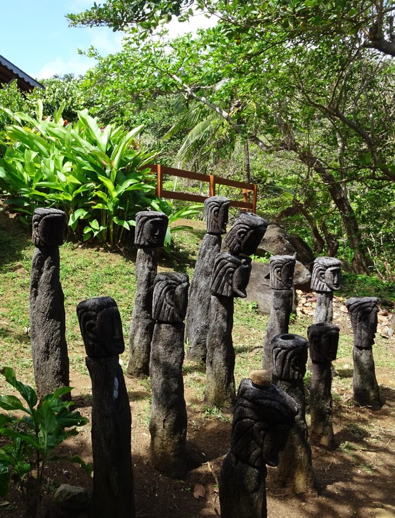
In some of the buildings there are displays of tools and other objects of daily life of the Kalinago, and others contain wooden fishing boats. Something I especially liked, were the traditional tree fern carvings, that stand in clusters in different parts of the grounds.
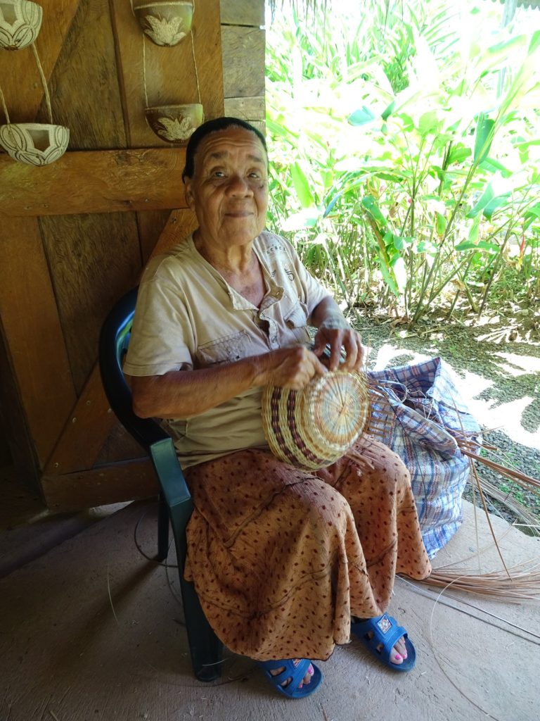
Something else I found pretty fascinating was the fact that you could watch women weaving the traditional larouma reed baskets (and of course you can buy them as a souvenir).
The Kalinago Barana Auté is located in the small village of Crayfish River. The road leading there branches off the main coastal highway opposite the Salybia Police Station.
Salybia Church and Church Ruins
Salybia is the village just to the south Crayfish River and the administrative centre of the Kalinago Territory.
A road just north of the Salybia River leads to the new Salybia Catholic Church, a brightly-painted modern building, which has a big mural of traditional village life inside. It was closed when I was there, but I could see everything inside through the many small windows all along the walls.
Much more impressive I found the ruins of the old Catholic Church, which lie a bit farther east on the way to the Ocean. The roof is gone, and just three walls remain of the building, but I thought it was a super atmospheric place, overgrown by trees as it is.
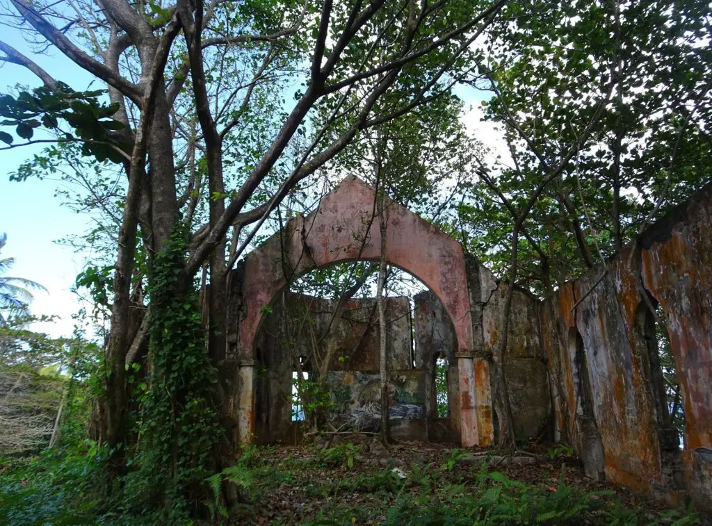
In the altar area, there are the remains of an interesting mural depicting villagers on the seashore. If you continue to the sea past the small cemetery, there’s a nice view of the bay and south to the small islets Petit L’Ilet (the closer one) and Gros L’Ilet.
Pagua Rock
This big rock outcropping just outside the northern border of the territory plays a big role in the folklore of the Kalinago and is said to be inhabited by a spirit. According to another legend, there’s also a magical flower that is said to grow there and bloom once a year.
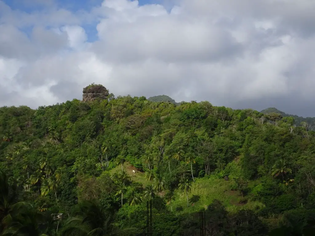
I encountered neither, but after climbing the steep hill it stands on, I was awarded with some great views all around. The rock is located to the west of Atkinson along the coastal highway. As it towers over the surrounding landscape, you really can’t miss it.
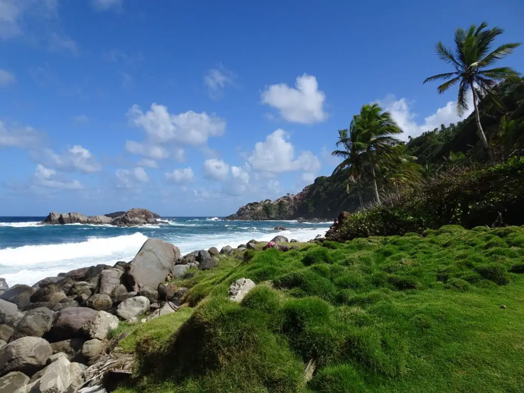
Sandy Bay Beach in Marigot
Sandy Bay is a beautiful tropical beach located close to the village of Marigot, some 5km or 3mi. north of the Kalinago Territory. When I was there, the sea was calm enough for swimming, which apparently is often the case, as the bay is protected by a reef.
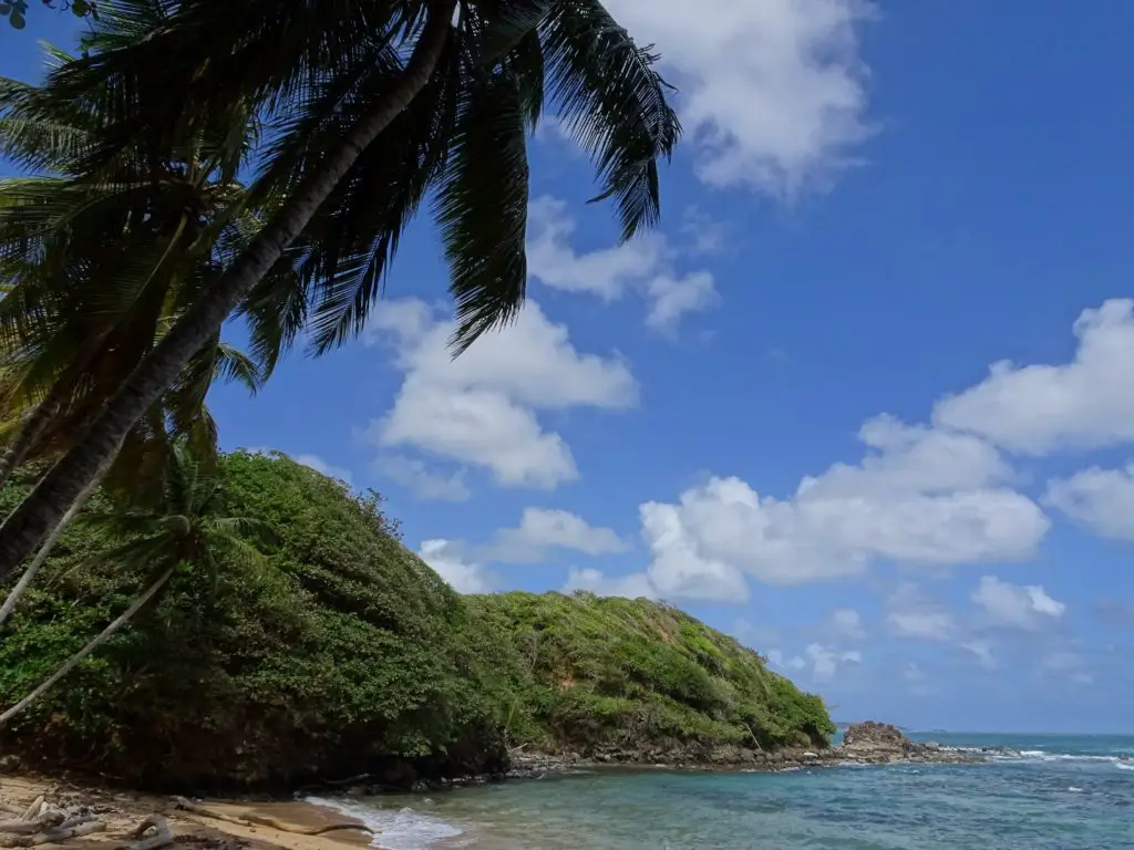
It’s also a nice spot to just enjoy the tropical beach vibe, with the backdrop of coconut palm trees and countless curious ghost crabs scuttling about. If you’re walking to Marigot from Pagua Rock, you’ll also pass the equally beautiful Pagua Bay Beach near the estuary of the Pagua River.
Kalinago Territory Map
All of the places described above can be found in this map of the Kalinago Territory.
Practicalities
Where to Stay in the Kalinago Territory
I found Crayfish River to be a convenient base. Nearby you’ll find most places described above, including the Kalinago Barana Auté Open Air Museum, which is arguably the biggest draw in the territory.
I stayed at Aywasi Kalinago Retreat, which is actually more of a mid-range option, where you can rent out self-contained cottages. Staff at my last accommodation told me that camping there was possible and after some confusion (apparently no one ever actually wants to camp there), I was allowed to pitch my hammock in one of the traditional lean-tos on the grounds.
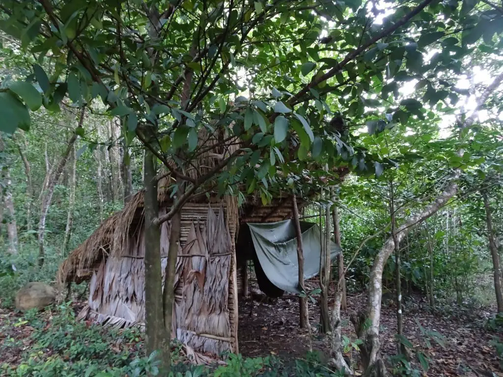
A nice added bonus was the possibility to use the natural tide-pool near the sea for swimming. Another option if you’re on a small budget would be the Carib Territory Guesthouse near Bataca.
Where to Eat in the Kalinago Territory
There are a couple of restaurants, cafés and grocery stores along the coastal road, especially around Crayfish River and Salybia. The Open-Air Museum itself has a small cafeteria as well.
One place you should definitely check out is the Cassava Bakery, where you can buy bread made from Cassava (Maniok). It is located along the main road, a bit to the west of the turn-off for the Kalinago Barana Auté.
How to Get to the Kalinago Territory
Minibuses running along the eastern coastal road from Portsmouth or Marigot in the North to Castle Bruce in the south pass through the territory and can be waved down from anywhere along the way.
If you’re traveling directly from Roseau, buses going to the Kalinago territory start near the New Market in River Bank Road.
Where to Go Next
Southeastern Dominica, home to some of the coolest waterfalls on the island
Central Dominica with the unique Boiling Lake
Calibishie, which is home to my favourite beach on the island