Guadeloupe consists of two very different parts. Grande-Terre is the more developed eastern half, but while we checked out some interesting historical and natural attractions there, the real reason to come to the island for us was to visit Basse-Terre, the wilder and arguably more beautiful western half.
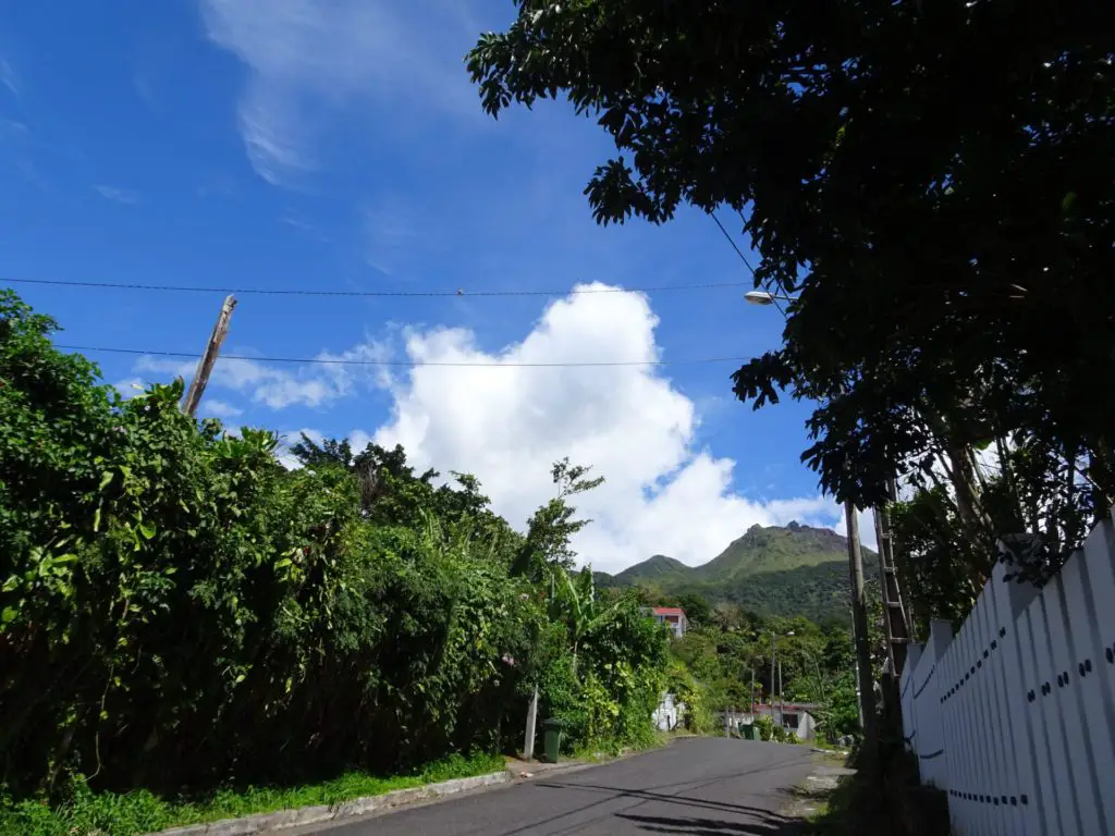
The rugged interior of Basse-Terre is dominated by lots of mountains and foremost among these is La Soufrière Volcano, the highest mountain in the Lesser Antilles. It lies in the southern part of the beautiful Parc Nationale de la Guadeloupe and climbing it was one of the highlights of our trip around the island.
Read on for everything you need to know about climbing La Soufrière.

This post may contain affiliate links, and I might earn a small commission at no additional cost to you. For more info, click here.
What to Know About La Soufrière
At 1467m or 4813ft., La Soufrière is not only the highest point on Guadeloupe but on all the Lesser Antilles and we were able to make out its imposing shape from most parts of the island, when the weather was clear.
That said, clear days seem to be in short supply, and when we were there it was mostly shrouded in clouds, which might be due to the fact that it’s still very much an active volcano, which constantly produces smoke and fog.
In fact, it’s still seismically so active that five eruptions have been recorded since 1718, the most recent one in 2021. Werner Herzog immortalized the volcano in a short documentary with the ominous title “La Soufrière – Waiting for an inevitable disaster”.
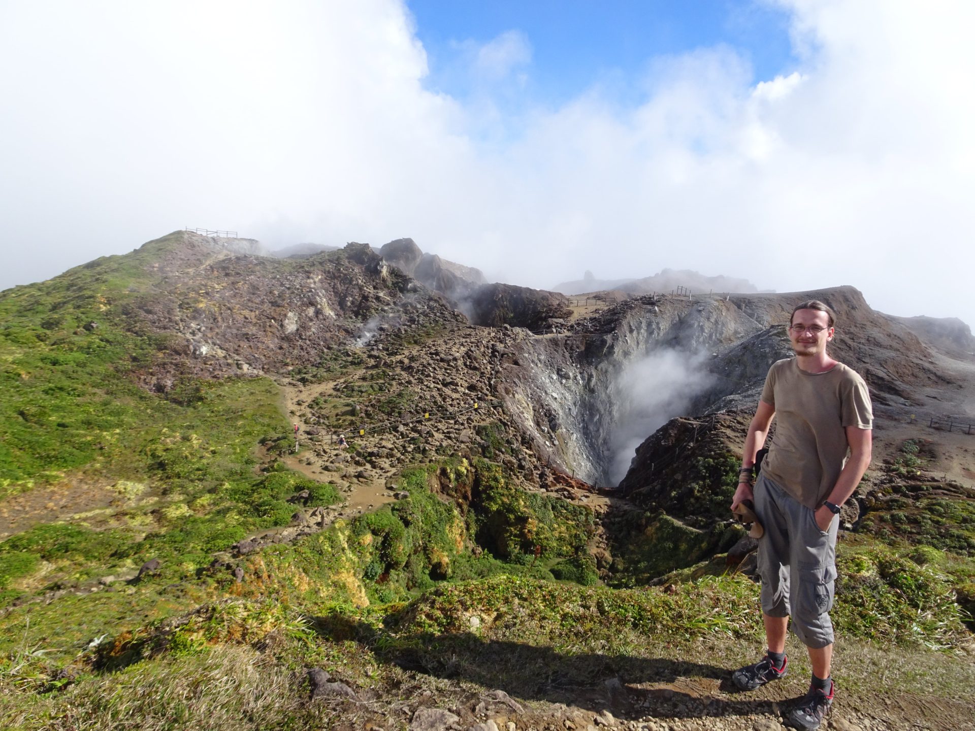
Disaster wasn’t looming when we were there, so we climbed La Soufrière and were rewarded with great views of the surrounding mountains and of course the chance to peek into the smoking crater.
Practicalities
How to Get to the Trailhead
We took the trail up the western slope of th emountain, which is the most popular route, but also the easiest one to reach by public transport. The trailhead is located near Saint-Claude village, which lies already halfway up the mountain.
To get to Saint-Claude, we took the bus from Guadeloupe’s capital Basse-Terre. The central bus terminal lies close to the sea at the big roundabout south of the parliament building (Palais du conseil general).
You can also board the bus anywhere along Rue Eboué, Rue Victor Hugues or Avenue de Saint-Claude. From the terminal, it only takes about 15 to 20 minutes to reach the Saint-Claude and we paid about 2€.
Once you’re in Saint-Claude, you’ll have to follow the main road through the village towards the mountain, which you can clearly see on a sunny day. The parking area at “Les Bains Jaunes” is where the real hike up La Soufrière begins. From here, it’s about 3km or 2mi. to the summit with an elevation gain of about 500m or 1,600ft.
Do You Need a Guide?
We did it on our own. The trail is well-marked and mostly easy to navigate, although it gets somewhat more difficult the closer you get to the top, and there’s a bit of scrambling involved. That said, if you’re reasonably fit, it’s very doable without a guide.
Best Time to Hike La Soufrière
It’s hard to give a straight answer, as this really depends a lot on the weather and you need to keep a bit of flexibility. It’s best to check the forecast, as it’s very possible that the top is shrouded in clouds in the morning, but clear in the afternoon.
We ended up climbing it a day earlier than we originally planned, as the weather was clear when we arrived in Saint-Claude in the afternoon. Going for the hike right away was the right decision, as it was again tightly shrouded in clouds the next morning.
That said, don’t be discouraged if clouds suddenly move in on the way up, as they might vanish just as quickly. We entered a wall of mist several times on the way up, but were still rewarded with a clear view in the end. The weather here changed almost as quickly as it did during our trip to the Faroe Islands.
How Long Does the Hike Take?
It took Stefanie and me a little under two hours to hike from the trailhead at Les Baines Jaunes to the top, and about 1 hour for the way back. If you want to spend some time at the top, to enjoy the views and stare mesmerized into the crater (like we did) you should plan around 4 hours for the whole hike. Add an hour, if you plan on walking to the trailhead from Saint-Claude.
What to Bring
Apart from enough drinking water and some snacks, you might consider taking some swimwear and a towel in case you want to stop by the warm springs on your way back.
Is There an Entrance Fee?
Nope, La Soufrière and the surrounding National Park are two of many cool natural attractions on Guadeloupe that are completely free.
Where to Stay Near La Soufrière
We decided to climb La Soufrière in the afternoon and spend the night at Sainte-Claude, but technically it should be doable as a day-trip from Basse-Terre or even Pointe-à-Pitre. Should you decide to stay in Saint-Claude, the only budget options are private rooms like Chez Ena or the aptly named Studio proche de la Soufrière.
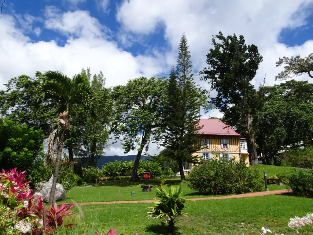
If you’re aiming for an early start, Les Pimentiers de Papaye is located already pretty high in the village, close to the trailhead for La Soufrière. If money isn’t an issue, there are also a couple of mid-range options in town, e.g. Hôtel Saint-Georges.
Description of the Hike up La Soufrière
First of all, you’ll have to get to the proper trailhead at the parking-spot “Les Bains Jaunes” (at about 950m/3,100ft. elevation) by either driving or walking along the asphalt road leading up from Saint-Claude.
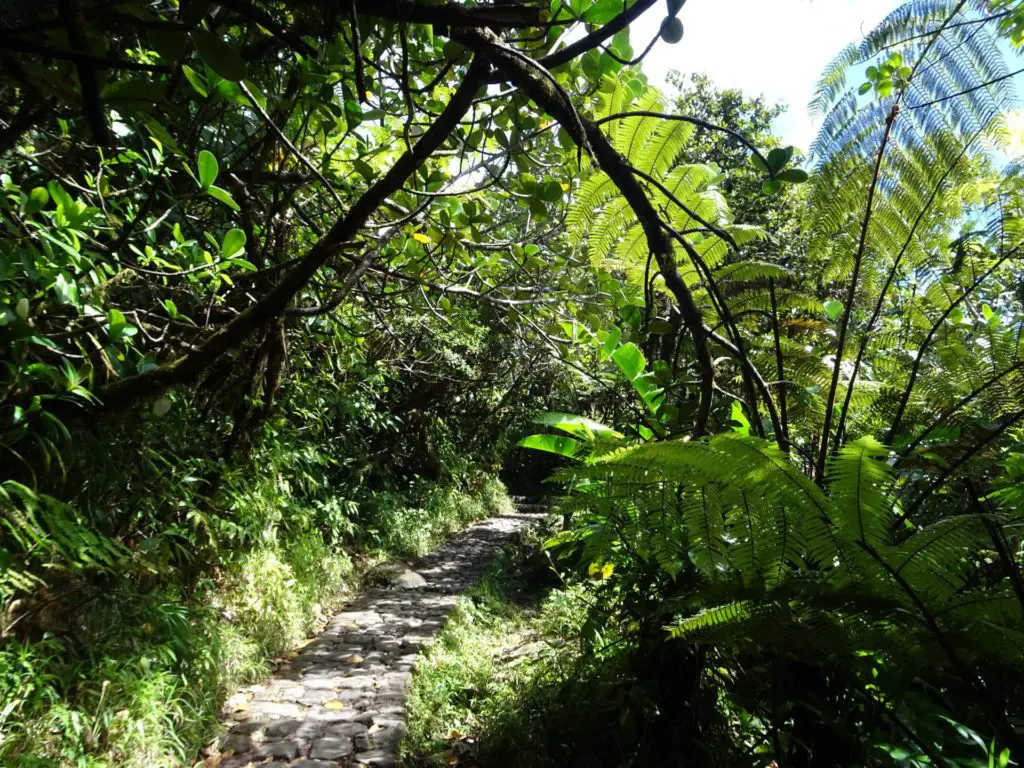
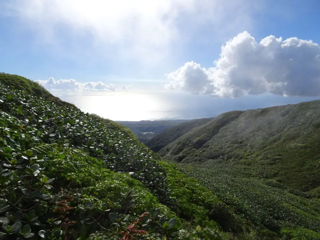
From the eponymous hot baths, you’ll have to follow the trail which climbs gently through the beautiful rainforest, where we spotted loads of Lesser Antillean Flycatchers, as well as some hummingbirds and even a sneaky mongoose (which were apparently introduced to the Antilles in the late 19th century).
After about 20 to 30 minutes, you’ll leave the forest behind you and the trees will be replaced by low shrubs. After a couple of minutes, you’ll reach the former parking lot at the old trailhead, which has been inaccessible for cars since the 1976 eruption of La Soufrière.
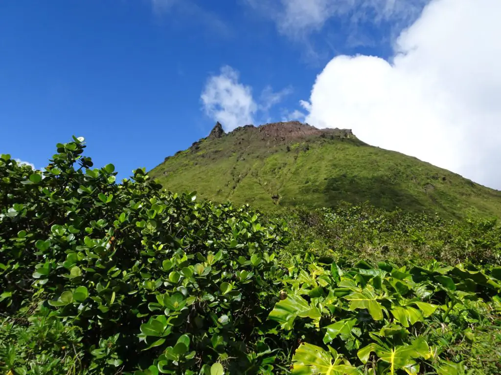
From here on out, you’ll need to be a little more careful than before, as the trail becomes narrower, rockier and steeper. Definitely watch out for seemingly solid rocks that will sometimes break loose once you tread on them.
As you’ve left the forest behind you, this is also where the fantastic views to the West and South begin (if the weather is clear), so make sure to stop once in a while to take a look behind you. The route, called “Le Chemin des Dames” (The Ladies’ Trail) follows the western slope of La Soufrière, eventually circling around to the north where the final ascent to the top starts.
This requires some light scrambling up increasingly bigger rocks. It’s not too tough, but it comes at a point when you’ll likely be slightly exhausted, so try to be careful.
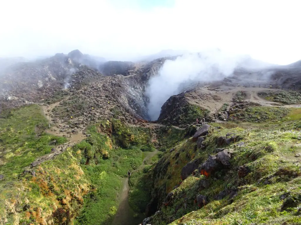
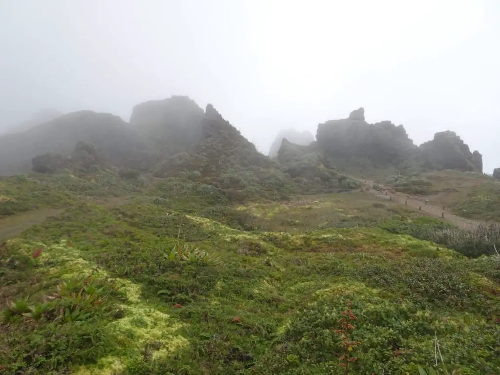
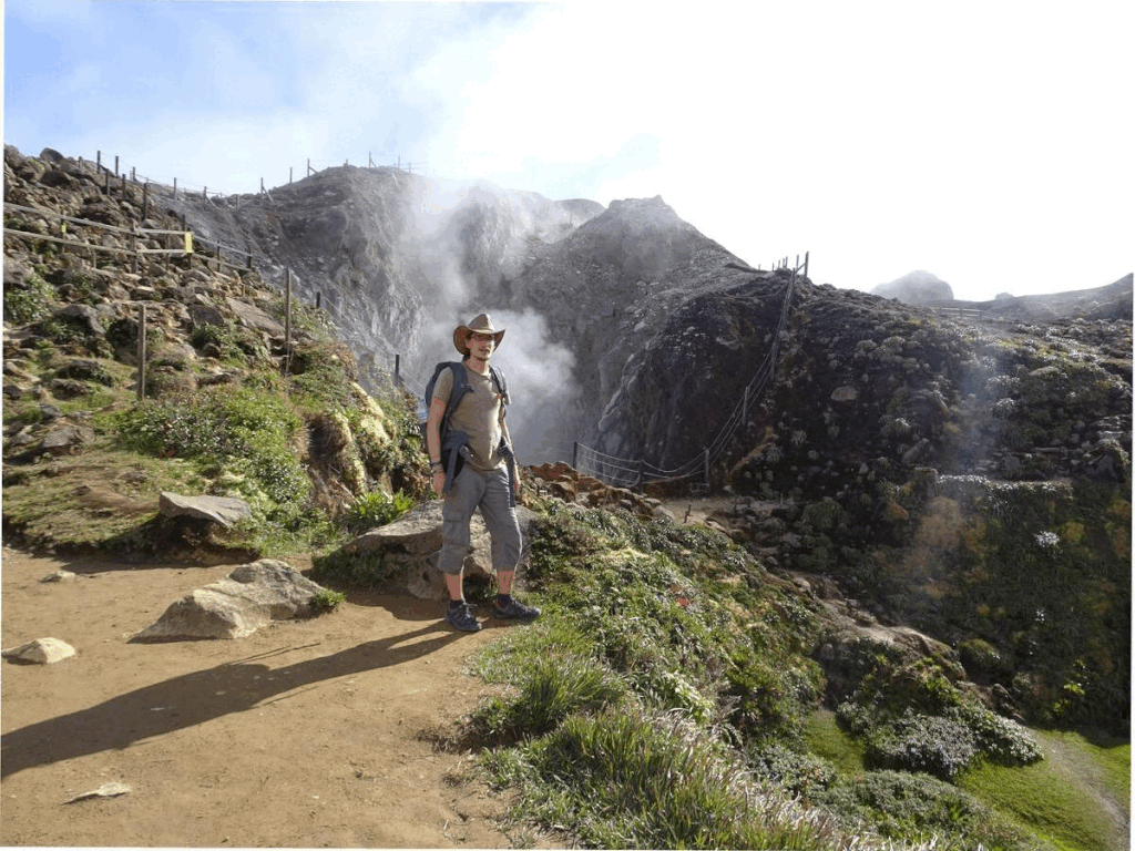
On this section of the hike, you’ll also pass some of the fault lines showing the enormous geological stress on the volcano. La Grande Faille is the biggest of these and looks almost like a small gorge. From this point, a final push of maybe ten minutes brings you to the plateau at the top.
On top of La Soufrière, you can check out the fantastic views in all directions by walking around the rim. The plateau is criss-crossed by small trails, which lead around various cracks and sinkholes.

We found the crater itself to be quite a mesmerizing sight, as it was constantly spewing smoke, but there are other interesting spots, including a section of fractured rock known as Portes de l’Enfer (Gates of Hell).
You can also see the remains of lots of lava tubes and fault lines all over the top, which give you an idea how frequently La Soufrière has erupted.
Also have a look for the bright red Pitcairnia bromeliad that grows in some sections of the plateau and gives a bit of colour to the landscape. When you’ve had your fill of rocks and smoke, you can circle around to the northern portion of the top and climb down the way you came.
Map of the La Soufrière Hike
This map shows the exact route we took and which I described above.
Where to Go Next
Deshaies, a beautiful beach town and filming location for the BBC’s “Death in Paradise”
Pointe-à-Pitre, the biggest and most lively city on Guadeloupe